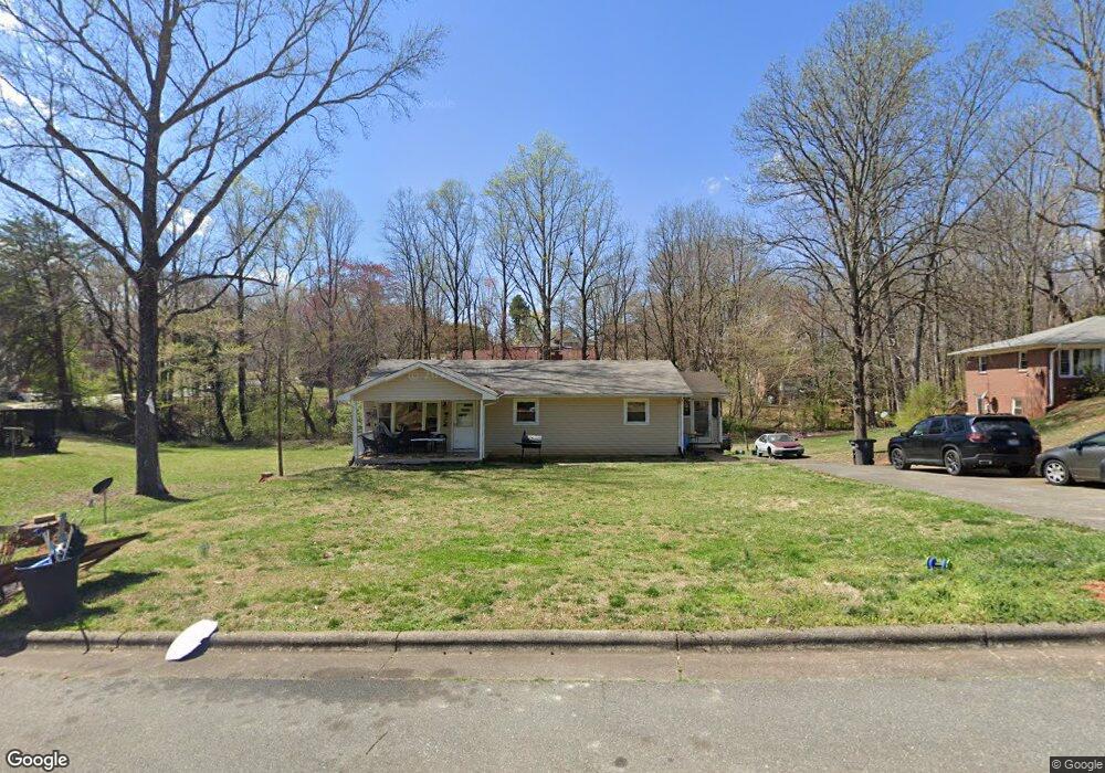
3910 Tony Dr Winston Salem, NC 27105
Northwoods-Old Carver NeighborhoodEstimated Value: $143,000 - $184,000
3
Beds
1
Bath
1,170
Sq Ft
$137/Sq Ft
Est. Value
About This Home
This home is located at 3910 Tony Dr, Winston Salem, NC 27105 and is currently estimated at $160,047, approximately $136 per square foot. 3910 Tony Dr is a home located in Forsyth County with nearby schools including Ibraham Elementary School, Mineral Springs Middle School, and Carver High.
Ownership History
Date
Name
Owned For
Owner Type
Purchase Details
Closed on
May 23, 2006
Sold by
Terry Dale and Brown Jeff
Bought by
Jamison Dorothy
Current Estimated Value
Home Financials for this Owner
Home Financials are based on the most recent Mortgage that was taken out on this home.
Original Mortgage
$68,918
Outstanding Balance
$40,301
Interest Rate
6.57%
Mortgage Type
FHA
Estimated Equity
$119,746
Purchase Details
Closed on
Sep 15, 2003
Sold by
Jones Lester E
Bought by
Terry Dale and Brown Jeff
Home Financials for this Owner
Home Financials are based on the most recent Mortgage that was taken out on this home.
Original Mortgage
$63,000
Interest Rate
6.33%
Mortgage Type
Purchase Money Mortgage
Create a Home Valuation Report for This Property
The Home Valuation Report is an in-depth analysis detailing your home's value as well as a comparison with similar homes in the area
Home Values in the Area
Average Home Value in this Area
Purchase History
| Date | Buyer | Sale Price | Title Company |
|---|---|---|---|
| Jamison Dorothy | $70,000 | None Available | |
| Terry Dale | $70,000 | -- |
Source: Public Records
Mortgage History
| Date | Status | Borrower | Loan Amount |
|---|---|---|---|
| Open | Jamison Dorothy | $68,918 | |
| Previous Owner | Terry Dale | $63,000 |
Source: Public Records
Tax History Compared to Growth
Tax History
| Year | Tax Paid | Tax Assessment Tax Assessment Total Assessment is a certain percentage of the fair market value that is determined by local assessors to be the total taxable value of land and additions on the property. | Land | Improvement |
|---|---|---|---|---|
| 2024 | $1,063 | $79,400 | $13,500 | $65,900 |
| 2023 | $1,063 | $79,400 | $13,500 | $65,900 |
| 2022 | $1,043 | $79,400 | $13,500 | $65,900 |
| 2021 | $1,024 | $79,400 | $13,500 | $65,900 |
| 2020 | $933 | $67,600 | $13,500 | $54,100 |
| 2019 | $940 | $67,600 | $13,500 | $54,100 |
| 2018 | $893 | $67,600 | $13,500 | $54,100 |
| 2016 | $517 | $39,337 | $13,000 | $26,337 |
| 2015 | $509 | $39,337 | $13,000 | $26,337 |
| 2014 | $494 | $39,337 | $13,000 | $26,337 |
Source: Public Records
Map
Nearby Homes
- 3990 Logan Ln
- 4316 Oak Ridge Dr
- 4372 Oak Ridge Dr
- 3878 Ruskin Ct
- 3882 Ruskin Ct
- 3734 Carver School Rd
- 3637 Carver School Rd
- 4239 Carver School Rd
- 3621 Carver School Rd
- 3643 Bates Dr
- 3651 Shaw Rd
- none New Walkertown Rd
- 4513 Lasley Dr
- 157 Lasley Ct
- 149 Lasley Ct
- 0 New Walkertown Rd Unit 10094434
- 00 New Walkertown Rd
- 3564 Prospect Dr
- 3535 Cortland Dr
- 4504 Lasley Dr
- 3912 Tony Dr
- 5085 Butterfield Dr
- 3901 Logan Ln
- 3921 Logan Ln
- 3901 Tony Dr
- 3911 Tony Dr
- 0 Tony Dr
- Lots 9A&9B Logan Ln
- 00 Butterfield Dr
- 3915 Tony Dr
- 00 Logan Ln
- 5100 Butterfield Dr
- 5080 Butterfield Dr
- 5065 Butterfield Dr
- 3917 Tony Dr
- 5088 Butterfield Dr
- 5104 Butterfield Dr
- 3980 Logan Ln
- 5076 Butterfield Dr
- 5090 Butterfield Dr