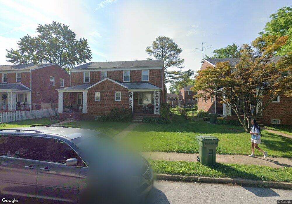
3911 Bartwood Rd Baltimore, MD 21215
Glen NeighborhoodEstimated Value: $188,000 - $199,105
Studio
2
Baths
1,384
Sq Ft
$140/Sq Ft
Est. Value
About This Home
This home is located at 3911 Bartwood Rd, Baltimore, MD 21215 and is currently estimated at $193,553, approximately $139 per square foot. 3911 Bartwood Rd is a home located in Baltimore City with nearby schools including Fallstaff Elementary School, Booker T. Washington Middle School, and Forest Park High School.
Ownership History
Date
Name
Owned For
Owner Type
Purchase Details
Closed on
Oct 31, 2007
Sold by
Feldstein Isaac E
Bought by
Perlstein Binyomin A and Perlstein Elisheva
Current Estimated Value
Home Financials for this Owner
Home Financials are based on the most recent Mortgage that was taken out on this home.
Original Mortgage
$96,013
Outstanding Balance
$71,614
Interest Rate
6.41%
Mortgage Type
Purchase Money Mortgage
Estimated Equity
$121,939
Purchase Details
Closed on
Jun 10, 2002
Sold by
Feldstein Isaac E
Bought by
Feldstein Isaac E and Feldstein Pauline
Create a Home Valuation Report for This Property
The Home Valuation Report is an in-depth analysis detailing your home's value as well as a comparison with similar homes in the area
Home Values in the Area
Average Home Value in this Area
Purchase History
| Date | Buyer | Sale Price | Title Company |
|---|---|---|---|
| Perlstein Binyomin A | $145,000 | -- | |
| Feldstein Isaac E | -- | -- |
Source: Public Records
Mortgage History
| Date | Status | Borrower | Loan Amount |
|---|---|---|---|
| Open | Perlstein Binyomin A | $96,013 | |
| Closed | Perlstein Binyomin A | $7,250 |
Source: Public Records
Tax History
| Year | Tax Paid | Tax Assessment Tax Assessment Total Assessment is a certain percentage of the fair market value that is determined by local assessors to be the total taxable value of land and additions on the property. | Land | Improvement |
|---|---|---|---|---|
| 2025 | $3,238 | $161,267 | -- | -- |
| 2024 | $3,238 | $150,200 | $38,000 | $112,200 |
| 2023 | $3,192 | $148,633 | $0 | $0 |
| 2022 | $3,160 | $147,067 | $0 | $0 |
| 2021 | $3,434 | $145,500 | $38,000 | $107,500 |
| 2020 | $3,031 | $141,333 | $0 | $0 |
| 2019 | $2,918 | $137,167 | $0 | $0 |
| 2018 | $2,901 | $133,000 | $38,000 | $95,000 |
| 2017 | $2,841 | $129,167 | $0 | $0 |
| 2016 | $2,667 | $125,333 | $0 | $0 |
| 2015 | $2,667 | $121,500 | $0 | $0 |
| 2014 | $2,667 | $118,533 | $0 | $0 |
Source: Public Records
Map
Nearby Homes
- 3720 Bartwood Rd
- 3737 Clarks Ln Unit 408
- 3737 Clarks Ln
- 3737 Clarks Ln Unit 205
- 3737 Clarks Ln Unit 405
- 4002 Clarks Ln
- 3601 Clarks Ln Unit 536
- 3601 Clarks Ln Unit 506
- 3601 Clarks Ln
- 3601 Clarks Ln
- 3601 Clarks Ln
- 6606 Park Heights Ave Unit 111
- 6606 Park Heights Ave Unit 905
- 6606 Park Heights Ave Unit 205
- 6606 Park Heights Ave Unit 811
- 6606 Park Heights Ave Unit 805
- 6606 Park Heights Ave Unit 615
- 6606 Park Heights Ave Unit 705
- 6606 Park Heights Ave Unit 701
- 3902 Rosecrest Ave
- 3909 Bartwood Rd
- 3913 Bartwood Rd
- 3907 Bartwood Rd
- 3915 Bartwood Rd
- 3905 Bartwood Rd
- 3910 Bancroft Rd
- 3908 Bancroft Rd
- 3912 Bancroft Rd
- 3906 Bancroft Rd
- 3903 Bartwood Rd
- 3914 Bancroft Rd
- 3904 Bancroft Rd
- 6511 Hopeton Ave
- 6509 Hopeton Ave
- 6513 Hopeton Ave
- 3901 Bartwood Rd
- 3902 Bancroft Rd
- 6505 Hopeton Ave
- 3900 Bancroft Rd
- 6503 Hopeton Ave
Your Personal Tour Guide
Ask me questions while you tour the home.