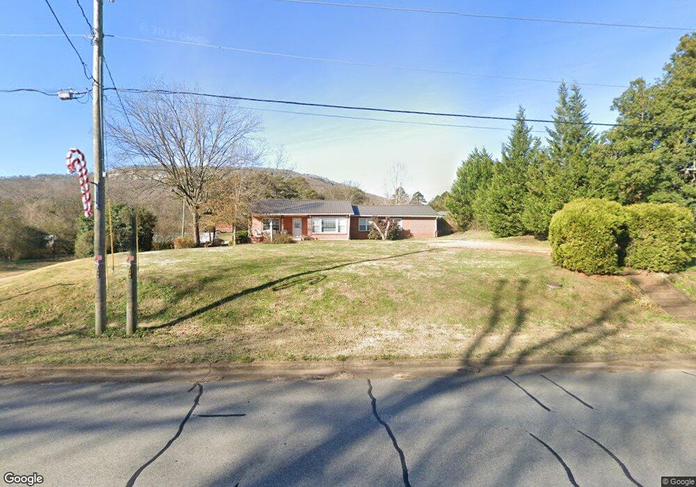
3911 Highway 11 Rising Fawn, GA 30738
Rising Fawn NeighborhoodEstimated Value: $306,000 - $362,000
3
Beds
2
Baths
1,878
Sq Ft
$180/Sq Ft
Est. Value
About This Home
This home is located at 3911 Highway 11, Rising Fawn, GA 30738 and is currently estimated at $338,641, approximately $180 per square foot. 3911 Highway 11 is a home located in Dade County with nearby schools including Dade Middle School and Dade County High School.
Ownership History
Date
Name
Owned For
Owner Type
Purchase Details
Closed on
May 30, 2025
Sold by
Patrick Loraleigh
Bought by
Morgana Portfolio Llc
Current Estimated Value
Home Financials for this Owner
Home Financials are based on the most recent Mortgage that was taken out on this home.
Original Mortgage
$175,000
Outstanding Balance
$117,972
Interest Rate
6.76%
Mortgage Type
New Conventional
Estimated Equity
$220,669
Purchase Details
Closed on
May 23, 2022
Sold by
Sanford William D
Bought by
Patrick Loraleigh and Patrick Richard
Purchase Details
Closed on
Mar 12, 2001
Sold by
Houser Joan Marie
Bought by
Sanford William D
Purchase Details
Closed on
Dec 21, 1999
Sold by
Miles Janet and Miles Hugh
Bought by
Houser Joan Marie
Purchase Details
Closed on
Jun 10, 1996
Sold by
Smaha Marie -Marjori
Bought by
Miles Janet and Miles Hugh
Create a Home Valuation Report for This Property
The Home Valuation Report is an in-depth analysis detailing your home's value as well as a comparison with similar homes in the area
Home Values in the Area
Average Home Value in this Area
Purchase History
| Date | Buyer | Sale Price | Title Company |
|---|---|---|---|
| Morgana Portfolio Llc | $100,000 | -- | |
| Patrick Loraleigh | $290,000 | -- | |
| Sanford William D | $95,000 | -- | |
| Houser Joan Marie | $92,500 | -- | |
| Miles Janet | $75,000 | -- |
Source: Public Records
Mortgage History
| Date | Status | Borrower | Loan Amount |
|---|---|---|---|
| Open | Morgana Portfolio Llc | $175,000 |
Source: Public Records
Tax History Compared to Growth
Tax History
| Year | Tax Paid | Tax Assessment Tax Assessment Total Assessment is a certain percentage of the fair market value that is determined by local assessors to be the total taxable value of land and additions on the property. | Land | Improvement |
|---|---|---|---|---|
| 2024 | $1,721 | $94,608 | $16,920 | $77,688 |
| 2023 | $2,074 | $92,620 | $16,920 | $75,700 |
| 2022 | $876 | $73,820 | $16,920 | $56,900 |
| 2021 | $835 | $61,648 | $10,440 | $51,208 |
| 2020 | $817 | $54,448 | $7,720 | $46,728 |
| 2019 | $825 | $45,008 | $7,720 | $37,288 |
| 2018 | $1,080 | $45,008 | $7,720 | $37,288 |
| 2017 | $840 | $45,008 | $7,720 | $37,288 |
| 2016 | $837 | $45,008 | $7,720 | $37,288 |
| 2015 | -- | $60,048 | $22,760 | $37,288 |
| 2014 | -- | $56,048 | $22,760 | $33,288 |
| 2013 | -- | $0 | $0 | $0 |
Source: Public Records
Map
Nearby Homes
- 3865 Highway 11 S
- 392 School St
- 550 Old Deer Head Cove Rd
- 2079 N Highway 11
- 2313 Sunset Dr
- 0 Puddin Ridge Rd
- 300 Canaan Ln
- 00 County Road 792
- 2970 Newsome Gap Rd
- 10 Acres Cr- 792 8-9
- 440 Mac Lake Dr
- 3607 County Road 792
- 308 Lakeview Dr
- 3584 Mason Rd
- 90 Crook View Rd
- 0 Plum Nelly Rd Unit 1511878
- 157 Highway
- 0 Long Branch Rd Unit 1514733
- 0 Long Branch Rd Unit RTC2942015
- 0 Long Branch Rd Unit 23920937
- 3911 S Hwy 11
- 3911 U S 11
- 3911 S Us Hwy 11 S
- 49 Steele Rd
- 56 Kenmer Ln
- 74 Kenmer Ln
- 74 Kenmer Ln
- 75 Steele Rd
- 40 Kenimer Ln
- 3847 Highway 11
- 4 Still Creek Rd
- 4 Still Creek Rd Unit LOT 4
- 1 Still Creek Rd
- 1 Still Creek Rd Unit LOT 1
- 0 Tauqueta Trail Unit 1164721
- 0 Tauqueta Trail Unit 1166600
- 0 Tauqueta Trail Unit 1211525
- Phase9 Lot 18
- 0 Tauqueta Trail Unit 1054152
- 0 Tauqueta Trail Unit 1051799