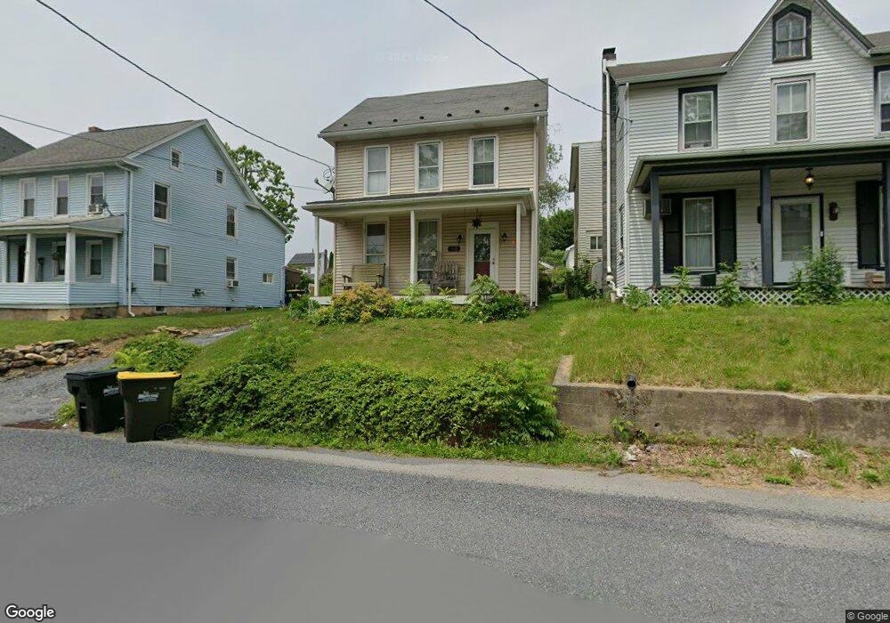
3911 Main St Slatington, PA 18080
Estimated Value: $157,000 - $286,000
2
Beds
1
Bath
1,056
Sq Ft
$197/Sq Ft
Est. Value
About This Home
This home is located at 3911 Main St, Slatington, PA 18080 and is currently estimated at $208,042, approximately $197 per square foot. 3911 Main St is a home with nearby schools including Peters Elementary School, Slatington Elementary School, and Northern Lehigh Middle School.
Ownership History
Date
Name
Owned For
Owner Type
Purchase Details
Closed on
May 27, 2025
Sold by
Rothrock Bonnie L
Bought by
Bonnie L Rothrock Family Trust and Rothrock
Current Estimated Value
Purchase Details
Closed on
Jul 18, 2000
Sold by
Eroh Bryon D
Bought by
Rothrock Bonnie L
Purchase Details
Closed on
Oct 1, 1992
Sold by
Rothrock Bonnie L
Bought by
Rothrock Bonnie L and Eroh Bryon D
Purchase Details
Closed on
Jul 27, 1987
Sold by
Rothrock Jr Theodore C and Rothrock Bonnie L
Bought by
Rothrock Bonnie L
Purchase Details
Closed on
Sep 11, 1980
Bought by
Rothrock Theodore C and Rothrock Bonnie L
Create a Home Valuation Report for This Property
The Home Valuation Report is an in-depth analysis detailing your home's value as well as a comparison with similar homes in the area
Home Values in the Area
Average Home Value in this Area
Purchase History
| Date | Buyer | Sale Price | Title Company |
|---|---|---|---|
| Bonnie L Rothrock Family Trust | -- | None Listed On Document | |
| Rothrock Bonnie L | $28,377 | -- | |
| Rothrock Bonnie L | $29,100 | -- | |
| Rothrock Bonnie L | -- | -- | |
| Rothrock Theodore C | $10,000 | -- |
Source: Public Records
Tax History
| Year | Tax Paid | Tax Assessment Tax Assessment Total Assessment is a certain percentage of the fair market value that is determined by local assessors to be the total taxable value of land and additions on the property. | Land | Improvement |
|---|---|---|---|---|
| 2026 | $2,304 | $76,100 | $14,800 | $61,300 |
| 2025 | $2,241 | $76,100 | $14,800 | $61,300 |
| 2024 | $2,203 | $76,100 | $14,800 | $61,300 |
| 2023 | $2,142 | $76,100 | $14,800 | $61,300 |
| 2022 | $2,104 | $76,100 | $61,300 | $14,800 |
| 2021 | $2,068 | $76,100 | $14,800 | $61,300 |
| 2020 | $2,024 | $76,100 | $14,800 | $61,300 |
| 2019 | $1,971 | $76,100 | $14,800 | $61,300 |
| 2018 | $1,924 | $76,100 | $14,800 | $61,300 |
| 2017 | $1,918 | $76,100 | $14,800 | $61,300 |
| 2016 | -- | $76,100 | $14,800 | $61,300 |
| 2015 | -- | $76,100 | $14,800 | $61,300 |
| 2014 | -- | $76,100 | $14,800 | $61,300 |
Source: Public Records
Map
Nearby Homes
- 3907 Main St
- 0 Main St Unit 769797
- 3714 Old Mill Rd
- 7763 Center St
- 7757 Center St
- 7761 Center St
- 3538 Mountain Rd Unit 3540
- 8600 Delong Dr
- 3006 Beddall St
- 420 7th St
- 9170 N Loop Rd
- 8624 Ashfield Rd
- 7126 Pa Route 873
- 123 4th St
- 556 Main St
- 3511 Timber Ln
- 210 2nd St
- 117 E Church St
- 356 1st St
- 356 First St
- 3913 Main St
- 3914 Main St
- 1572 E Grant St
- 3916 Main St
- 3918 Main St
- 3912 E Grant St
- 3914 E Grant St Unit Rear
- 3906 E Grant St
- 3916 E Grant St
- 3904 E Grant St
- 3922 E Grant St
- 3902 E Grant St
- 3907 E Grant St
- 3868 Main St
- 3926 E Grant St
- 3924 E Grant St
- 3928 E Grant St
- 3918 E Grant St
- 3921 E Grant St
- 3921 E Grant St
Your Personal Tour Guide
Ask me questions while you tour the home.