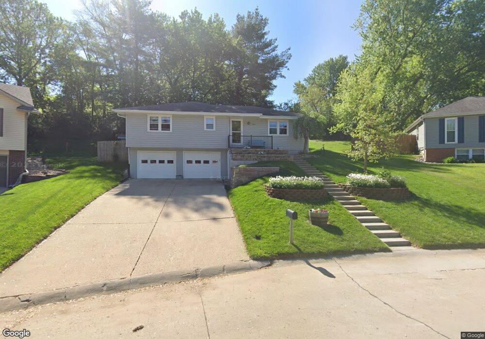
3911 Marble Ln Saint Joseph, MO 64505
Northside NeighborhoodEstimated Value: $256,000 - $292,000
Studio
--
Bath
1,296
Sq Ft
$208/Sq Ft
Est. Value
About This Home
This home is located at 3911 Marble Ln, Saint Joseph, MO 64505 and is currently estimated at $270,208, approximately $208 per square foot. 3911 Marble Ln is a home located in Buchanan County with nearby schools including Field Elementary School, Bode Middle School, and Central High School.
Ownership History
Date
Name
Owned For
Owner Type
Purchase Details
Closed on
May 5, 2008
Sold by
Sinclair Anthony D and Sinclair Sheila M
Bought by
Graham Brian R and Graham Heather M
Current Estimated Value
Home Financials for this Owner
Home Financials are based on the most recent Mortgage that was taken out on this home.
Original Mortgage
$135,000
Outstanding Balance
$84,935
Interest Rate
5.84%
Mortgage Type
New Conventional
Estimated Equity
$185,273
Create a Home Valuation Report for This Property
The Home Valuation Report is an in-depth analysis detailing your home's value as well as a comparison with similar homes in the area
Home Values in the Area
Average Home Value in this Area
Purchase History
| Date | Buyer | Sale Price | Title Company |
|---|---|---|---|
| Graham Brian R | $156,791 | Preferred Title Of St Joseph |
Source: Public Records
Mortgage History
| Date | Status | Borrower | Loan Amount |
|---|---|---|---|
| Open | Graham Brian R | $135,000 |
Source: Public Records
Tax History
| Year | Tax Paid | Tax Assessment Tax Assessment Total Assessment is a certain percentage of the fair market value that is determined by local assessors to be the total taxable value of land and additions on the property. | Land | Improvement |
|---|---|---|---|---|
| 2025 | $1,583 | $22,010 | $4,640 | $17,370 |
| 2024 | $1,496 | $20,810 | $4,640 | $16,170 |
| 2023 | $1,496 | $20,810 | $4,640 | $16,170 |
| 2022 | $1,382 | $20,810 | $4,640 | $16,170 |
| 2021 | $1,388 | $20,810 | $4,640 | $16,170 |
| 2020 | $1,379 | $20,810 | $4,640 | $16,170 |
| 2019 | $1,332 | $20,810 | $4,640 | $16,170 |
| 2018 | $1,204 | $20,810 | $4,640 | $16,170 |
| 2017 | $1,193 | $20,810 | $0 | $0 |
| 2015 | $0 | $20,810 | $0 | $0 |
| 2014 | $1,307 | $20,810 | $0 | $0 |
Source: Public Records
Map
Nearby Homes
- 2502 Flintstone Dr
- 28 Court Ln
- 3413 W Colony Square
- 2715 Cook Rd
- 4502 Orchard Rd
- 3111 Carlisle Ct
- 3109 Carlisle Ct
- 3107 Carlisle Ct
- 2918 Kimbrough Ln
- 4214 W Haverill St
- 3309 Westwood Dr
- 3117 Miller Ave
- 3103 Cook Rd
- 2610 Parallel Ave
- 2611 Parallel Ave
- 2634 Lucille Ave
- 4809 Miller Rd
- 2511 Kent St
- 3309 Mueller Ln
- 2324 Goff Ave
- 3917 Marble Ln
- 0 Marble Ln Unit 1999306
- 3907 Marble Ln
- 3919 Marble Ln
- 3914 Marble Ln
- 3812 Miller Rd
- 3816 Miller Rd
- 3810 Miller Rd
- 2715 Karnes Rd
- 3923 Marble Ln
- 2706 Flintstone Dr
- 3910 Marble Ln
- 2717 Karnes Rd
- 2714 Flintstone Dr
- 3808 Miller Rd
- 2713 Karnes Rd
- 2702 Flintstone Dr
- 3903 Marble Ln
- 2719 Karnes Rd
- 2618 Flintstone Dr
Your Personal Tour Guide
Ask me questions while you tour the home.