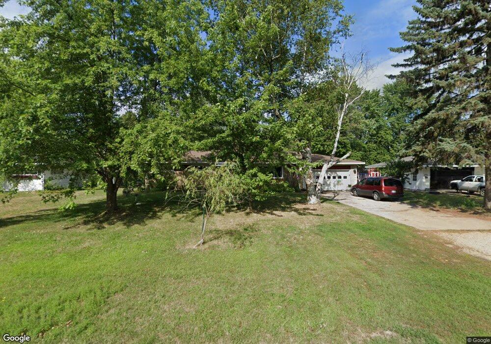
3911 Molly Blvd Muskegon, MI 49444
Estimated Value: $216,000 - $287,185
3
Beds
2
Baths
2,085
Sq Ft
$121/Sq Ft
Est. Value
About This Home
This home is located at 3911 Molly Blvd, Muskegon, MI 49444 and is currently estimated at $252,296, approximately $121 per square foot. 3911 Molly Blvd is a home located in Muskegon County with nearby schools including Fruitport High School, Edgewood Elementary Academy, and Dr. Martin Luther King Academy.
Ownership History
Date
Name
Owned For
Owner Type
Purchase Details
Closed on
Oct 26, 2004
Sold by
Fischer Albert
Bought by
Giles Michael L and Giles Leila M
Current Estimated Value
Home Financials for this Owner
Home Financials are based on the most recent Mortgage that was taken out on this home.
Original Mortgage
$127,890
Outstanding Balance
$63,949
Interest Rate
5.81%
Mortgage Type
FHA
Estimated Equity
$188,347
Purchase Details
Closed on
Mar 27, 2003
Sold by
Fischer Albert
Bought by
Giles Michael and Giles Leila M
Create a Home Valuation Report for This Property
The Home Valuation Report is an in-depth analysis detailing your home's value as well as a comparison with similar homes in the area
Home Values in the Area
Average Home Value in this Area
Purchase History
| Date | Buyer | Sale Price | Title Company |
|---|---|---|---|
| Giles Michael L | $130,000 | -- | |
| Giles Michael | -- | -- | |
| Fischer Albert | -- | -- |
Source: Public Records
Mortgage History
| Date | Status | Borrower | Loan Amount |
|---|---|---|---|
| Open | Giles Michael L | $127,890 |
Source: Public Records
Tax History Compared to Growth
Tax History
| Year | Tax Paid | Tax Assessment Tax Assessment Total Assessment is a certain percentage of the fair market value that is determined by local assessors to be the total taxable value of land and additions on the property. | Land | Improvement |
|---|---|---|---|---|
| 2025 | $2,562 | $124,000 | $0 | $0 |
| 2024 | $1,601 | $114,300 | $0 | $0 |
| 2023 | $1,531 | $100,000 | $0 | $0 |
| 2022 | $2,018 | $89,600 | $0 | $0 |
| 2021 | $1,963 | $82,700 | $0 | $0 |
| 2020 | $1,943 | $74,300 | $0 | $0 |
| 2019 | $1,909 | $69,700 | $0 | $0 |
| 2018 | $1,826 | $68,200 | $0 | $0 |
| 2017 | $1,788 | $64,600 | $0 | $0 |
| 2016 | $1,086 | $58,200 | $0 | $0 |
| 2015 | -- | $56,300 | $0 | $0 |
| 2014 | -- | $59,200 | $0 | $0 |
| 2013 | -- | $53,300 | $0 | $0 |
Source: Public Records
Map
Nearby Homes
- 3835 Ellen St
- 4060 Buck St
- 1454 Airport Rd
- 1201 Shettler Rd
- V/L 4535 Thompson Rd
- 1130 Englewood Ave
- 1068 Englewood Ave
- 3598 Valley View Dr Unit 10
- 2322 Cline Rd
- 4468 Spruce Ct
- 4535 Thompson Rd
- 2355 Cress Creek Dr
- 4476 Cedar Ln Unit 54
- 4677 Harvey St
- 3176 Klug St
- V/L S Sheridan Dr
- 4563 Keener St
- 1418 Saskatoon Ave
- 3125 Stratford St
- 1071 Calgary Dr
- 3895 Molly Blvd
- 3921 Molly Blvd
- 3904 Molly Blvd
- 3920 Molly Blvd
- 3889 Molly Blvd
- 3949 Molly Blvd
- 3890 Molly Blvd
- 3865 Molly Blvd
- 3951 Molly Blvd
- 3934 Molly Blvd
- 3874 Molly Blvd
- 3912 Taylor St
- 3851 Molly Blvd
- 3955 Molly Blvd
- 3917 Michael St
- 3860 Molly Blvd
- 3897 Michael St
- 3929 Michael St
- 3885 Michael St
- 3950 Taylor St