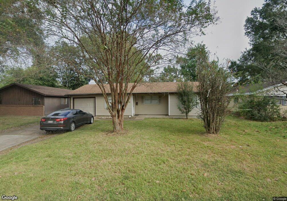
3912 Broadmoor Dr Unit 3912 Broadmoor Drive Beaumont, TX 77707
Safe Sommerset NeighborhoodEstimated Value: $149,364 - $245,000
3
Beds
2
Baths
1,320
Sq Ft
$137/Sq Ft
Est. Value
About This Home
This home is located at 3912 Broadmoor Dr Unit 3912 Broadmoor Drive, Beaumont, TX 77707 and is currently estimated at $180,591, approximately $136 per square foot. 3912 Broadmoor Dr Unit 3912 Broadmoor Drive is a home located in Jefferson County with nearby schools including Caldwood Elementary School, Odom Middle School, and West Brook Sr High School.
Ownership History
Date
Name
Owned For
Owner Type
Purchase Details
Closed on
Nov 27, 2018
Sold by
Wells Fargo Bank
Bought by
Rahal Anis
Current Estimated Value
Purchase Details
Closed on
Aug 5, 2009
Sold by
Wiggins Alton B and Wiggins Alton B
Bought by
Solomon Brett
Home Financials for this Owner
Home Financials are based on the most recent Mortgage that was taken out on this home.
Original Mortgage
$93,279
Interest Rate
5.44%
Mortgage Type
FHA
Create a Home Valuation Report for This Property
The Home Valuation Report is an in-depth analysis detailing your home's value as well as a comparison with similar homes in the area
Home Values in the Area
Average Home Value in this Area
Purchase History
| Date | Buyer | Sale Price | Title Company |
|---|---|---|---|
| Rahal Anis | -- | None Available | |
| Solomon Brett | -- | Stewart Title |
Source: Public Records
Mortgage History
| Date | Status | Borrower | Loan Amount |
|---|---|---|---|
| Previous Owner | Solomon Brett | $93,279 |
Source: Public Records
Tax History Compared to Growth
Tax History
| Year | Tax Paid | Tax Assessment Tax Assessment Total Assessment is a certain percentage of the fair market value that is determined by local assessors to be the total taxable value of land and additions on the property. | Land | Improvement |
|---|---|---|---|---|
| 2025 | $3,653 | $157,286 | $5,890 | $151,396 |
| 2024 | $3,653 | $157,286 | $5,890 | $151,396 |
| 2023 | $3,653 | $153,302 | $5,890 | $147,412 |
| 2022 | $3,486 | $133,381 | $5,890 | $127,491 |
| 2021 | $3,189 | $117,445 | $5,890 | $111,555 |
| 2020 | $2,455 | $90,433 | $5,890 | $84,543 |
| 2019 | $2,301 | $84,410 | $5,890 | $78,520 |
| 2018 | $2,192 | $78,370 | $5,890 | $72,480 |
| 2017 | $2,319 | $84,390 | $5,890 | $78,500 |
| 2016 | $2,320 | $84,390 | $5,890 | $78,500 |
| 2015 | $2,385 | $81,120 | $5,890 | $75,230 |
| 2014 | $2,385 | $86,910 | $5,890 | $81,020 |
Source: Public Records
Map
Nearby Homes
- 3875 Bellgreen Place
- 3850 Bristol Dr
- 3966 Broadmoor Dr
- 45 Ruth St
- 290 Rosine St
- 253 Hampton Ln
- 3970 Bayou Rd
- 289 Hampton Ln
- 3890 Bryan Dr
- 4030 Bayou Rd
- 340 Maxwell Dr
- 3845 Holland Dr
- 280 Berkshire Ln
- 92 Sparrow Way
- 260 Canterbury Dr
- 0 Gentry Rd
- 5010 Swallow Dr
- 4195 College St
- 5530 Bristol Dr
- 5060 Swallow Dr
- 3912 Broadmoor Dr
- 3906 Broadmoor Dr
- 3918 Broadmoor Dr
- 3924 Broadmoor Dr
- 3915 Bristol Dr
- 3905 Bristol Dr
- 3921 Bristol Dr
- 3929 Bristol Dr
- 3911 Broadmoor Dr
- 3930 Broadmoor Dr
- 3890 Broadmoor Dr
- 3905 Broadmoor Dr
- 3917 Broadmoor Dr
- 3935 Bristol Dr
- 3925 Broadmoor Dr
- 3895 Bristol Dr
- 3936 Broadmoor Dr
- 3880 Broadmoor Dr
- 3931 Broadmoor Dr
- 3895 Broadmoor Dr