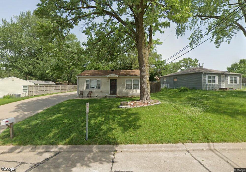
3912 High Meadow Ln Bellevue, NE 68147
Estimated Value: $187,000 - $213,352
2
Beds
1
Bath
1,180
Sq Ft
$170/Sq Ft
Est. Value
About This Home
This home is located at 3912 High Meadow Ln, Bellevue, NE 68147 and is currently estimated at $200,088, approximately $169 per square foot. 3912 High Meadow Ln is a home located in Sarpy County with nearby schools including Gilder Elementary School, Bryan Middle School, and Bryan High School.
Ownership History
Date
Name
Owned For
Owner Type
Purchase Details
Closed on
Jan 20, 2010
Sold by
Patchin Ronald G
Bought by
Donnelly David E
Current Estimated Value
Home Financials for this Owner
Home Financials are based on the most recent Mortgage that was taken out on this home.
Original Mortgage
$104,150
Outstanding Balance
$68,830
Interest Rate
5.08%
Estimated Equity
$131,258
Purchase Details
Closed on
Apr 24, 2003
Sold by
Schendt Jennifer Ebert and Schendt Mark
Bought by
Patchin Ronald G
Home Financials for this Owner
Home Financials are based on the most recent Mortgage that was taken out on this home.
Original Mortgage
$60,500
Interest Rate
5.8%
Create a Home Valuation Report for This Property
The Home Valuation Report is an in-depth analysis detailing your home's value as well as a comparison with similar homes in the area
Home Values in the Area
Average Home Value in this Area
Purchase History
| Date | Buyer | Sale Price | Title Company |
|---|---|---|---|
| Donnelly David E | $102,000 | Nlta | |
| Patchin Ronald G | $92,000 | -- |
Source: Public Records
Mortgage History
| Date | Status | Borrower | Loan Amount |
|---|---|---|---|
| Open | Donnelly David E | $104,150 | |
| Previous Owner | Patchin Ronald G | $60,500 |
Source: Public Records
Tax History Compared to Growth
Tax History
| Year | Tax Paid | Tax Assessment Tax Assessment Total Assessment is a certain percentage of the fair market value that is determined by local assessors to be the total taxable value of land and additions on the property. | Land | Improvement |
|---|---|---|---|---|
| 2025 | $2,752 | $181,716 | $30,000 | $151,716 |
| 2024 | $3,417 | $164,041 | $25,000 | $139,041 |
| 2023 | $3,417 | $158,274 | $25,000 | $133,274 |
| 2022 | $3,268 | $149,700 | $25,000 | $124,700 |
| 2021 | $2,964 | $134,910 | $20,000 | $114,910 |
| 2020 | $2,703 | $122,233 | $20,000 | $102,233 |
| 2019 | $2,482 | $112,026 | $16,000 | $96,026 |
| 2018 | $2,384 | $106,804 | $16,000 | $90,804 |
| 2017 | $2,287 | $101,966 | $16,000 | $85,966 |
| 2016 | $2,197 | $98,664 | $16,000 | $82,664 |
| 2015 | $2,141 | $96,933 | $16,000 | $80,933 |
| 2014 | $2,127 | $97,042 | $16,000 | $81,042 |
| 2012 | -- | $96,924 | $16,000 | $80,924 |
Source: Public Records
Map
Nearby Homes
- 7639 S 39th Ave
- 7675 S 41st Ave
- 8006 Groves Cir
- 4113 Bartmann Dr
- 3701 Groves Rd
- 3708 Greene Ave
- 3613 Emiline St
- 8205 S 39th Ave
- 7613 S 34th St
- 7703 S 34th St
- 7608 S 33rd Ave
- 7612 S 33rd Ave
- 7616 S 33rd Ave
- 3951 Stephanie Ln
- 7518 Chandler Acres Dr
- 7224 Blue Ridge Dr
- 7220 Blue Ridge Dr
- 6505 S 42nd St
- 7731 S 31st St
- 4545 Polk St
- 3908 High Meadow Ln
- 3916 High Meadow Ln
- 3920 High Meadow Ln
- 3911 Baldwin Cir
- 3907 Baldwin Cir
- 3911 High Meadow Ln
- 3915 Baldwin Cir
- 3903 Baldwin Cir
- 3907 High Meadow Ln
- 7607 S 39th Ave
- 3924 High Meadow Ln
- 3951 High Meadow Ln
- 7507 S 40th St
- 7604 S 39th Ave
- 3903 High Meadow Ln
- 3919 Baldwin Cir
- 7608 S 39th Ave
- 7601 S 40th St
- 7611 S 39th Ave
- 7611 39