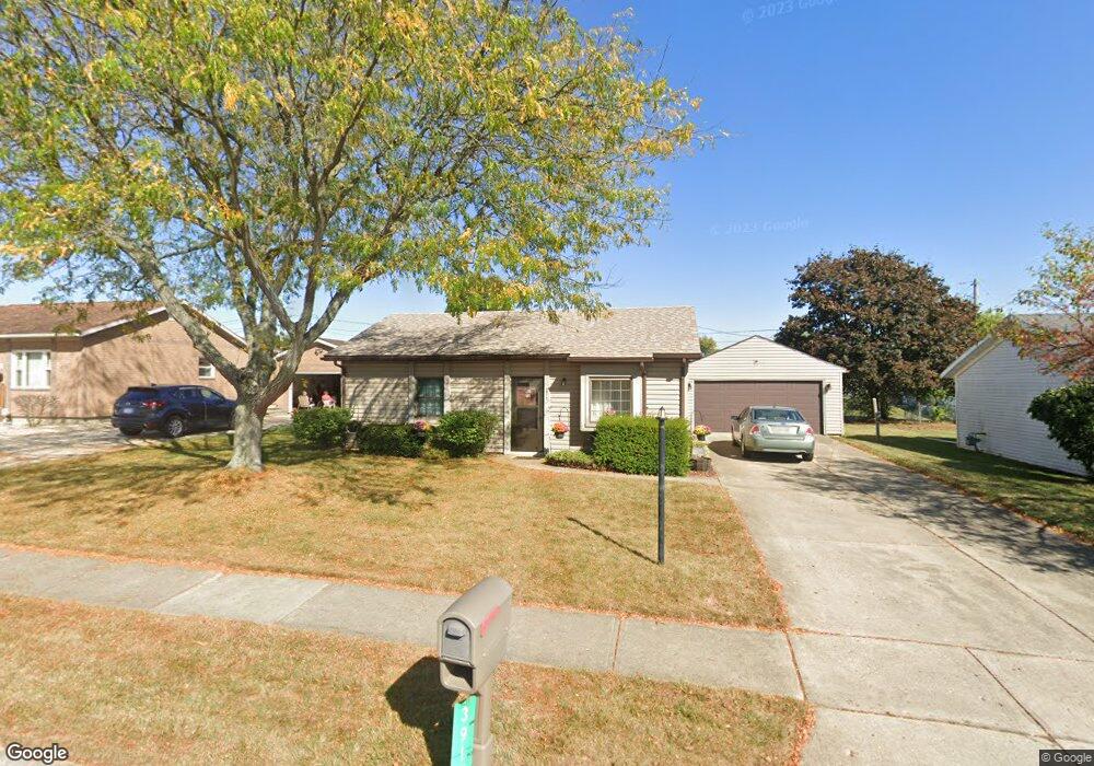
3912 Tacoma St Springfield, OH 45503
Estimated Value: $143,581 - $184,000
2
Beds
1
Bath
768
Sq Ft
$218/Sq Ft
Est. Value
About This Home
This home is located at 3912 Tacoma St, Springfield, OH 45503 and is currently estimated at $167,645, approximately $218 per square foot. 3912 Tacoma St is a home located in Clark County with nearby schools including Northridge Elementary School, Kenton Ridge Middle & High School, and Emmanuel Christian Academy.
Ownership History
Date
Name
Owned For
Owner Type
Purchase Details
Closed on
Oct 31, 1994
Sold by
Ahrens Mark S
Bought by
Dafforn Ronald G and Dafforn Nancy
Current Estimated Value
Home Financials for this Owner
Home Financials are based on the most recent Mortgage that was taken out on this home.
Original Mortgage
$58,100
Interest Rate
8.68%
Mortgage Type
Purchase Money Mortgage
Purchase Details
Closed on
Dec 1, 1983
Create a Home Valuation Report for This Property
The Home Valuation Report is an in-depth analysis detailing your home's value as well as a comparison with similar homes in the area
Home Values in the Area
Average Home Value in this Area
Purchase History
| Date | Buyer | Sale Price | Title Company |
|---|---|---|---|
| Dafforn Ronald G | $57,500 | -- | |
| -- | $38,800 | -- |
Source: Public Records
Mortgage History
| Date | Status | Borrower | Loan Amount |
|---|---|---|---|
| Closed | Dafforn Ronald G | $58,100 |
Source: Public Records
Tax History
| Year | Tax Paid | Tax Assessment Tax Assessment Total Assessment is a certain percentage of the fair market value that is determined by local assessors to be the total taxable value of land and additions on the property. | Land | Improvement |
|---|---|---|---|---|
| 2025 | $1,007 | $45,770 | $12,090 | $33,680 |
| 2024 | $1,000 | $32,830 | $10,710 | $22,120 |
| 2023 | $1,000 | $32,830 | $10,710 | $22,120 |
| 2022 | $1,022 | $32,830 | $10,710 | $22,120 |
| 2021 | $677 | $22,270 | $8,310 | $13,960 |
| 2020 | $678 | $22,270 | $8,310 | $13,960 |
| 2019 | $691 | $22,270 | $8,310 | $13,960 |
| 2018 | $927 | $26,110 | $7,620 | $18,490 |
| 2017 | $795 | $23,734 | $7,616 | $16,118 |
| 2016 | $789 | $23,734 | $7,616 | $16,118 |
| 2015 | $797 | $23,514 | $7,396 | $16,118 |
| 2014 | $797 | $23,514 | $7,396 | $16,118 |
| 2013 | $778 | $23,514 | $7,396 | $16,118 |
Source: Public Records
Map
Nearby Homes
- 3942 Harris Ln
- 1921 Elaina Dr
- 1711 Pinehurst Dr
- 1811 Saint Andrews Ct
- 1503 Kingsgate Rd
- 1505 Kingsgate Rd
- 1507 Kingsgate Rd
- 1500 Kingsgate Rd
- 1502 Kingsgate Rd
- 1500 Kingsgate Rd Unit 19430
- 1502 Kingsgate Rd Unit 19432
- 1509 Kingsgate Rd
- 3631 Kingsgate Ln
- 4256 Midfield St Unit 9
- 4028 Ryland Dr Unit 4028
- 1201 Kingsgate Rd
- 4446 Ridgewood Rd E Unit 3
- 1341 Student Ave
- 1162 Kingsgate Rd
- 4577 Reno Ln Unit 2
- 3920 Tacoma St
- 3906 Tacoma St
- 3931 Delmar Cir
- 3924 Tacoma St
- 3937 Delmar Cir
- 1714 Elaina Dr
- 3911 Tacoma St
- 3927 Delmar Cir
- 3917 Tacoma St
- 3905 Tacoma St
- 3930 Tacoma St
- 3921 Tacoma St
- 1722 Elaina Dr
- 3923 Delmar Cir
- 3901 Tacoma St
- 3927 Tacoma St
- 3941 Delmar Cir
- 3936 Tacoma St
- 1728 Elaina Dr
- 3917 Delmar Cir
Your Personal Tour Guide
Ask me questions while you tour the home.