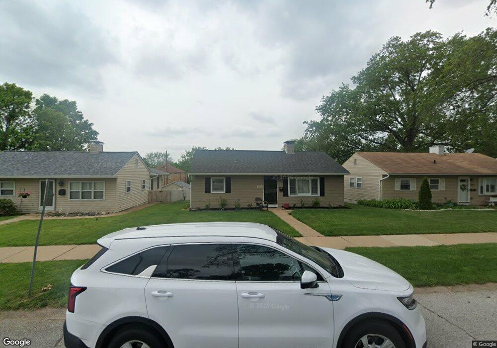
3915 Wenzlick Ave Saint Louis, MO 63109
Lindenwood Park NeighborhoodEstimated Value: $193,000 - $227,000
3
Beds
1
Bath
1,728
Sq Ft
$125/Sq Ft
Est. Value
About This Home
This home is located at 3915 Wenzlick Ave, Saint Louis, MO 63109 and is currently estimated at $215,526, approximately $124 per square foot. 3915 Wenzlick Ave is a home located in St. Louis City with nearby schools including Mason Elementary School, Long International Middle School, and Roosevelt High School.
Ownership History
Date
Name
Owned For
Owner Type
Purchase Details
Closed on
Aug 29, 2014
Sold by
Mcfall Jeannie M and Ross Robert A
Bought by
Mcfall Jeannie M and Revocab Robert
Current Estimated Value
Purchase Details
Closed on
Sep 24, 2013
Sold by
Ross Robert A
Bought by
Ross Robert A and Mcfall Jeannie M
Purchase Details
Closed on
Jun 28, 2012
Sold by
Mazzucca Paula J and Baer Deborah
Bought by
Ross Robert A
Home Financials for this Owner
Home Financials are based on the most recent Mortgage that was taken out on this home.
Original Mortgage
$100,107
Outstanding Balance
$69,526
Interest Rate
3.8%
Mortgage Type
VA
Estimated Equity
$146,000
Create a Home Valuation Report for This Property
The Home Valuation Report is an in-depth analysis detailing your home's value as well as a comparison with similar homes in the area
Home Values in the Area
Average Home Value in this Area
Purchase History
| Date | Buyer | Sale Price | Title Company |
|---|---|---|---|
| Mcfall Jeannie M | -- | None Available | |
| Ross Robert A | -- | None Available | |
| Ross Robert A | -- | Sec |
Source: Public Records
Mortgage History
| Date | Status | Borrower | Loan Amount |
|---|---|---|---|
| Open | Ross Robert A | $100,107 |
Source: Public Records
Tax History Compared to Growth
Tax History
| Year | Tax Paid | Tax Assessment Tax Assessment Total Assessment is a certain percentage of the fair market value that is determined by local assessors to be the total taxable value of land and additions on the property. | Land | Improvement |
|---|---|---|---|---|
| 2025 | $2,397 | $33,390 | $2,850 | $30,540 |
| 2024 | $2,281 | $28,300 | $2,850 | $25,450 |
| 2023 | $2,281 | $28,300 | $2,850 | $25,450 |
| 2022 | $2,176 | $25,990 | $2,850 | $23,140 |
| 2021 | $2,173 | $25,990 | $2,850 | $23,140 |
| 2020 | $1,968 | $23,690 | $2,850 | $20,840 |
| 2019 | $1,962 | $23,690 | $2,850 | $20,840 |
| 2018 | $1,695 | $19,800 | $2,620 | $17,180 |
| 2017 | $1,667 | $19,800 | $2,620 | $17,180 |
| 2016 | $1,608 | $18,850 | $2,620 | $16,230 |
| 2015 | $1,459 | $18,850 | $2,620 | $16,230 |
| 2014 | $1,419 | $18,850 | $2,620 | $16,230 |
| 2013 | -- | $18,330 | $2,620 | $15,710 |
Source: Public Records
Map
Nearby Homes
- 6646 Mardel Ave
- 6973 Winona Ave
- 6968 Winona Ave
- 6927-6931 Sutherland Ave
- 6659 Tholozan Ave
- 6709 Lansdowne Ave
- 3815 Mccausland Ave Unit 4
- 6935 Lansdowne Ave
- 6561 Bancroft Ave
- 6621 Tholozan Ave
- 6561 Mardel Ave
- 6631 Pernod Ave
- 6656 Oleatha Ave
- 6968 Lansdowne Ave
- 7047 Tholozan Ave
- 7038 Pernod Ave
- 6637 Devonshire Ave Unit 2
- 3914 Watson Rd
- 6562 Oleatha Ave
- 7044 Lansdowne Ave
- 3919 Wenzlick Ave
- 3911 Wenzlick Ave
- 3923 Wenzlick Ave
- 3907 Wenzlick Ave
- 3912 Jamieson Ave
- 3916 Jamieson Ave
- 3927 Wenzlick Ave
- 6804 Lindenwood Place
- 3920 Jamieson Ave
- 3908 Jamieson Ave
- 3924 Jamieson Ave
- 6814 Lindenwood Place
- 3916 Wenzlick Ave
- 69696971 Lindenwood Place
- 3912 Wenzlick Ave
- 3920 Wenzlick Ave
- 3931 Wenzlick Ave
- 3908 Wenzlick Ave
- 3928 Jamieson Ave
- 3924 Wenzlick Ave