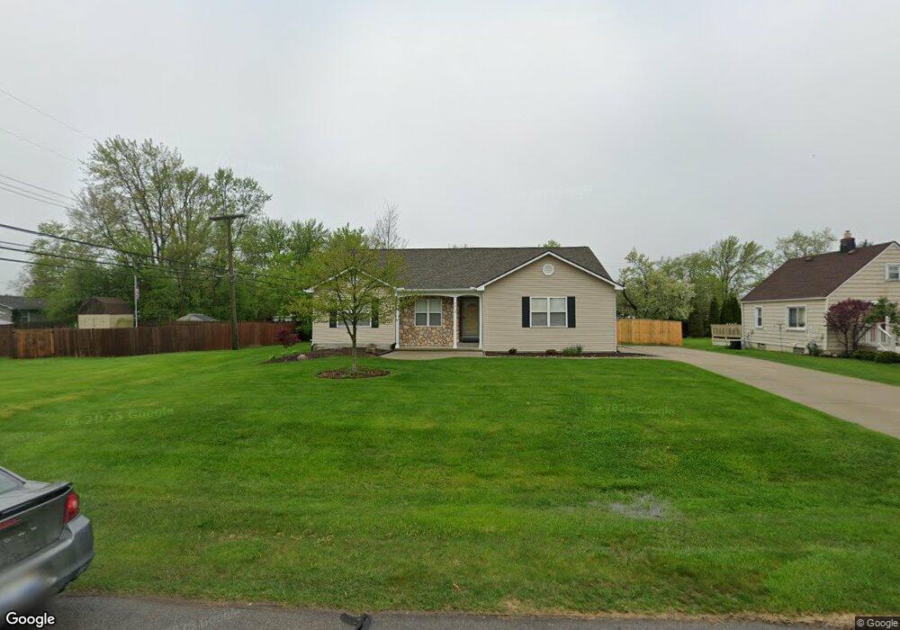
3918 Samuel Ave Unit Bldg-Unit Rochester Hills, MI 48309
Estimated Value: $384,000 - $414,000
3
Beds
3
Baths
1,296
Sq Ft
$310/Sq Ft
Est. Value
About This Home
This home is located at 3918 Samuel Ave Unit Bldg-Unit, Rochester Hills, MI 48309 and is currently estimated at $402,120, approximately $310 per square foot. 3918 Samuel Ave Unit Bldg-Unit is a home located in Oakland County with nearby schools including Deerfield Elementary School, Avondale Middle School, and Avondale High School.
Ownership History
Date
Name
Owned For
Owner Type
Purchase Details
Closed on
Mar 12, 2025
Sold by
Richardson Jeffrey L and Richardson Katharine S
Bought by
Vincent Alysha M
Current Estimated Value
Home Financials for this Owner
Home Financials are based on the most recent Mortgage that was taken out on this home.
Original Mortgage
$365,750
Outstanding Balance
$363,907
Interest Rate
6.95%
Mortgage Type
New Conventional
Estimated Equity
$38,213
Purchase Details
Closed on
Feb 22, 2018
Sold by
Poston Robert D and Poston Jennifer G
Bought by
Richardson Jeffrey L and Richardson Katharine S
Create a Home Valuation Report for This Property
The Home Valuation Report is an in-depth analysis detailing your home's value as well as a comparison with similar homes in the area
Home Values in the Area
Average Home Value in this Area
Purchase History
| Date | Buyer | Sale Price | Title Company |
|---|---|---|---|
| Vincent Alysha M | $400,000 | Ata National Title | |
| Vincent Alysha M | $400,000 | Ata National Title | |
| Richardson Jeffrey L | $245,000 | None Available |
Source: Public Records
Mortgage History
| Date | Status | Borrower | Loan Amount |
|---|---|---|---|
| Open | Vincent Alysha M | $365,750 |
Source: Public Records
Tax History Compared to Growth
Tax History
| Year | Tax Paid | Tax Assessment Tax Assessment Total Assessment is a certain percentage of the fair market value that is determined by local assessors to be the total taxable value of land and additions on the property. | Land | Improvement |
|---|---|---|---|---|
| 2022 | $2,395 | $133,180 | $0 | $0 |
| 2018 | $2,610 | $100,660 | $0 | $0 |
| 2017 | $3,789 | $99,190 | $0 | $0 |
| 2015 | -- | $91,150 | $0 | $0 |
| 2014 | -- | $80,770 | $0 | $0 |
| 2011 | -- | $69,730 | $0 | $0 |
Source: Public Records
Map
Nearby Homes
- 1755 South Blvd W
- 3970 Cone Ave
- 6952 Granger Dr
- 538 Scone Dr
- 1370 South Blvd W
- 6768 Merrick Dr Unit 12
- 1838 Alsdorf Ave
- 6817 Woodcrest Dr
- 2119 Cattail Cir Unit 24
- 2106 Cattail Cir Unit 41
- 58 Ingram Dr
- 3226 Fantail Dr Unit 12
- 2179 Lagoon Dr Unit 19
- 3315 Donley Ave
- 3225 Donley Ave
- 6460 Elmoor Dr
- 273 Strawberry Dr
- 3706 Winding Brook Cir Unit U42
- 2530 South Blvd W
- 3437 Cascade Cir Unit 3
- 3888 Samuel Ave
- 3917 Alida Ave
- 3950 Samuel Ave
- 3925 Alida Ave
- 3925 Alida Ave
- 3874 Samuel Ave
- 3903 Alida Ave
- 1650 South Blvd W
- 3881 Alida Ave
- 3883 Samuel Ave
- 3935 Samuel Ave
- 3864 Samuel Ave
- 3909 Samuel Ave
- 1690 South Blvd W
- 1690 South Blvd W
- 3867 Alida Ave
- 3861 Samuel Ave
- 3963 Samuel Ave
- 3854 Samuel Ave
- 3853 Alida Ave