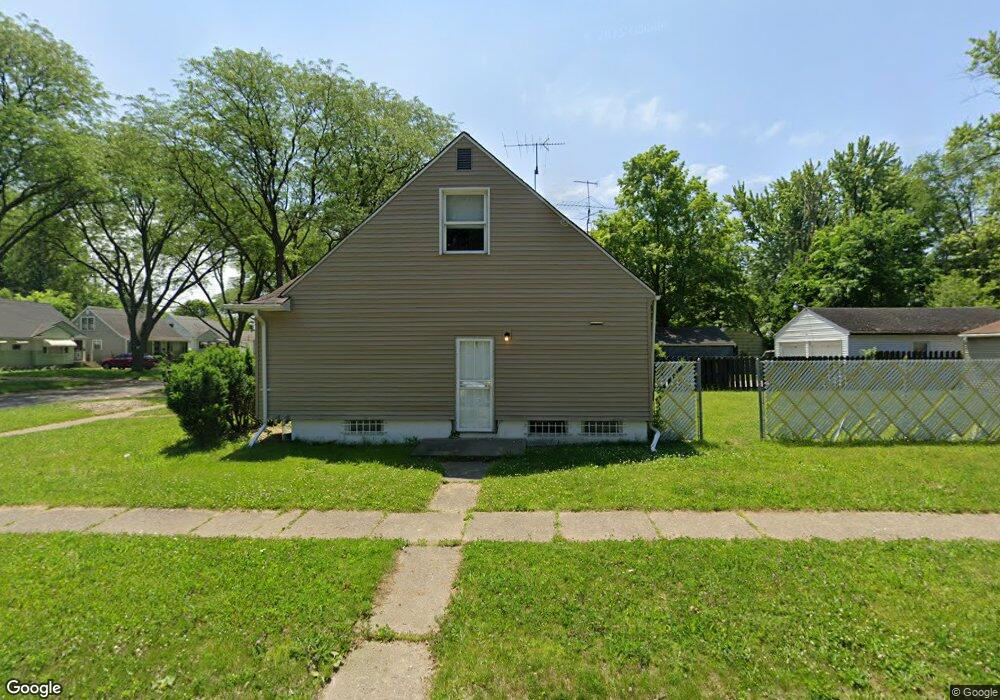
3919 Brownell Blvd Flint, MI 48504
Merill NeighborhoodEstimated Value: $40,000 - $66,000
3
Beds
2
Baths
1,130
Sq Ft
$49/Sq Ft
Est. Value
About This Home
This home is located at 3919 Brownell Blvd, Flint, MI 48504 and is currently estimated at $55,116, approximately $48 per square foot. 3919 Brownell Blvd is a home located in Genesee County with nearby schools including Brownell STEM Academy, Greater Heights Academy, and Eagle's Nest Academy.
Ownership History
Date
Name
Owned For
Owner Type
Purchase Details
Closed on
Mar 11, 2021
Sold by
Genesee County Land Bank Authority
Bought by
Taylor Kristal Lynn
Current Estimated Value
Purchase Details
Closed on
Jul 14, 2017
Sold by
Jackson Gladys
Bought by
Daniel Marla
Purchase Details
Closed on
Nov 20, 2013
Sold by
Genesee County Treasurer
Bought by
Jackson Gladys
Purchase Details
Closed on
Oct 3, 2012
Sold by
Residential Fund 69 Llc
Bought by
Chapman Marcus
Purchase Details
Closed on
Oct 26, 2000
Sold by
Russell Lavern
Bought by
Redmond Monique S
Purchase Details
Closed on
Oct 31, 1996
Sold by
Russell R Russell L and Russell C A
Bought by
Russell Lavern
Create a Home Valuation Report for This Property
The Home Valuation Report is an in-depth analysis detailing your home's value as well as a comparison with similar homes in the area
Home Values in the Area
Average Home Value in this Area
Purchase History
| Date | Buyer | Sale Price | Title Company |
|---|---|---|---|
| Taylor Kristal Lynn | $1,500 | None Listed On Document | |
| Daniel Marla | -- | Cislo Title Co | |
| Jackson Gladys | $1,500 | None Available | |
| Chapman Marcus | -- | None Available | |
| Redmond Monique S | $54,000 | Guaranty Title Company | |
| Russell Lavern | -- | -- |
Source: Public Records
Tax History
| Year | Tax Paid | Tax Assessment Tax Assessment Total Assessment is a certain percentage of the fair market value that is determined by local assessors to be the total taxable value of land and additions on the property. | Land | Improvement |
|---|---|---|---|---|
| 2025 | $990 | $17,500 | $0 | $0 |
| 2024 | $920 | $15,700 | $0 | $0 |
| 2023 | $902 | $12,000 | $0 | $0 |
| 2022 | $0 | $9,200 | $0 | $0 |
| 2021 | $268 | $0 | $0 | $0 |
| 2020 | $268 | $0 | $0 | $0 |
| 2019 | $941 | $10,400 | $0 | $0 |
| 2018 | $1,087 | $12,400 | $0 | $0 |
| 2017 | $1,106 | $0 | $0 | $0 |
| 2016 | $1,098 | $0 | $0 | $0 |
| 2015 | -- | $0 | $0 | $0 |
| 2014 | -- | $0 | $0 | $0 |
| 2012 | -- | $17,300 | $0 | $0 |
Source: Public Records
Map
Nearby Homes
- 3710 Kellar Ave
- 3808 Comstock Ave
- 3617 Kellar Ave
- 3506 Brownell Blvd
- 3517 Leerda St
- 3505 Leerda St
- 3419 Leerda St
- 3413 Leerda St
- 3420 Fleming Rd
- 1315 W Myrtle Ave
- 3218 Trumbull Ave
- 2006 W Mcclellan St
- 3022 Seneca St
- 3722 Sterling St
- 3221 Burgess St
- 2013 Canniff St
- 2907 Trumbull Ave
- 4539 Trumbull Dr
- 4306 Berger Dr
- 4702 Warrington Dr
- 3913 Brownell Blvd
- 3907 Brownell Blvd
- 3922 Winona St
- 4001 Brownell Blvd
- 3916 Winona St
- 4002 Winona St
- 3901 Brownell Blvd
- 3910 Winona St
- 4005 Brownell Blvd
- 4008 Winona St
- 3825 Brownell Blvd
- 3920 Brownell Blvd
- 3914 Brownell Blvd
- 3902 Winona St
- 4013 Brownell Blvd
- 4017 Brownell Blvd
- 3908 Brownell Blvd
- 4012 Winona St
- 4002 Brownell Blvd
- 3921 Winona St
Your Personal Tour Guide
Ask me questions while you tour the home.