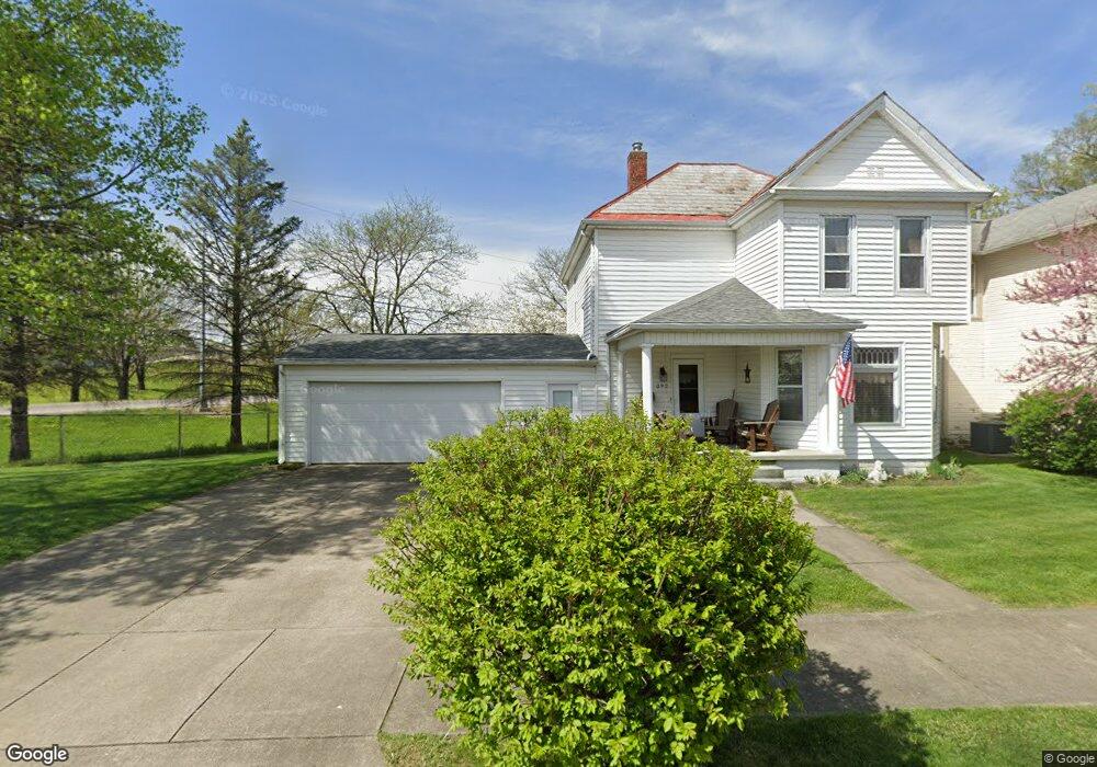
392 Andover St Newark, OH 43055
Estimated Value: $184,000 - $198,000
4
Beds
1
Bath
1,360
Sq Ft
$141/Sq Ft
Est. Value
About This Home
This home is located at 392 Andover St, Newark, OH 43055 and is currently estimated at $192,249, approximately $141 per square foot. 392 Andover St is a home located in Licking County with nearby schools including Carson Elementary School, Heritage Middle School, and Newark High School.
Ownership History
Date
Name
Owned For
Owner Type
Purchase Details
Closed on
May 12, 2025
Sold by
Lemley James R and Lemley Teresa J
Bought by
Lemley Irrevocable Family Preservation Trust and Lemley
Current Estimated Value
Purchase Details
Closed on
Jun 9, 2000
Sold by
Lemley Roland
Bought by
Lemley James R and Lemley Teresa J
Home Financials for this Owner
Home Financials are based on the most recent Mortgage that was taken out on this home.
Original Mortgage
$60,000
Interest Rate
8.14%
Mortgage Type
New Conventional
Create a Home Valuation Report for This Property
The Home Valuation Report is an in-depth analysis detailing your home's value as well as a comparison with similar homes in the area
Home Values in the Area
Average Home Value in this Area
Purchase History
| Date | Buyer | Sale Price | Title Company |
|---|---|---|---|
| Lemley Irrevocable Family Preservation Trust | -- | None Listed On Document | |
| Lemley James R | $76,500 | -- |
Source: Public Records
Mortgage History
| Date | Status | Borrower | Loan Amount |
|---|---|---|---|
| Previous Owner | Lemley James R | $60,000 |
Source: Public Records
Tax History Compared to Growth
Tax History
| Year | Tax Paid | Tax Assessment Tax Assessment Total Assessment is a certain percentage of the fair market value that is determined by local assessors to be the total taxable value of land and additions on the property. | Land | Improvement |
|---|---|---|---|---|
| 2024 | $1,624 | $45,470 | $12,040 | $33,430 |
| 2023 | $1,623 | $45,470 | $12,040 | $33,430 |
| 2022 | $1,020 | $25,520 | $5,430 | $20,090 |
| 2021 | $981 | $23,380 | $3,290 | $20,090 |
| 2020 | $1,003 | $23,380 | $3,290 | $20,090 |
| 2019 | $837 | $18,800 | $2,730 | $16,070 |
| 2018 | $838 | $0 | $0 | $0 |
| 2017 | $772 | $0 | $0 | $0 |
| 2016 | $720 | $0 | $0 | $0 |
| 2015 | $735 | $0 | $0 | $0 |
| 2014 | $941 | $0 | $0 | $0 |
| 2013 | $700 | $0 | $0 | $0 |
Source: Public Records
Map
Nearby Homes
- 60 Dewey Ave
- 167 Essex St
- 430 E Main St
- 76 Oakwood Ave
- 160 N Cedar St
- 284 Everett Ave
- 136 Hunter St
- 81 Madison Ave
- 51 Mill St
- 232 Rosehill Ave
- 452 Walnut Ln
- 240 N Wing St
- 408 Cedarcrest Ave
- 203 Lawrence St
- 61 Rosebud Ave
- 491 Garfield Ave
- 16 N Buena Vista St
- 424 Ridge Ave
- 554 Garfield Ave
- 870 Jones St
- 394 Andover St
- 396 Andover St
- 398 Andover St
- 391 Andover St
- 397 Florence St
- 385 Andover St
- 395 Andover St
- 402 Andover St
- 399 Andover St
- 403 Florence St
- 91 Penney Ave
- 401 Florence St
- 403 Andover St
- 405 Andover St
- 407 Florence St
- 53 Penney Ave
- 88 Penney Ave
- 88 Penney Ave Unit 88
- 390 Tuscarawas St
- 86 Penney Ave Unit 86 and half