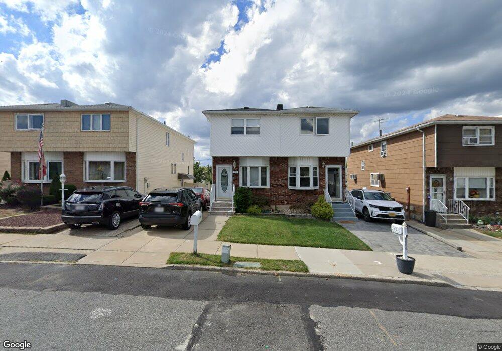
392 Brookfield Ave Unit Building Staten Island, NY 10308
Great Kills NeighborhoodEstimated Value: $677,000 - $733,000
--
Bed
4
Baths
1,232
Sq Ft
$572/Sq Ft
Est. Value
About This Home
This home is located at 392 Brookfield Ave Unit Building, Staten Island, NY 10308 and is currently estimated at $704,787, approximately $572 per square foot. 392 Brookfield Ave Unit Building is a home located in Richmond County with nearby schools including P.S. 32 The Gifford School, I.S. 075 Frank D. Paulo, and Susan E Wagner High School.
Ownership History
Date
Name
Owned For
Owner Type
Purchase Details
Closed on
Sep 29, 2021
Sold by
Ng Emily and Santos Paul V
Bought by
Ng Emily
Current Estimated Value
Purchase Details
Closed on
Jul 15, 2021
Sold by
Skiles Alan and Skiles Grace
Bought by
Ng Emily and Santos Paul V
Home Financials for this Owner
Home Financials are based on the most recent Mortgage that was taken out on this home.
Original Mortgage
$520,200
Outstanding Balance
$472,217
Interest Rate
2.93%
Mortgage Type
New Conventional
Estimated Equity
$232,570
Purchase Details
Closed on
Jan 17, 2017
Sold by
Goldstein Andrew
Bought by
Skiles Alan and Skiles Grace
Home Financials for this Owner
Home Financials are based on the most recent Mortgage that was taken out on this home.
Original Mortgage
$478,225
Interest Rate
3.75%
Mortgage Type
FHA
Purchase Details
Closed on
Apr 22, 2013
Sold by
Wells Fargo Bank Na
Bought by
Goldstein Andrew
Home Financials for this Owner
Home Financials are based on the most recent Mortgage that was taken out on this home.
Original Mortgage
$294,566
Interest Rate
3.37%
Mortgage Type
FHA
Purchase Details
Closed on
May 23, 2012
Sold by
Capici Virginia
Bought by
Wells Fargo Bank Na
Purchase Details
Closed on
Mar 23, 2006
Sold by
Capici Joseph S and Hansen Jessica
Bought by
Capici Joseph S and Capici Virginia
Home Financials for this Owner
Home Financials are based on the most recent Mortgage that was taken out on this home.
Original Mortgage
$240,000
Interest Rate
6.28%
Mortgage Type
Fannie Mae Freddie Mac
Purchase Details
Closed on
May 12, 2005
Sold by
Capici Joseph S and Capici Virginia
Bought by
Capici Joseph S and Hansen Jessica
Home Financials for this Owner
Home Financials are based on the most recent Mortgage that was taken out on this home.
Original Mortgage
$210,000
Interest Rate
5.73%
Mortgage Type
Fannie Mae Freddie Mac
Create a Home Valuation Report for This Property
The Home Valuation Report is an in-depth analysis detailing your home's value as well as a comparison with similar homes in the area
Home Values in the Area
Average Home Value in this Area
Purchase History
| Date | Buyer | Sale Price | Title Company |
|---|---|---|---|
| Ng Emily | -- | Security Ttl Guarantee Corp | |
| Ng Emily | $578,000 | Exclusive Land Services Inc | |
| Skiles Alan | $500,000 | M&L Land Services & Abstract | |
| Goldstein Andrew | $304,500 | None Available | |
| Wells Fargo Bank Na | $357,787 | None Available | |
| Capici Joseph S | -- | None Available | |
| Capici Joseph S | -- | -- |
Source: Public Records
Mortgage History
| Date | Status | Borrower | Loan Amount |
|---|---|---|---|
| Open | Ng Emily | $520,200 | |
| Previous Owner | Skiles Alan | $478,225 | |
| Previous Owner | Goldstein Andrew | $294,566 | |
| Previous Owner | Capici Joseph S | $240,000 | |
| Previous Owner | Capici Joseph S | $210,000 |
Source: Public Records
Tax History Compared to Growth
Tax History
| Year | Tax Paid | Tax Assessment Tax Assessment Total Assessment is a certain percentage of the fair market value that is determined by local assessors to be the total taxable value of land and additions on the property. | Land | Improvement |
|---|---|---|---|---|
| 2025 | $6,348 | $35,700 | $7,366 | $28,334 |
| 2024 | $6,348 | $37,080 | $6,956 | $30,124 |
| 2023 | $6,083 | $29,952 | $6,335 | $23,617 |
| 2022 | $5,979 | $34,380 | $8,160 | $26,220 |
| 2021 | $5,991 | $32,760 | $8,160 | $24,600 |
| 2020 | $5,685 | $32,220 | $8,160 | $24,060 |
| 2019 | $5,510 | $32,220 | $8,160 | $24,060 |
| 2018 | $5,088 | $24,960 | $8,160 | $16,800 |
| 2017 | $4,826 | $25,145 | $7,971 | $17,174 |
| 2016 | $4,432 | $23,722 | $8,065 | $15,657 |
| 2015 | $3,907 | $22,380 | $7,560 | $14,820 |
| 2014 | $3,907 | $21,950 | $6,477 | $15,473 |
Source: Public Records
Map
Nearby Homes
- 400 Brookfield Ave
- 379 Brookfield Ave
- 466 Doane Ave
- 1069 Armstrong Ave
- 74 E Brandis Ave
- 72 Eric Ln
- 969 Armstrong Ave
- 87 Pemberton Ave
- 12 Lexington Ln
- 339 Abingdon Ave
- 360 Barlow Ave Unit 32
- 360 Barlow Ave Unit 12
- 919 Armstrong Ave
- 132 Elkhart St
- 420 Arthur Kill Rd
- 234 Brookfield Ave
- 88 Cortelyou Ave
- 20 Michael Ct
- 543 Eltingville Blvd
- 248 Abingdon Ave
- 392 Brookfield Ave
- 390 Brookfield Ave
- 394 Brookfield Ave
- 388 Brookfield Ave
- 396 Brookfield Ave
- 386 Brookfield Ave
- 398 Brookfield Ave
- 384 Brookfield Ave
- 455 Abingdon Ave
- 459 Abingdon Ave
- 382 Brookfield Ave
- 451 Abingdon Ave
- 402 Brookfield Ave
- 463 Abingdon Ave
- 447 Abingdon Ave
- 380 Brookfield Ave
- 445 Abingdon Ave
- 467 Abingdon Ave
- 378 Brookfield Ave
- 441 Abingdon Ave