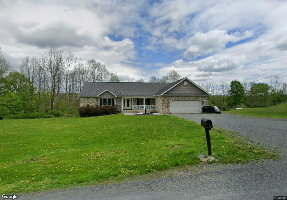
392 Burns Rd Waymart, PA 18472
Estimated Value: $410,000 - $453,800
3
Beds
4
Baths
2,180
Sq Ft
$198/Sq Ft
Est. Value
About This Home
This home is located at 392 Burns Rd, Waymart, PA 18472 and is currently estimated at $432,200, approximately $198 per square foot. 392 Burns Rd is a home located in Wayne County with nearby schools including Western Wayne High School.
Ownership History
Date
Name
Owned For
Owner Type
Purchase Details
Closed on
Sep 8, 2010
Sold by
Neblett Eleanor D
Bought by
Neblett Eleanor D and Susan Mundy M
Current Estimated Value
Purchase Details
Closed on
Sep 29, 2006
Sold by
Neblett Eleanor D
Bought by
Neblett Eleanor D
Home Financials for this Owner
Home Financials are based on the most recent Mortgage that was taken out on this home.
Original Mortgage
$35,000
Interest Rate
6.52%
Mortgage Type
New Conventional
Create a Home Valuation Report for This Property
The Home Valuation Report is an in-depth analysis detailing your home's value as well as a comparison with similar homes in the area
Home Values in the Area
Average Home Value in this Area
Purchase History
| Date | Buyer | Sale Price | Title Company |
|---|---|---|---|
| Neblett Eleanor D | -- | None Available | |
| Neblett Eleanor D | -- | None Available |
Source: Public Records
Mortgage History
| Date | Status | Borrower | Loan Amount |
|---|---|---|---|
| Previous Owner | Neblett Eleanor D | $35,000 |
Source: Public Records
Tax History Compared to Growth
Tax History
| Year | Tax Paid | Tax Assessment Tax Assessment Total Assessment is a certain percentage of the fair market value that is determined by local assessors to be the total taxable value of land and additions on the property. | Land | Improvement |
|---|---|---|---|---|
| 2025 | $5,374 | $332,300 | $43,900 | $288,400 |
| 2024 | $5,108 | $332,300 | $43,900 | $288,400 |
| 2023 | $7,235 | $332,300 | $43,900 | $288,400 |
| 2022 | $4,581 | $194,000 | $42,200 | $151,800 |
| 2021 | $4,467 | $194,000 | $42,200 | $151,800 |
| 2020 | $4,417 | $194,000 | $42,200 | $151,800 |
| 2019 | $4,174 | $194,000 | $42,200 | $151,800 |
| 2018 | $4,150 | $194,000 | $42,200 | $151,800 |
| 2017 | $856 | $194,000 | $42,200 | $151,800 |
| 2016 | $2,955 | $194,000 | $42,200 | $151,800 |
| 2014 | -- | $194,000 | $42,200 | $151,800 |
Source: Public Records
Map
Nearby Homes
- 344 Burns Rd
- 649 Creek Dr
- 0 Town Hill Rd
- 36 Stone Bridge Ln
- 961 Creek Dr
- 1019 Creek Dr
- 27 Gillow Ln
- 765 Elk Lake Dr
- 52 Laurel Dr
- 13 Bucklands Ln
- 310 Stanton Dr
- 11 Mizianty Ln
- 905 Belmont Turnpike
- 6 Silhouette Ln
- 157 Creek Dr
- 105 Grimms Rd
- 430 Flat Rock Rd
- 429 Flat Rock Rd
- 8 Sleepy Hollow Rd
- 17 Court St
- 376 Burns Rd
- 106 Dutchman Hill
- 170 Dutchman Hill
- 11 the Oasis
- 75 Dutchman Hill
- 20 Deer Run Ln
- 0 Holland Drive Dutchman's Hill
- 441 Burns Rd
- 0 Jacob Rd Unit (DUTCHMAN HILL)
- 0 Jacob Rd
- 39 Jacob Rd
- 12 Jacob Rd
- 21 Dutchman Hill
- 0 Dutchman Hill
- 0 Deer Run Ln
- 36 Deer Run Ln
- 29 Jacob Rd
- 0 Pennsylvania 170
- 324 Burns Rd
- 314 Burns Rd