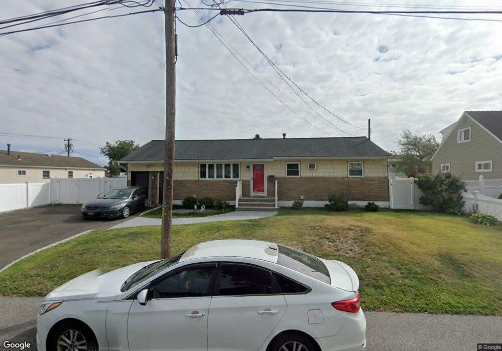
392 Columbus Ave West Babylon, NY 11704
Estimated Value: $573,000 - $610,000
3
Beds
1
Bath
1,034
Sq Ft
$575/Sq Ft
Est. Value
About This Home
This home is located at 392 Columbus Ave, West Babylon, NY 11704 and is currently estimated at $594,378, approximately $574 per square foot. 392 Columbus Ave is a home located in Suffolk County with nearby schools including Robert Moses Middle School and North Babylon High School.
Ownership History
Date
Name
Owned For
Owner Type
Purchase Details
Closed on
Dec 5, 2016
Sold by
Paradiso Thomas M and Paradiso Carol L
Bought by
Hansen Mailinda
Current Estimated Value
Home Financials for this Owner
Home Financials are based on the most recent Mortgage that was taken out on this home.
Original Mortgage
$245,250
Outstanding Balance
$201,089
Interest Rate
4.03%
Mortgage Type
New Conventional
Estimated Equity
$393,289
Purchase Details
Closed on
Jun 20, 1994
Sold by
Gubinski Josephine
Bought by
Paradiso Thomas M and Paradiso Carol L
Create a Home Valuation Report for This Property
The Home Valuation Report is an in-depth analysis detailing your home's value as well as a comparison with similar homes in the area
Home Values in the Area
Average Home Value in this Area
Purchase History
| Date | Buyer | Sale Price | Title Company |
|---|---|---|---|
| Hansen Mailinda | $272,500 | None Available | |
| Paradiso Thomas M | -- | First American Title Ins Co |
Source: Public Records
Mortgage History
| Date | Status | Borrower | Loan Amount |
|---|---|---|---|
| Open | Hansen Mailinda | $245,250 |
Source: Public Records
Tax History
| Year | Tax Paid | Tax Assessment Tax Assessment Total Assessment is a certain percentage of the fair market value that is determined by local assessors to be the total taxable value of land and additions on the property. | Land | Improvement |
|---|---|---|---|---|
| 2024 | $9,430 | $2,730 | $240 | $2,490 |
| 2023 | $9,430 | $2,730 | $240 | $2,490 |
| 2022 | $7,369 | $2,730 | $240 | $2,490 |
| 2021 | $7,369 | $2,730 | $240 | $2,490 |
| 2020 | $8,543 | $2,730 | $240 | $2,490 |
| 2019 | $8,543 | $0 | $0 | $0 |
| 2018 | $8,401 | $2,730 | $240 | $2,490 |
| 2017 | $7,160 | $2,730 | $240 | $2,490 |
| 2016 | $7,131 | $2,730 | $240 | $2,490 |
| 2015 | -- | $2,730 | $240 | $2,490 |
| 2014 | -- | $2,730 | $240 | $2,490 |
Source: Public Records
Map
Nearby Homes
- 828 Windmill Ave
- 1390 America Ave
- 771 Peconic Ave
- 418 Old Farmingdale Rd
- 1286 America Ave
- 221 Amsterdam Ave
- 118 Terrace Ave
- 9 Hamilton Ave
- 519 Gwynn St
- 130 Claremont Ave
- 149 Phelps Ln
- 30 Jenkins Ave
- 1259 America Ave
- 41 Liberty Ave
- 610 Windmill Ave
- 60 Liberty Ave
- 41 Stone Ave
- 32 Springwood Dr
- 295 Silver St
- 22 Berkshire Rd
- 501 Rutgers Rd
- 987 Peconic Ave
- 983 Peconic Ave
- 989 Peconic Ave
- 965 Peconic Ave
- 391 Columbus Ave
- 385 Columbus Ave
- 374 Columbus Ave
- 395 Columbus Ave
- 963 Peconic Ave
- 370 Columbus Ave
- 373 Columbus Ave
- 402 Manhattan Ave
- 984 Peconic Ave
- 485 Rutgers Rd
- 368 Columbus Ave
- 408 Manhattan Ave
- 396 Manhattan Ave
- 961 Peconic Ave
- 968 Peconic Ave
Your Personal Tour Guide
Ask me questions while you tour the home.