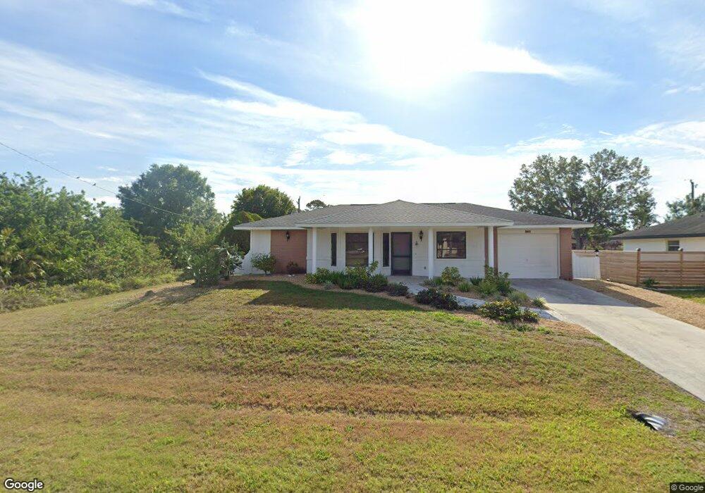
392 Dewhurst St Port Charlotte, FL 33954
Estimated Value: $189,633 - $241,000
2
Beds
2
Baths
1,029
Sq Ft
$212/Sq Ft
Est. Value
About This Home
This home is located at 392 Dewhurst St, Port Charlotte, FL 33954 and is currently estimated at $217,658, approximately $211 per square foot. 392 Dewhurst St is a home located in Charlotte County with nearby schools including Liberty Elementary School, Murdock Middle School, and Port Charlotte High School.
Ownership History
Date
Name
Owned For
Owner Type
Purchase Details
Closed on
Dec 17, 2018
Sold by
Patricia Beneway Larry and Patricia Brantiangham
Bought by
Beneway Larry A and Brantingham Patricia K
Current Estimated Value
Purchase Details
Closed on
Jan 15, 2015
Sold by
Beneway Larry
Bought by
Beneway Larry and Brantingham Patricia
Purchase Details
Closed on
Oct 22, 2012
Sold by
Beneway John and Rosen Judy
Bought by
Beneway Larry
Purchase Details
Closed on
Jul 19, 2010
Sold by
Lugert Arline B
Bought by
Beneway John and Mclaughlin Diane
Purchase Details
Closed on
Mar 31, 2000
Sold by
Hockett Berrier G and Hockett Rita
Bought by
Lugert John J and Lugert Arline B
Create a Home Valuation Report for This Property
The Home Valuation Report is an in-depth analysis detailing your home's value as well as a comparison with similar homes in the area
Home Values in the Area
Average Home Value in this Area
Purchase History
| Date | Buyer | Sale Price | Title Company |
|---|---|---|---|
| Beneway Larry A | -- | Attorney | |
| Beneway Larry | -- | Attorney | |
| Beneway Larry | -- | None Available | |
| Beneway John | -- | Attorney | |
| Lugert John J | $62,500 | -- |
Source: Public Records
Tax History Compared to Growth
Tax History
| Year | Tax Paid | Tax Assessment Tax Assessment Total Assessment is a certain percentage of the fair market value that is determined by local assessors to be the total taxable value of land and additions on the property. | Land | Improvement |
|---|---|---|---|---|
| 2023 | $2,657 | $104,623 | $0 | $0 |
| 2022 | $2,419 | $129,118 | $14,025 | $115,093 |
| 2021 | $2,104 | $86,465 | $5,950 | $80,515 |
| 2020 | $2,002 | $84,236 | $5,100 | $79,136 |
| 2019 | $1,863 | $81,178 | $4,675 | $76,503 |
| 2018 | $1,647 | $75,234 | $4,250 | $70,984 |
| 2017 | $1,541 | $66,048 | $4,080 | $61,968 |
| 2016 | $1,467 | $54,362 | $0 | $0 |
| 2015 | $1,344 | $49,420 | $0 | $0 |
| 2014 | $1,247 | $44,227 | $0 | $0 |
Source: Public Records
Map
Nearby Homes
- 21296 Argyle Ave
- 21288 Argyle Ave
- 408 Fletcher St
- 375 Waterside St
- 400 Waterside St
- 304 Fletcher St
- 21507 Dobbins Ave
- 21475 Argosy Ave
- 21335 Leonard Ave
- 21359 Leonard Ave
- 21271 Leonard Ave
- 399 Kensington St
- 21460 Chipman Ave
- 1012 Waterside St
- 207 Fletcher St
- 21229 Peachland Blvd
- 1022 Waterside St
- 234 Harbor Blvd
- 21220 Pemberton Ave
- 448 Yorkshire St
- 400 Dewhurst St
- 384 Dewhurst St
- 391 Fletcher St
- 399 Fletcher St
- 391 Dewhurst St
- 376 Dewhurst St
- 407 Fletcher St
- 375 Fletcher St
- 21312 Birwood Ave
- 21304 Argyle Ave
- 367 Fletcher St
- 415 Fletcher St
- 376 Fletcher St
- 392 Fletcher St
- 21311 Gaylord Ave
- 21295 Birwood Ave
- 360 Dewhurst St
- 21296 Birwood Ave
- 359 Fletcher St
- 423 Fletcher St