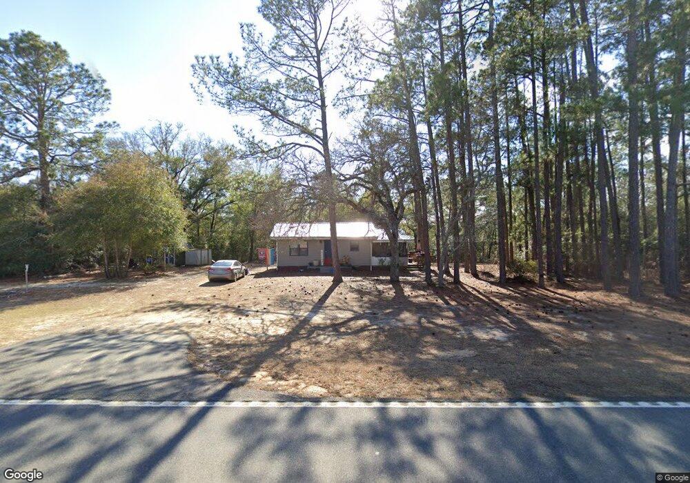
392 Ga Highway 90 E Rupert, GA 31081
Estimated Value: $85,269 - $210,000
2
Beds
1
Bath
748
Sq Ft
$162/Sq Ft
Est. Value
About This Home
This home is located at 392 Ga Highway 90 E, Rupert, GA 31081 and is currently estimated at $121,067, approximately $161 per square foot. 392 Ga Highway 90 E is a home located in Taylor County with nearby schools including Taylor County Primary School, Taylor County Upper Elementary School, and Taylor County Middle School.
Ownership History
Date
Name
Owned For
Owner Type
Purchase Details
Closed on
Oct 29, 2024
Sold by
Peterman Joshua Wayne
Bought by
Jones Micah Hart and Peterman Joshua Wayne
Current Estimated Value
Purchase Details
Closed on
Mar 4, 2022
Sold by
Peterman Jerry Wayne
Bought by
Peterman Joshua Wayne
Purchase Details
Closed on
Feb 21, 2020
Sold by
Binkley James H
Bought by
Peterman Jerry Wayne and Peterman Deborah K
Purchase Details
Closed on
Oct 5, 2007
Sold by
Barrow James Franklin
Bought by
Binkley James H and Binkley Hazel
Create a Home Valuation Report for This Property
The Home Valuation Report is an in-depth analysis detailing your home's value as well as a comparison with similar homes in the area
Purchase History
We collect this data history from publicly available records. To have your information removed, we recommend requesting removal directly through your county’s website.
| Date | Buyer | Sale Price | Title Company |
|---|---|---|---|
| Jones Micah Hart | -- | -- | |
| Peterman Joshua Wayne | -- | -- | |
| Peterman Jerry Wayne | $40,000 | -- | |
| Binkley James H | $9,000 | -- |
Source: Public Records
Mortgage History
We collect this data history from publicly available records. To have your information removed, we recommend requesting removal directly through your county’s website.
| Date | Status | Borrower | Loan Amount |
|---|---|---|---|
| Closed | Binkley James H | $0 |
Source: Public Records
Tax History
| Year | Tax Paid | Tax Assessment Tax Assessment Total Assessment is a certain percentage of the fair market value that is determined by local assessors to be the total taxable value of land and additions on the property. | Land | Improvement |
|---|---|---|---|---|
| 2025 | $480 | $22,840 | $2,960 | $19,880 |
| 2024 | $457 | $21,640 | $2,040 | $19,600 |
| 2023 | $385 | $17,200 | $1,760 | $15,440 |
| 2022 | $377 | $16,400 | $1,760 | $14,640 |
| 2021 | $359 | $15,240 | $1,480 | $13,760 |
| 2020 | $240 | $10,120 | $1,480 | $8,640 |
| 2019 | $244 | $10,120 | $1,480 | $8,640 |
| 2018 | $244 | $10,120 | $1,480 | $8,640 |
| 2017 | $293 | $12,316 | $1,800 | $10,516 |
| 2016 | $295 | $12,316 | $1,800 | $10,516 |
| 2015 | -- | $12,316 | $1,800 | $10,516 |
| 2014 | -- | $4,040 | $801 | $3,238 |
| 2013 | -- | $5,300 | $2,000 | $3,300 |
Source: Public Records
Map
Nearby Homes
- 298 E Highway 127
- 257 Carpenter Rd
- 0 Southland Rd Unit 262528
- 0 Hwy 90 E Unit 27060969
- 0 Jaye Rd Unit 23804581
- 0 Jaye Rd Unit 10638259
- 0 Allmon Rd Unit 25510364
- 0 Allmon Rd Unit 25510570
- 0 Allmon Rd Unit 25510363
- 0 Allmon Rd Unit 25510361
- 0 Allmon Rd Unit 25510366
- Brooks Mill Rd
- 0 Marvis Chapman Rd Unit 10319071
- 0 Marvis Chapman Rd Unit 25510380
- 29 Mallard Rd
- Parcel 6B Carl Rodgers Rd
- Parcel 5 Carl Rogers Rd
- Parcel 12 Carl Rogers Rd
- Parcel 8B Carl Rogers Rd
- Parcel 8 Carl Rogers Rd
- 346 Ga Highway 90 E
- 392 Ga Highway 90 E
- 75 Hugh Milliron Rd
- 367 Georgia 127
- 421 Ga Highway 127 E
- 366 Carpenter Rd
- 347 Ga Highway 90 E
- 396 Ga Highway 127 E
- 354 Carpenter Rd
- 318 Carpenter Rd
- 157 State Highway 90 E
- 367 Ga Highway 127 E
- 88 Wheeler Rogers Rd
- 303 Carpenter Rd
- 450 Ga Highway 90 E
- 298 Georgia 127
- 88 Wheeler Rogers Rd
- 0 Carpenter Rd Unit 23525247
- 223 Carpenter Rd
- 169 Carpenter Rd
Your Personal Tour Guide
Ask me questions while you tour the home.