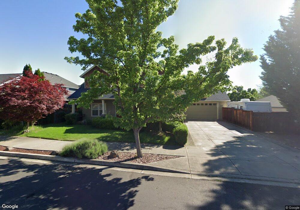
392 Leandra Ln Eagle Point, OR 97524
Estimated Value: $511,806 - $593,000
3
Beds
3
Baths
2,257
Sq Ft
$249/Sq Ft
Est. Value
About This Home
This home is located at 392 Leandra Ln, Eagle Point, OR 97524 and is currently estimated at $561,952, approximately $248 per square foot. 392 Leandra Ln is a home located in Jackson County with nearby schools including Eagle Point Middle School, White Mountain Middle School, and Eagle Point High School.
Ownership History
Date
Name
Owned For
Owner Type
Purchase Details
Closed on
Dec 17, 2008
Sold by
Kelley Brien M and Kelley Mary K
Bought by
Helstowski Merle Scott and Helstowski Christina Lee
Current Estimated Value
Home Financials for this Owner
Home Financials are based on the most recent Mortgage that was taken out on this home.
Original Mortgage
$205,500
Outstanding Balance
$134,308
Interest Rate
6.16%
Mortgage Type
Purchase Money Mortgage
Estimated Equity
$427,644
Purchase Details
Closed on
Jun 16, 2004
Sold by
Miller Dion H and Miller Minerva B
Bought by
Kelley Brien M and Kelley Mary K
Create a Home Valuation Report for This Property
The Home Valuation Report is an in-depth analysis detailing your home's value as well as a comparison with similar homes in the area
Home Values in the Area
Average Home Value in this Area
Purchase History
We collect this data history from publicly available records. To have your information removed, we recommend requesting removal directly through your county’s website.
| Date | Buyer | Sale Price | Title Company |
|---|---|---|---|
| Helstowski Merle Scott | $299,900 | Lawyers Title Ins | |
| Kelley Brien M | $96,900 | Lawyers Title Ins |
Source: Public Records
Mortgage History
We collect this data history from publicly available records. To have your information removed, we recommend requesting removal directly through your county’s website.
| Date | Status | Borrower | Loan Amount |
|---|---|---|---|
| Open | Helstowski Merle Scott | $205,500 |
Source: Public Records
Tax History
| Year | Tax Paid | Tax Assessment Tax Assessment Total Assessment is a certain percentage of the fair market value that is determined by local assessors to be the total taxable value of land and additions on the property. | Land | Improvement |
|---|---|---|---|---|
| 2026 | $3,973 | $291,970 | -- | -- |
| 2025 | $3,973 | $283,470 | $123,970 | $159,500 |
| 2024 | $3,879 | $275,220 | $120,360 | $154,860 |
| 2023 | $3,747 | $267,210 | $116,860 | $150,350 |
| 2022 | $3,645 | $267,210 | $116,860 | $150,350 |
| 2021 | $3,537 | $259,430 | $113,450 | $145,980 |
| 2020 | $3,758 | $251,880 | $110,150 | $141,730 |
| 2019 | $3,700 | $237,430 | $103,830 | $133,600 |
| 2018 | $3,630 | $230,520 | $100,810 | $129,710 |
| 2017 | $3,541 | $230,520 | $100,810 | $129,710 |
| 2016 | $3,472 | $217,300 | $95,020 | $122,280 |
| 2015 | $3,358 | $217,300 | $95,020 | $122,280 |
| 2014 | $3,262 | $204,840 | $89,570 | $115,270 |
Source: Public Records
Map
Nearby Homes
- 374 Leandra Ln
- 1135 Pumpkin Ridge Unit 319
- 1141 Pumpkin Ridge Unit 320
- 1134 Pumpkin Ridge Unit 337
- 1140 Pumpkin Ridge Unit 336
- 1146 Pumpkin Unit 335
- 1147 Pumpkin Unit 321
- 1159 Pumpkin Ridge Unit 323
- 262 Robert Trent Jones Blvd
- 1164 Pumpkin Unit 332
- 1153 Pumpkin Unit 322
- 1054 Pumpkin Ridge
- 210 Bellerive Dr
- 1043 Arrowhead Trail
- 17 Blue Heron Ct
- 468 Pinnacle Ridge Unit 88
- 437 Pinnacle Ridge Unit 80
- 461 Pinnacle Ridge Unit 94
- 455 Pinnacle Ridge Unit 76
- 206 Eagle View Dr
- 410 Patricia Ln
- 386 Leandra Ln
- 1111 Pumpkin Ridge
- 395 Leandra Ln
- 402 Patricia Ln
- 380 Leandra Ln
- 383 Leandra Ln
- 10 Milagros Ct
- 413 Patricia Ln
- 1105 Pumpkin Ridge
- 417 Patricia Ln
- 396 Patricia Ln
- 16 Milagros Ct
- 390 Patricia Ln
- 410 Leandra Ln
- 19 Milagros Ct
- 291 Robert Trent Jones Blvd
- 5 Milagros Ct
- 291 Robert Trent Jones Jr Blvd
- 0 Robert Trent Jones Tl 4700 Blvd Unit 102936433
Your Personal Tour Guide
Ask me questions while you tour the home.