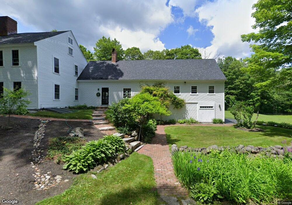
392 Maple St Andover, NH 03216
Estimated Value: $809,000 - $934,922
4
Beds
3
Baths
4,041
Sq Ft
$220/Sq Ft
Est. Value
About This Home
This home is located at 392 Maple St, Andover, NH 03216 and is currently estimated at $888,641, approximately $219 per square foot. 392 Maple St is a home located in Merrimack County with nearby schools including Andover Elementary Middle School, Merrimack Valley High School, and Proctor Academy.
Ownership History
Date
Name
Owned For
Owner Type
Purchase Details
Closed on
May 14, 2022
Sold by
Makechnie Brendaen
Bought by
Makechnie Jill A
Current Estimated Value
Purchase Details
Closed on
Nov 21, 2000
Sold by
Charles S Mccrave Ret
Bought by
Mcmahon Ethney M
Home Financials for this Owner
Home Financials are based on the most recent Mortgage that was taken out on this home.
Original Mortgage
$372,000
Interest Rate
7.78%
Mortgage Type
Purchase Money Mortgage
Create a Home Valuation Report for This Property
The Home Valuation Report is an in-depth analysis detailing your home's value as well as a comparison with similar homes in the area
Home Values in the Area
Average Home Value in this Area
Purchase History
| Date | Buyer | Sale Price | Title Company |
|---|---|---|---|
| Makechnie Jill A | -- | None Available | |
| Mcmahon Ethney M | $465,000 | -- |
Source: Public Records
Mortgage History
| Date | Status | Borrower | Loan Amount |
|---|---|---|---|
| Previous Owner | Mcmahon Ethney M | $315,000 | |
| Previous Owner | Mcmahon Ethney M | $339,000 | |
| Previous Owner | Mcmahon Ethney M | $40,000 | |
| Previous Owner | Mcmahon Ethney M | $372,000 |
Source: Public Records
Tax History
| Year | Tax Paid | Tax Assessment Tax Assessment Total Assessment is a certain percentage of the fair market value that is determined by local assessors to be the total taxable value of land and additions on the property. | Land | Improvement |
|---|---|---|---|---|
| 2025 | $14,090 | $961,800 | $182,000 | $779,800 |
| 2024 | $14,081 | $961,800 | $182,000 | $779,800 |
| 2023 | $12,203 | $531,700 | $119,200 | $412,500 |
| 2022 | $11,267 | $531,700 | $119,200 | $412,500 |
| 2021 | $11,118 | $531,700 | $119,200 | $412,500 |
| 2020 | $11,346 | $531,700 | $119,200 | $412,500 |
| 2019 | $11,506 | $531,700 | $119,200 | $412,500 |
| 2018 | $9,658 | $421,000 | $97,400 | $323,600 |
| 2017 | $9,624 | $421,000 | $97,400 | $323,600 |
| 2016 | $8,950 | $421,000 | $97,400 | $323,600 |
| 2015 | $8,369 | $421,000 | $97,400 | $323,600 |
| 2014 | $8,580 | $421,000 | $97,400 | $323,600 |
| 2013 | $8,338 | $444,700 | $100,700 | $344,000 |
Source: Public Records
Map
Nearby Homes
- 32 Monticello Dr
- 29 Horseshoe Pond Rd
- 32 Maple St
- 161 Tucker Mountain Rd
- 97 Salisbury Hwy
- 0 Putney Rd Unit 433
- 151 Beech Hill Rd
- 1057 Old Turnpike Rd
- 419 Flaghole Rd
- 516 W Salisbury Rd
- 428 North Rd
- 32 Deckmans Rd
- 350 North Rd
- 780 Flaghole Rd
- 174 Lakeshore Dr
- 179 New Rd
- 108 Littlefield Rd
- 203 Lakeshore Dr
- 215 Lake Shore Dr
- 46 New Rd Unit 5
- 153 Old College Rd
- 130 Old College Rd
- 130 Old College Rd Unit 4158796
- 130 Old College Rd Unit 4225830
- 173 Old College Rd
- 0 Old College Rd
- 00 Old College Rd Unit 643
- 0 Old College Rd
- 346 Maple St
- 197 Old College Rd
- 520 Elbow Pond Rd
- 206 Old College Rd
- 214 Old College Rd
- 319 Maple St
- 316 Maple St
- 488 Elbow Pond Rd
- 484 Elbow Pond Rd
- 293 Maple St
- 292 Maple St
- 266 Old College Rd
Your Personal Tour Guide
Ask me questions while you tour the home.