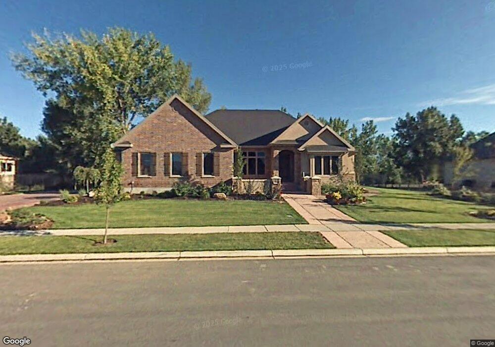
392 W River Side Ln Spanish Fork, UT 84660
Estimated Value: $847,000 - $1,111,597
2
Beds
2
Baths
5,295
Sq Ft
$177/Sq Ft
Est. Value
About This Home
This home is located at 392 W River Side Ln, Spanish Fork, UT 84660 and is currently estimated at $935,649, approximately $176 per square foot. 392 W River Side Ln is a home located in Utah County with nearby schools including Riverview Elementary School, Spanish Fork Jr High School, and Spanish Fork High School.
Ownership History
Date
Name
Owned For
Owner Type
Purchase Details
Closed on
Jul 14, 2025
Sold by
Ford Carol A
Bought by
Carol A Ford Revocable Trust and Ford
Current Estimated Value
Purchase Details
Closed on
Sep 25, 2008
Sold by
Maughan Mitchell D
Bought by
Ford Carol A
Purchase Details
Closed on
May 31, 2007
Sold by
Hall Bruce
Bought by
Maughan Mitchell D
Purchase Details
Closed on
Mar 18, 2005
Sold by
Quail Hollow Development Llc
Bought by
Maughan Mitchell D
Create a Home Valuation Report for This Property
The Home Valuation Report is an in-depth analysis detailing your home's value as well as a comparison with similar homes in the area
Home Values in the Area
Average Home Value in this Area
Purchase History
| Date | Buyer | Sale Price | Title Company |
|---|---|---|---|
| Carol A Ford Revocable Trust | -- | None Listed On Document | |
| Ford Carol A | -- | Wasatch Land & Title | |
| Maughan Mitchell D | -- | Wasatch Land & Title | |
| Maughan Mitchell D | -- | None Available |
Source: Public Records
Tax History Compared to Growth
Tax History
| Year | Tax Paid | Tax Assessment Tax Assessment Total Assessment is a certain percentage of the fair market value that is determined by local assessors to be the total taxable value of land and additions on the property. | Land | Improvement |
|---|---|---|---|---|
| 2025 | $4,757 | $548,515 | $344,100 | $653,200 |
| 2024 | $4,757 | $490,325 | $0 | $0 |
| 2023 | $4,842 | $499,620 | $0 | $0 |
| 2022 | $5,280 | $534,325 | $0 | $0 |
| 2021 | $4,829 | $781,800 | $249,600 | $532,200 |
| 2020 | $4,447 | $700,000 | $226,900 | $473,100 |
| 2019 | $4,217 | $698,400 | $226,900 | $471,500 |
| 2018 | $3,829 | $613,000 | $203,000 | $410,000 |
| 2017 | $3,348 | $288,035 | $0 | $0 |
| 2016 | $3,238 | $274,945 | $0 | $0 |
| 2015 | -- | $224,620 | $0 | $0 |
| 2014 | $2,682 | $225,775 | $0 | $0 |
Source: Public Records
Map
Nearby Homes
- 984 S 550 W Unit 917
- 668 W 1370 S
- 787 W 1120 S
- 1152 S 800 W
- 733 S 170 W
- 242 W Hillcrest Dr Unit 6
- 632 W 1460 S
- 264 W Hillcrest Dr
- 286 W Hillcrest Dr Unit 4
- 134 W 700 S
- 1701 Del Monte Rd Unit 21
- Orchard Plan at Skye Meadows
- Savannah Plan at Skye Meadows
- Ash Plan at Skye Meadows
- Hazel Plan at Skye Meadows
- Pasture Plan at Skye Meadows
- Grassland Plan at Skye Meadows
- Woodland Plan at Skye Meadows
- Willow Plan at Skye Meadows
- Blossom Plan at Skye Meadows
- 362 W River Side Ln
- 362 W River Side Ln Unit 1
- 408 W River Side Ln
- 367 W River Side Ln
- 367 W River Side Ln Unit 22
- 413 W River Side Ln
- 348 W River Side Ln
- 432 W River Side Ln
- 1097 S River View Dr
- 388 River Rock Rd
- 347 W River Side Ln
- 364 River Rock Rd
- 1116 S River View Dr
- 332 W River Side Ln
- 433 W River Side Ln
- 333 W River Side Ln
- 454 W River Side Ln
- 342 River Rock Rd Unit 17
- 342 River Rock Rd
- 1146 S River View Dr