Estimated Value: $264,000 - $381,000
4
Beds
1
Bath
1,806
Sq Ft
$174/Sq Ft
Est. Value
About This Home
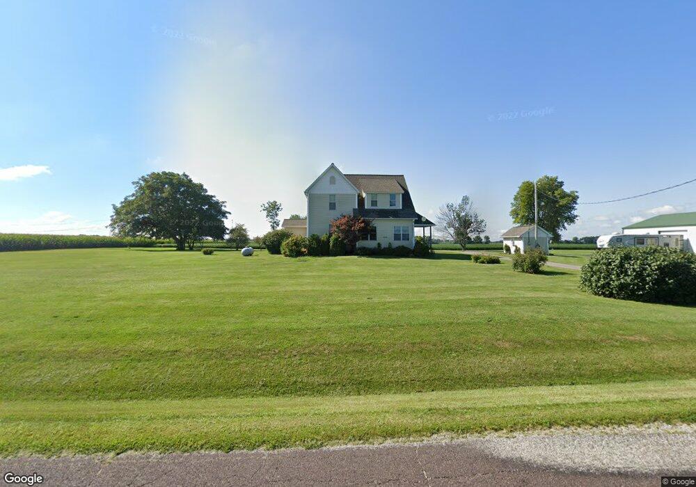
This home is located at 3920 Allentown Rd, Pekin, IL 61554 and is currently estimated at $314,140, approximately $173 per square foot. 3920 Allentown Rd is a home located in Tazewell County with nearby schools including Washington Intermediate School, L.E. Starke Elementary School, and Edison Junior High School.
Ownership History
Date
Name
Owned For
Owner Type
Purchase Details
Closed on
Apr 25, 2012
Sold by
Flier Richard J and Flier Jerry L
Bought by
Hess Wendy L and Hess Jerome S
Current Estimated Value
Home Financials for this Owner
Home Financials are based on the most recent Mortgage that was taken out on this home.
Original Mortgage
$170,972
Outstanding Balance
$118,513
Interest Rate
3.91%
Mortgage Type
New Conventional
Estimated Equity
$195,627
Create a Home Valuation Report for This Property
The Home Valuation Report is an in-depth analysis detailing your home's value as well as a comparison with similar homes in the area
Home Values in the Area
Average Home Value in this Area
Purchase History
| Date | Buyer | Sale Price | Title Company |
|---|---|---|---|
| Hess Wendy L | $180,000 | None Available | |
| Hess Wendy L | -- | None Available |
Source: Public Records
Mortgage History
| Date | Status | Borrower | Loan Amount |
|---|---|---|---|
| Open | Hess Wendy L | $170,972 |
Source: Public Records
Tax History Compared to Growth
Tax History
| Year | Tax Paid | Tax Assessment Tax Assessment Total Assessment is a certain percentage of the fair market value that is determined by local assessors to be the total taxable value of land and additions on the property. | Land | Improvement |
|---|---|---|---|---|
| 2024 | $5,133 | $79,070 | $13,910 | $65,160 |
| 2023 | $5,133 | $72,590 | $12,770 | $59,820 |
| 2022 | $4,808 | $67,580 | $11,890 | $55,690 |
| 2021 | $4,584 | $64,980 | $11,430 | $53,550 |
| 2020 | $4,430 | $63,710 | $11,210 | $52,500 |
| 2019 | $4,340 | $63,710 | $11,210 | $52,500 |
| 2018 | $4,226 | $63,710 | $11,210 | $52,500 |
| 2017 | $4,136 | $62,460 | $10,990 | $51,470 |
| 2016 | $4,032 | $62,460 | $10,990 | $51,470 |
| 2015 | $3,810 | $0 | $0 | $0 |
| 2013 | $3,735 | $62,460 | $10,990 | $51,470 |
Source: Public Records
Map
Nearby Homes
- 116 Lost Creek Ct
- 107 Lost Creek Ct
- 105 Royal Point Ct
- 1920-1922 Mayflower Dr
- 1960-1962 Mayflower Dr
- 227 Indian Creek Dr
- 16810 Springfield Rd
- 9 Cypress Point
- Lot 37 Grandview Ct
- Lot 2 Grandview Ct
- Lot 13 Grandview Ct
- Lot 33 Grandview Ct
- Lot 1 Grandview Ct
- Lot 3 Grandview Ct
- Lot 20 Grandview Ct
- Lot 35 Grandview Ct
- Lot 7 Grandview Ct
- Lot 6 Grandview Ct
- 3747 Grandview Ct
- 16 Point Ct E
- 3935 Allentown Rd
- 3865 Allentown Rd
- 4041 Allentown Rd
- 4150 Allentown Rd
- 4150 Allentown Rd
- 4175 Allentown Rd
- 4177 Allentown Rd
- 3664 Allentown Rd
- 4225 Allentown Rd
- 3701 Allentown Rd
- 3604 Allentown Rd
- 4284 Allentown Rd
- 5321 Allentown Rd
- 19572 State Route 9
- 3537 Allentown Rd
- 19568 State Route 9
- 3531 Allentown Rd
- 15436 Mennonite Church Rd
- 19055 State Route 9
- 19055 State Route 9