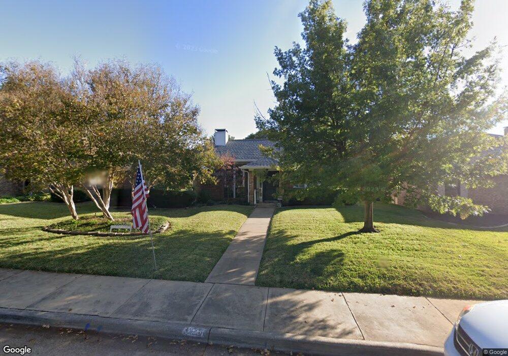
3920 Bobbin Ln Addison, TX 75001
Estimated Value: $498,876 - $563,000
3
Beds
2
Baths
1,711
Sq Ft
$305/Sq Ft
Est. Value
About This Home
This home is located at 3920 Bobbin Ln, Addison, TX 75001 and is currently estimated at $522,469, approximately $305 per square foot. 3920 Bobbin Ln is a home located in Dallas County with nearby schools including George Herbert Walker Bush Elementary School, E.D. Walker Middle School, and W T White High School.
Ownership History
Date
Name
Owned For
Owner Type
Purchase Details
Closed on
Jul 16, 2013
Sold by
Mckenney Chad A and Mckenney Kendall Y
Bought by
Williams Nancy
Current Estimated Value
Purchase Details
Closed on
Sep 28, 2006
Sold by
Peterson Keith N and Peterson Irene P
Bought by
Mckenney Chad A and Mckenney Kendall Y
Home Financials for this Owner
Home Financials are based on the most recent Mortgage that was taken out on this home.
Original Mortgage
$22,500
Interest Rate
6.44%
Mortgage Type
Stand Alone Second
Purchase Details
Closed on
Apr 30, 1999
Sold by
Whitmer Vicki Lynn
Bought by
The Peterson Trust
Home Financials for this Owner
Home Financials are based on the most recent Mortgage that was taken out on this home.
Original Mortgage
$110,000
Interest Rate
6.99%
Create a Home Valuation Report for This Property
The Home Valuation Report is an in-depth analysis detailing your home's value as well as a comparison with similar homes in the area
Home Values in the Area
Average Home Value in this Area
Purchase History
| Date | Buyer | Sale Price | Title Company |
|---|---|---|---|
| Williams Nancy | -- | None Available | |
| Mckenney Chad A | -- | None Available | |
| The Peterson Trust | -- | -- |
Source: Public Records
Mortgage History
| Date | Status | Borrower | Loan Amount |
|---|---|---|---|
| Previous Owner | Mckenney Chad A | $22,500 | |
| Previous Owner | Mckenney Chad A | $180,000 | |
| Previous Owner | The Peterson Trust | $110,000 |
Source: Public Records
Tax History
| Year | Tax Paid | Tax Assessment Tax Assessment Total Assessment is a certain percentage of the fair market value that is determined by local assessors to be the total taxable value of land and additions on the property. | Land | Improvement |
|---|---|---|---|---|
| 2025 | $3,859 | $490,380 | $100,000 | $390,380 |
| 2024 | $3,859 | $450,200 | $100,000 | $350,200 |
| 2023 | $3,859 | $425,000 | $80,000 | $345,000 |
| 2022 | $8,692 | $367,600 | $80,000 | $287,600 |
| 2021 | $8,120 | $327,520 | $60,000 | $267,520 |
| 2020 | $7,947 | $312,230 | $60,000 | $252,230 |
| 2019 | $8,176 | $312,230 | $60,000 | $252,230 |
| 2018 | $7,771 | $312,230 | $60,000 | $252,230 |
| 2017 | $7,797 | $312,230 | $60,000 | $252,230 |
| 2016 | $6,970 | $279,090 | $50,000 | $229,090 |
| 2015 | $4,777 | $246,700 | $50,000 | $196,700 |
| 2014 | $4,777 | $232,810 | $50,000 | $182,810 |
Source: Public Records
Map
Nearby Homes
- 3919 Winter Park Ln
- 4020 Morman Ln
- 3840 Azure Ln
- 14660 Bentwater Ct
- 14633 Lakecrest Dr
- 4045 Morman Ln
- 4130 Proton Dr Unit 6D
- 4130 Proton Dr Unit 47B
- 4067 Beltway Dr Unit 151
- 4067 Beltway Dr Unit 118
- 4067 Beltway Dr Unit 137
- 3912 Amberwood Dr
- 3934 Amberwood Dr
- 4160 Towne Green Cir
- 3932 Asbury Ln
- 3941 Asbury Ln
- 3888 Everwood Ln
- 14572 Berklee Dr
- 14561 Juliard Ln
- 14956 Oak St
Your Personal Tour Guide
Ask me questions while you tour the home.