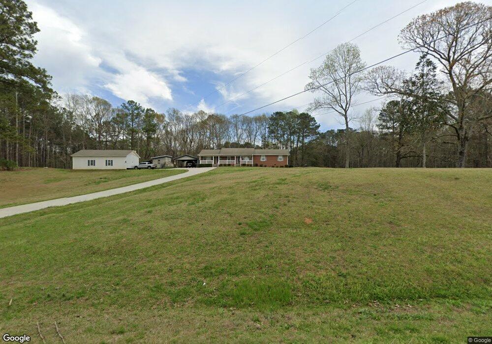
3920 Mooty Bridge Rd Lagrange, GA 30240
Estimated Value: $228,000 - $318,000
3
Beds
2
Baths
1,800
Sq Ft
$148/Sq Ft
Est. Value
About This Home
This home is located at 3920 Mooty Bridge Rd, Lagrange, GA 30240 and is currently estimated at $267,286, approximately $148 per square foot. 3920 Mooty Bridge Rd is a home located in Troup County with nearby schools including Hillcrest Elementary School, Franklin Forest Elementary School, and Hollis Hand Elementary School.
Ownership History
Date
Name
Owned For
Owner Type
Purchase Details
Closed on
Apr 21, 2003
Sold by
Bailey Darlenen
Bought by
Bailey Avery Ricky and Bailey Darlene
Current Estimated Value
Purchase Details
Closed on
Oct 9, 1992
Sold by
Brogdon Darlene M
Bought by
Bailey Darlenen
Purchase Details
Closed on
Jan 1, 1989
Bought by
Brogdon Darlene M
Purchase Details
Closed on
Mar 5, 1986
Create a Home Valuation Report for This Property
The Home Valuation Report is an in-depth analysis detailing your home's value as well as a comparison with similar homes in the area
Home Values in the Area
Average Home Value in this Area
Purchase History
| Date | Buyer | Sale Price | Title Company |
|---|---|---|---|
| Bailey Avery Ricky | -- | -- | |
| Bailey Darlenen | -- | -- | |
| Brogdon Darlene M | -- | -- | |
| -- | $52,500 | -- |
Source: Public Records
Tax History Compared to Growth
Tax History
| Year | Tax Paid | Tax Assessment Tax Assessment Total Assessment is a certain percentage of the fair market value that is determined by local assessors to be the total taxable value of land and additions on the property. | Land | Improvement |
|---|---|---|---|---|
| 2024 | $1,510 | $57,360 | $10,000 | $47,360 |
| 2023 | $976 | $55,680 | $10,000 | $45,680 |
| 2022 | $1,430 | $53,240 | $10,000 | $43,240 |
| 2021 | $1,459 | $50,376 | $10,000 | $40,376 |
| 2020 | $1,459 | $50,376 | $10,000 | $40,376 |
| 2019 | $1,526 | $52,596 | $10,000 | $42,596 |
| 2018 | $1,174 | $40,920 | $6,800 | $34,120 |
| 2017 | $1,083 | $37,880 | $6,800 | $31,080 |
| 2016 | $1,075 | $37,640 | $6,800 | $30,840 |
| 2015 | $1,077 | $37,640 | $6,800 | $30,840 |
| 2014 | $1,030 | $36,017 | $6,800 | $29,217 |
| 2013 | -- | $36,659 | $6,800 | $29,859 |
Source: Public Records
Map
Nearby Homes
- 57 Hubbard Rd
- 0 River Club Dr Unit 10311961
- 305 Edgemont Dr
- 116 Firefly Run
- 110 Firefly Run
- 1006 Wares Cross Rd
- 96 Firefly Run
- 56 Firefly Run
- 183 Indian Bend Dr
- 147 Wolf Creek Cove
- 206 Sturbridge Dr
- 14 Firefly Run
- 155 Indian Bend Dr
- 4555 Mooty Bridge Rd
- 5 Firefly Run
- 178 Wolf Creek Cove
- 223 Village Dr
- 125 Montrose Way
- 115 Wolf Creek Cove
- 105 Wolf Creek Cove
- 0 Riverbend Dr Unit 8454167
- 0 Riverbend Dr Unit 20108408
- 0 Riverbend Dr Unit 20040965
- 0 Riverbend Dr Unit 33 8060611
- 0 Riverbend Dr Unit 8683988
- 0 Riverbend Dr Unit 8678763
- 0 Hubbard Rd Unit 4 8343343
- 0 Hubbard Rd Unit 3 8343337
- 0 Hubbard Rd Unit 4 8621574
- 0 Hubbard Rd Unit 2 8621569
- 3956 Mooty Bridge Rd
- 49 Beaver Cove Dr
- 150 Hubbard Rd Unit 1
- 3961 Mooty Bridge Rd
- 31 Hubbard Rd
- 3988 Mooty Bridge Rd
- 21 Riverbend Dr
- 30 Riverbend Dr
- 3987 Mooty Bridge Rd
- 127 Beaver Cove Dr