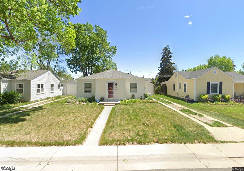
3920 S Grant St Englewood, CO 80113
South Broadway Heights NeighborhoodEstimated Value: $438,626 - $484,000
2
Beds
1
Bath
888
Sq Ft
$518/Sq Ft
Est. Value
About This Home
This home is located at 3920 S Grant St, Englewood, CO 80113 and is currently estimated at $460,407, approximately $518 per square foot. 3920 S Grant St is a home located in Arapahoe County with nearby schools including Cherrelyn Elementary School, Englewood Middle School, and Englewood High School.
Ownership History
Date
Name
Owned For
Owner Type
Purchase Details
Closed on
Nov 12, 2010
Sold by
Perkins Geary J
Bought by
Brooks Stephanie
Current Estimated Value
Home Financials for this Owner
Home Financials are based on the most recent Mortgage that was taken out on this home.
Original Mortgage
$141,324
Interest Rate
3.93%
Mortgage Type
FHA
Purchase Details
Closed on
May 14, 1987
Sold by
Conversion Arapco
Bought by
Perkins Geary J
Purchase Details
Closed on
Nov 1, 1980
Sold by
Conversion Arapco
Bought by
Conversion Arapco
Purchase Details
Closed on
Jul 4, 1776
Bought by
Conversion Arapco
Create a Home Valuation Report for This Property
The Home Valuation Report is an in-depth analysis detailing your home's value as well as a comparison with similar homes in the area
Home Values in the Area
Average Home Value in this Area
Purchase History
| Date | Buyer | Sale Price | Title Company |
|---|---|---|---|
| Brooks Stephanie | $145,000 | None Available | |
| Perkins Geary J | -- | -- | |
| Conversion Arapco | -- | -- | |
| Conversion Arapco | -- | -- |
Source: Public Records
Mortgage History
| Date | Status | Borrower | Loan Amount |
|---|---|---|---|
| Previous Owner | Brooks Stephanie | $141,324 |
Source: Public Records
Tax History Compared to Growth
Tax History
| Year | Tax Paid | Tax Assessment Tax Assessment Total Assessment is a certain percentage of the fair market value that is determined by local assessors to be the total taxable value of land and additions on the property. | Land | Improvement |
|---|---|---|---|---|
| 2024 | $1,855 | $26,371 | -- | -- |
| 2023 | $1,855 | $26,371 | $0 | $0 |
| 2022 | $1,567 | $21,511 | $0 | $0 |
| 2021 | $1,561 | $21,511 | $0 | $0 |
| 2020 | $1,498 | $20,399 | $0 | $0 |
| 2019 | $1,489 | $20,399 | $0 | $0 |
| 2018 | $1,479 | $18,907 | $0 | $0 |
| 2017 | $1,465 | $18,907 | $0 | $0 |
| 2016 | $1,320 | $16,135 | $0 | $0 |
| 2015 | $1,090 | $16,135 | $0 | $0 |
| 2014 | -- | $12,099 | $0 | $0 |
| 2013 | -- | $12,950 | $0 | $0 |
Source: Public Records
Map
Nearby Homes
- 3928 S Pearl St
- 3135 S Washington St
- 3839 S Broadway
- 3978 S Washington St
- 4127 S Logan St
- 3857 S Clarkson St
- 3837 S Acoma St
- 4159 S Sherman St
- 3768 S Acoma St
- 4087 S Clarkson St
- 4065 S Bannock St
- 3780 S Cherokee St
- 3675 S Cherokee St Unit 102A
- 4291 S Clarkson St
- 1075 E Oxford Ln
- 4221 S Cherokee St
- 3810 S Fox St
- 3556 S Emerson St
- 3586 S Ogden St
- 4420 S Grant St
- 3930 S Grant St
- 3936 S Grant St
- 3900 S Grant St
- 3911 S Logan St
- 3940 S Grant St
- 3915 S Logan St
- 3905 S Logan St
- 3903 S Logan St
- 3915 S Grant St
- 3923 S Grant St
- 3935 S Grant St
- 3950 S Grant St
- 3903 S Grant St
- 3941 S Logan St
- 3894 S Grant St
- 3945 S Grant St
- 3951 S Logan St
- 3960 S Grant St
- 3953 S Grant St
- 3897 S Logan St