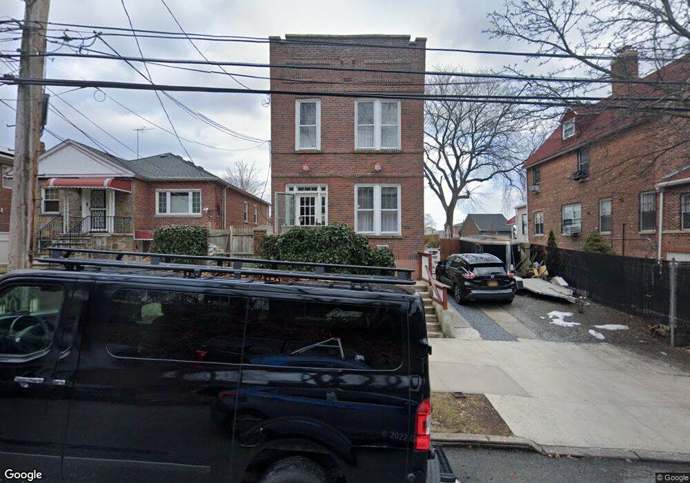
3920 Secor Ave Bronx, NY 10466
Eastchester NeighborhoodEstimated Value: $587,410 - $901,000
Studio
--
Bath
1,800
Sq Ft
$418/Sq Ft
Est. Value
About This Home
This home is located at 3920 Secor Ave, Bronx, NY 10466 and is currently estimated at $752,103, approximately $417 per square foot. 3920 Secor Ave is a home located in Bronx County with nearby schools including Cornerstone Academy For Social Action, Baychester Middle School, and One World Middle School At Edenwald.
Ownership History
Date
Name
Owned For
Owner Type
Purchase Details
Closed on
Oct 27, 2008
Sold by
Cruz Eneida and Cruz Louis
Bought by
Cruz Louis
Current Estimated Value
Home Financials for this Owner
Home Financials are based on the most recent Mortgage that was taken out on this home.
Original Mortgage
$300,000
Outstanding Balance
$197,413
Interest Rate
6.13%
Mortgage Type
Purchase Money Mortgage
Estimated Equity
$554,690
Purchase Details
Closed on
Sep 7, 1989
Sold by
Wright Gwendolyn and Wright Victor
Bought by
Cruz Eneida and Cruz Louis
Create a Home Valuation Report for This Property
The Home Valuation Report is an in-depth analysis detailing your home's value as well as a comparison with similar homes in the area
Home Values in the Area
Average Home Value in this Area
Purchase History
| Date | Buyer | Sale Price | Title Company |
|---|---|---|---|
| Cruz Louis | $450,000 | -- | |
| Cruz Eneida | -- | -- |
Source: Public Records
Mortgage History
| Date | Status | Borrower | Loan Amount |
|---|---|---|---|
| Open | Cruz Louis | $300,000 |
Source: Public Records
Tax History
| Year | Tax Paid | Tax Assessment Tax Assessment Total Assessment is a certain percentage of the fair market value that is determined by local assessors to be the total taxable value of land and additions on the property. | Land | Improvement |
|---|---|---|---|---|
| 2025 | $6,037 | $30,586 | $7,285 | $23,301 |
| 2024 | $6,037 | $30,058 | $7,148 | $22,910 |
| 2023 | $6,104 | $30,058 | $7,366 | $22,692 |
| 2022 | $5,717 | $40,260 | $9,660 | $30,600 |
| 2021 | $5,686 | $32,700 | $9,660 | $23,040 |
| 2020 | $5,395 | $29,880 | $9,660 | $20,220 |
| 2019 | $5,240 | $29,880 | $9,660 | $20,220 |
| 2018 | $5,106 | $25,048 | $8,748 | $16,300 |
| 2017 | $4,865 | $23,864 | $8,812 | $15,052 |
| 2016 | $4,501 | $22,514 | $7,647 | $14,867 |
| 2015 | $2,828 | $21,240 | $10,740 | $10,500 |
| 2014 | $2,828 | $20,874 | $9,859 | $11,015 |
Source: Public Records
Map
Nearby Homes
- 3946 Secor Ave
- 1461 E 233rd St
- 3919 Pratt Ave
- 4048 Harper Ave
- 3924 Duryea Ave
- 4040 Pratt Ave
- 3964 Duryea Ave
- 3968 Duryea Ave
- 3963 Duryea Ave
- 2110 Light St
- 2181 Strang Ave
- 3735 Rombouts Ave
- 42 Wildwood Ave
- 62 Washington Blvd
- 75 W Kingsbridge Rd
- 29 Bell Ave
- 15 Saint Pauls Place
- 724 S 4th Ave
- 138 W Kingsbridge Rd
- 4083 Seton Ave
- 3916 Secor Ave
- 3926 Secor Ave
- 3910 Secor Ave Unit 1st Floor
- 3910 Secor Ave
- 3930 Secor Ave
- 3919 Dyre Ave
- 3921 Dyre Ave
- 3917 Dyre Ave
- 3923 Dyre Ave
- 3915 Dyre Ave
- 3929 Dyre Ave
- 3911 Dyre Ave
- 3942 Secor Ave
- 3913 Dyre Ave
- 3909 Dyre Ave
- 3911 Secor Ave
- 3911 Secor Ave
- 1525 E 233rd St
- 1531 E 233rd St
- 3909 Secor Ave
Your Personal Tour Guide
Ask me questions while you tour the home.