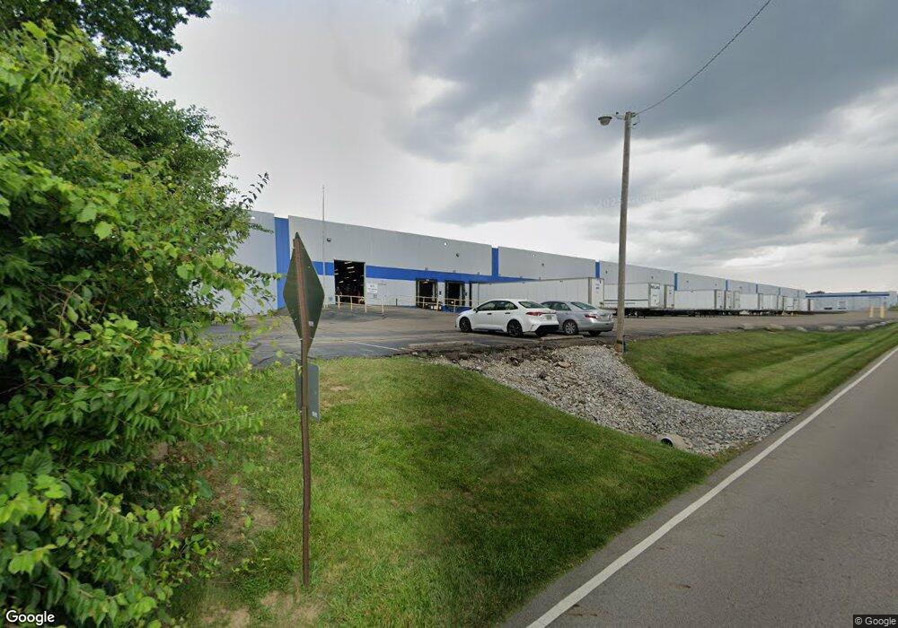
3920 Space Dr Dayton, OH 45414
Estimated Value: $10,881,447
--
Bed
--
Bath
239,750
Sq Ft
$45/Sq Ft
Est. Value
About This Home
This home is located at 3920 Space Dr, Dayton, OH 45414 and is currently estimated at $10,881,447, approximately $45 per square foot. 3920 Space Dr is a home located in Montgomery County with nearby schools including Demmitt Elementary School, Smith Middle School, and Butler High School.
Ownership History
Date
Name
Owned For
Owner Type
Purchase Details
Closed on
Sep 1, 2022
Sold by
3920 Sapace Dr Bldg 47 Llc
Bought by
Sealy Space Drive Llc
Current Estimated Value
Purchase Details
Closed on
May 27, 2005
Sold by
Mid States Development Co
Bought by
3920 Space Dr Bldg 47 Llc
Purchase Details
Closed on
Nov 1, 1999
Sold by
Mid States Development Co
Bought by
3920 Space Dr Bldg 47 Llc
Purchase Details
Closed on
Mar 12, 1998
Sold by
Mid States Development Co
Bought by
The Prudential Insurance Co America
Create a Home Valuation Report for This Property
The Home Valuation Report is an in-depth analysis detailing your home's value as well as a comparison with similar homes in the area
Home Values in the Area
Average Home Value in this Area
Purchase History
| Date | Buyer | Sale Price | Title Company |
|---|---|---|---|
| Sealy Space Drive Llc | $8,842,700 | Chicago Title | |
| 3920 Space Dr Bldg 47 Llc | -- | -- | |
| 3920 Space Dr Bldg 47 Llc | -- | -- | |
| The Prudential Insurance Co America | $13,717 | -- |
Source: Public Records
Tax History Compared to Growth
Tax History
| Year | Tax Paid | Tax Assessment Tax Assessment Total Assessment is a certain percentage of the fair market value that is determined by local assessors to be the total taxable value of land and additions on the property. | Land | Improvement |
|---|---|---|---|---|
| 2024 | $140,266 | $3,094,920 | $206,890 | $2,888,030 |
| 2023 | $140,266 | $1,931,910 | $206,890 | $1,725,020 |
| 2022 | $129,915 | $1,609,930 | $172,410 | $1,437,520 |
| 2021 | $131,363 | $1,609,930 | $172,410 | $1,437,520 |
| 2020 | $130,825 | $1,609,930 | $172,410 | $1,437,520 |
| 2019 | $126,446 | $1,551,620 | $172,410 | $1,379,210 |
| 2018 | $127,689 | $1,551,620 | $172,410 | $1,379,210 |
| 2017 | $127,231 | $1,551,620 | $172,410 | $1,379,210 |
| 2016 | $126,692 | $1,551,620 | $172,410 | $1,379,210 |
| 2015 | $125,964 | $1,551,620 | $172,410 | $1,379,210 |
| 2014 | $125,964 | $1,551,620 | $172,410 | $1,379,210 |
| 2012 | -- | $1,583,660 | $176,240 | $1,407,420 |
Source: Public Records
Map
Nearby Homes
- 3320 Benchwood Rd
- 3291 Benchwood Rd
- 6114 Miller Ln
- 3280 Benchwood Rd
- 6020 Volkman Dr
- 6494 Shore Dr
- 6512 Shore Dr
- 679 Deerhurst Dr
- 715 Deerhurst Dr
- 710 Deerhurst Dr
- 678 Deerhurst Dr
- Fairfax Plan at Foxfire - Maple Street Collection
- Yosemite Plan at Foxfire - Maple Street Collection
- Cumberland Plan at Foxfire - Maple Street Collection
- Jensen Plan at Foxfire - Maple Street Collection
- Beacon Plan at Foxfire - Maple Street Collection
- Wesley Plan at Foxfire - Maple Street Collection
- Breckenridge Plan at Foxfire - Maple Street Collection
- Danville Plan at Foxfire - Maple Street Collection
- DaVinci Plan at Foxfire - Maple Street Collection
- 6690 Homestretch Rd
- 0 Homestretch Rd
- 6661 Homestretch Rd
- 0 Homestretch Rd Unit 578611
- 6530 Poe Ave
- 3575 Wyse Rd
- 6640 Poe Ave
- 6520 Poe Ave
- 6790 Homestretch Rd
- 6800 Homestretch Rd
- 3908 Image Dr
- 6819 Homestretch Rd
- 6827 Homestretch Rd
- 6450 Poe Ave
- 6837 Homestretch Rd
- 6688 Miller Ln
- 6921 Homestretch Rd
- 6911 Homestretch Rd
- 6931 Homestretch Rd
- 6887 Homestretch Rd