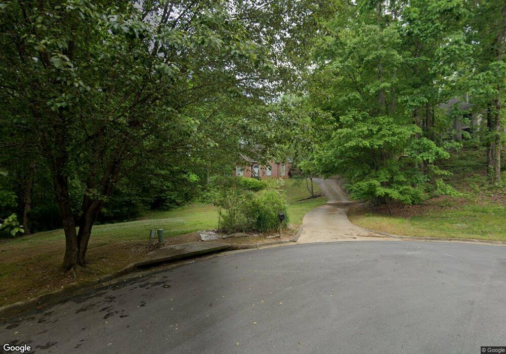
3922 Grahams Port Ln Unit II Snellville, GA 30039
Estimated Value: $642,325 - $701,000
5
Beds
5
Baths
6,457
Sq Ft
$104/Sq Ft
Est. Value
About This Home
This home is located at 3922 Grahams Port Ln Unit II, Snellville, GA 30039 and is currently estimated at $669,081, approximately $103 per square foot. 3922 Grahams Port Ln Unit II is a home located in Gwinnett County with nearby schools including Partee Elementary School, Shiloh Middle School, and Shiloh High School.
Ownership History
Date
Name
Owned For
Owner Type
Purchase Details
Closed on
Jul 22, 2022
Sold by
Clement Dorothy H Estate
Bought by
Clement Linda D
Current Estimated Value
Purchase Details
Closed on
Jul 6, 2011
Sold by
Mcilvain Curtis A and Mcilvain Andrea J
Bought by
Clement Dorothy H
Home Financials for this Owner
Home Financials are based on the most recent Mortgage that was taken out on this home.
Original Mortgage
$224,071
Interest Rate
4.37%
Mortgage Type
FHA
Purchase Details
Closed on
Aug 30, 2002
Sold by
Sikes Kris K and Sikes Jeffrey G
Bought by
Mcilvain Andrea J and Mcilvain Curtis A
Home Financials for this Owner
Home Financials are based on the most recent Mortgage that was taken out on this home.
Original Mortgage
$202,000
Interest Rate
6.31%
Mortgage Type
New Conventional
Create a Home Valuation Report for This Property
The Home Valuation Report is an in-depth analysis detailing your home's value as well as a comparison with similar homes in the area
Home Values in the Area
Average Home Value in this Area
Purchase History
| Date | Buyer | Sale Price | Title Company |
|---|---|---|---|
| Clement Linda D | -- | -- | |
| Clement Dorothy H | $229,900 | -- | |
| Mcilvain Andrea J | $252,500 | -- |
Source: Public Records
Mortgage History
| Date | Status | Borrower | Loan Amount |
|---|---|---|---|
| Previous Owner | Clement Dorothy H | $224,071 | |
| Previous Owner | Mcilvain Andrea J | $202,000 |
Source: Public Records
Tax History Compared to Growth
Tax History
| Year | Tax Paid | Tax Assessment Tax Assessment Total Assessment is a certain percentage of the fair market value that is determined by local assessors to be the total taxable value of land and additions on the property. | Land | Improvement |
|---|---|---|---|---|
| 2025 | $3,993 | $277,400 | $34,880 | $242,520 |
| 2024 | $3,989 | $265,280 | $34,880 | $230,400 |
| 2023 | $3,989 | $236,520 | $41,280 | $195,240 |
| 2022 | $7,691 | $204,880 | $32,080 | $172,800 |
| 2021 | $5,196 | $167,400 | $24,080 | $143,320 |
| 2020 | $5,235 | $167,400 | $24,080 | $143,320 |
| 2019 | $5,113 | $167,400 | $24,080 | $143,320 |
| 2018 | $4,307 | $129,720 | $20,080 | $109,640 |
| 2016 | $3,796 | $105,280 | $20,080 | $85,200 |
| 2015 | $3,833 | $105,280 | $20,080 | $85,200 |
| 2014 | $3,056 | $79,560 | $14,040 | $65,520 |
Source: Public Records
Map
Nearby Homes
- 3845 Laurel Brook Ln
- 3862 Grahams Port Ln
- 3915 Laurel Brook Way Unit 2
- 3904 Laurel Crest Dr
- 4040 Camaron Way
- 3655 Graycliff Rd
- 3677 Trillium Forest Dr
- 3819 Maiden Fern Ln
- 3906 Laurens Ln
- 3591 Eagle Landing Dr
- 4341 Horder Ct
- 3839 Saddle Ridge Dr
- 3629 Centerville Rosebud Rd
- 3749 Centerville Rosebud Rd
- 4201 Antelope Ln
- 4237 Shoreside Cir Unit 1
- 4184 Red Laurel Way
- 3655 Centerville Rosebud Rd
- 3932 Grahams Port Ln
- 3805 Laurel Brook Ln Unit 1
- 3790 Laurel Brook Ln
- 3815 Laurel Brook Ln
- 3923 Grahams Port Ln
- 3825 Laurel Brook Ln
- 3892 Grahams Port Ln
- 3913 Grahams Port Ln
- 3608 Grahamridge Ct Unit II
- 3835 Laurel Brook Ln
- 0 Laurel Brook Ln Unit 7203662
- 0 Laurel Brook Ln Unit 8525327
- 0 Laurel Brook Ln Unit 8069995
- 3882 Grahams Port Ln
- 3618 Grahamridge Ct
- 3810 Laurel Brook Ln
- 3800 Laurel Brook Ln
- 3607 Grahamridge Ct
- 3872 Grahams Port Ln
- 3628 Grahamridge Ct
