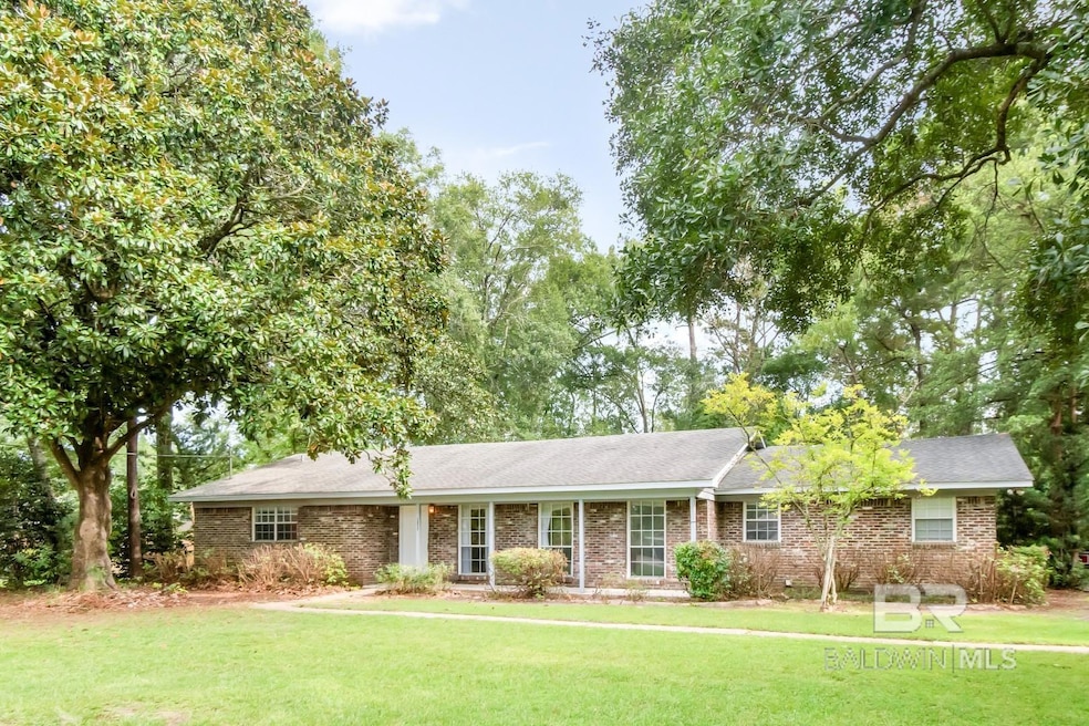
3923 Cypress Shores Dr N Mobile, AL 36619
Cypress Shores NeighborhoodEstimated payment $1,051/month
Highlights
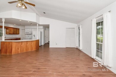
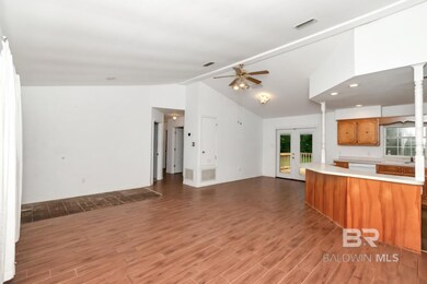
- Vaulted Ceiling
- No HOA
- Tile Flooring
- Bonus Room
- Brick or Stone Mason
- Outdoor Storage
About This Home
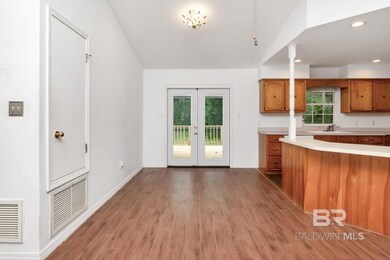
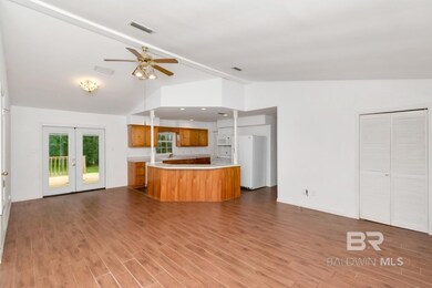
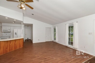
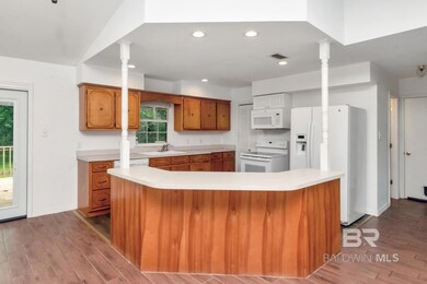
Nice 3/2 brick ranch in popular Cypress Shores on Dog River. There is a community boat launch for your boating activities on the river. Very close to the interstate with shopping opportunities minutes away on Rangeline. This home sits on a huge level lot with a private fenced backyard. Inside is an open floor plan with vaulted ceilings, nice kitchen, and a big pantry. Take advantage of this great value and make your appointment today. Buyer responsible for verifying all measurements and relevant details Buyer to verify all information during due diligence. Year Built Unknown.
Listing Agent
Roberts Brothers TREC Brokerage Email: beckymiller@robertsbrothers.com Listed on: 08/22/2025

Home Details
Home Type
- Single Family
Est. Annual Taxes
- $672
Lot Details
- 0.49 Acre Lot
- Lot Dimensions are 100 x 214 x 101 x 214
- Fenced
- Level Lot
Home Design
- Ranch Property
- Brick or Stone Mason
- Slab Foundation
- Composition Roof
Interior Spaces
- 1,539 Sq Ft Home
- 1-Story Property
- Vaulted Ceiling
- Ceiling Fan
- Bonus Room
Kitchen
- Electric Range
- Microwave
- Dishwasher
- Disposal
Flooring
- Laminate
- Tile
Bedrooms and Bathrooms
- 3 Bedrooms
- 2 Full Bathrooms
- Bathtub and Shower Combination in Primary Bathroom
Laundry
- Laundry on main level
- Dryer
- Washer
Parking
- 2 Parking Spaces
- 2 Carport Spaces
Additional Features
- Outdoor Storage
- Heating Available
Community Details
- No Home Owners Association
Listing and Financial Details
- Legal Lot and Block 5 / 5
- Assessor Parcel Number 3306390004036XXX
Map
Home Values in the Area
Average Home Value in this Area
Tax History
| Year | Tax Paid | Tax Assessment Tax Assessment Total Assessment is a certain percentage of the fair market value that is determined by local assessors to be the total taxable value of land and additions on the property. | Land | Improvement |
|---|---|---|---|---|
| 2024 | $716 | $12,490 | $2,400 | $10,090 |
| 2023 | $682 | $12,060 | $2,360 | $9,700 |
| 2022 | $603 | $11,290 | $2,000 | $9,290 |
| 2021 | $603 | $11,290 | $2,000 | $9,290 |
| 2020 | $603 | $11,290 | $2,000 | $9,290 |
| 2019 | $551 | $10,360 | $2,000 | $8,360 |
| 2018 | $551 | $10,380 | $0 | $0 |
| 2017 | $1,316 | $20,720 | $0 | $0 |
| 2016 | $1,349 | $21,240 | $0 | $0 |
| 2013 | $585 | $10,140 | $0 | $0 |
Property History
| Date | Event | Price | List to Sale | Price per Sq Ft |
|---|---|---|---|---|
| 11/17/2025 11/17/25 | Pending | -- | -- | -- |
| 09/22/2025 09/22/25 | Price Changed | $189,000 | -5.0% | $123 / Sq Ft |
| 08/22/2025 08/22/25 | For Sale | $199,000 | -- | $129 / Sq Ft |
Purchase History
| Date | Type | Sale Price | Title Company |
|---|---|---|---|
| Warranty Deed | $75,000 | None Available | |
| Warranty Deed | -- | None Available |
Mortgage History
| Date | Status | Loan Amount | Loan Type |
|---|---|---|---|
| Open | $60,000 | New Conventional |
Source: Baldwin REALTORS®
MLS Number: 384160
APN: 33-06-39-0-004-036
Disclaimer: Certain information contained herein is derived from information provided by parties other than Homes.com. All information provided is deemed reliable, but is not guaranteed to be accurate and should be independently verified.
![]() IDX information is provided exclusively for personal, non-commercial use, and may not be used for any purpose other than to identify prospective properties consumers may be interested in purchasing. Information is deemed reliable but not guaranteed.
IDX information is provided exclusively for personal, non-commercial use, and may not be used for any purpose other than to identify prospective properties consumers may be interested in purchasing. Information is deemed reliable but not guaranteed.
- 4301 Sawyer Ave
- 3865 Cypress Shores Dr N
- 3923 Patricia Dr
- 3875 Patricia Dr
- 3820 Cypress Shores Dr
- 4601 Cypress Shores Dr
- 4601 Cypress Shores Dr Unit 1
- 4650 Benson Rd
- 4525 Brentwood Dr
- 4073 Canal Cir E
- 4087 Canal Cir E
- 4077 Higgins Rd
- 4219 Canal Dr
- 4055 Riviere Du Chien Rd
- 3904 St Andrews Dr W
- 3904 Saint Andrews Dr W
- 0 St Andrews Dr E Unit 7510683
- 4156 Furman Dr
- 3116 Riviere Du Chien Loop W
- 4047 Leighton Place Dr