Estimated Value: $260,000 - $378,000
3
Beds
3
Baths
2,176
Sq Ft
$142/Sq Ft
Est. Value
About This Home
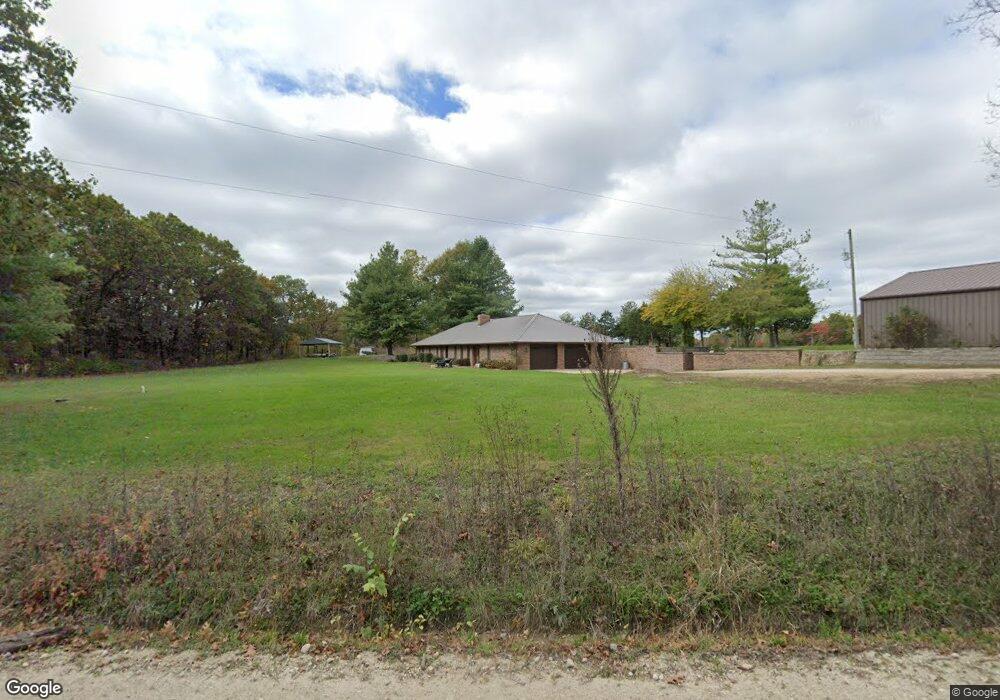
This home is located at 3923 Loeb Rd, Bland, MO 65014 and is currently estimated at $309,460, approximately $142 per square foot. 3923 Loeb Rd is a home with nearby schools including Owensville High School.
Ownership History
Date
Name
Owned For
Owner Type
Purchase Details
Closed on
Jan 31, 2024
Sold by
Poets Land Corporation
Bought by
Sumner Land Company Llc
Current Estimated Value
Purchase Details
Closed on
Mar 19, 2021
Sold by
Decker Darly B and Decker Briana
Bought by
Decker Joint Revocable Trust
Create a Home Valuation Report for This Property
The Home Valuation Report is an in-depth analysis detailing your home's value as well as a comparison with similar homes in the area
Purchase History
| Date | Buyer | Sale Price | Title Company |
|---|---|---|---|
| Sumner Land Company Llc | -- | None Listed On Document | |
| Decker Joint Revocable Trust | -- | None Listed On Document |
Source: Public Records
Tax History
| Year | Tax Paid | Tax Assessment Tax Assessment Total Assessment is a certain percentage of the fair market value that is determined by local assessors to be the total taxable value of land and additions on the property. | Land | Improvement |
|---|---|---|---|---|
| 2025 | $1,411 | $26,170 | $0 | $0 |
| 2024 | $1,251 | $24,450 | $0 | $0 |
| 2023 | $1,250 | $24,450 | $0 | $0 |
| 2022 | $1,250 | $24,450 | $0 | $0 |
| 2021 | $1,251 | $24,453 | $2,637 | $21,816 |
| 2020 | $1,168 | $20,910 | $0 | $0 |
| 2019 | $1,165 | $20,910 | $0 | $0 |
| 2018 | $1,081 | $20,910 | $0 | $0 |
| 2017 | $0 | $20,900 | $0 | $0 |
| 2016 | $1,082 | $20,910 | $0 | $0 |
| 2015 | -- | $20,910 | $0 | $0 |
| 2014 | -- | $0 | $0 | $0 |
| 2013 | -- | $0 | $0 | $0 |
Source: Public Records
Map
Nearby Homes
- 3767 Highway Ee
- 1412 Highway 28
- 60.51 ACRES S Tbd 4th St
- 1867 Hecker Rd
- 1862 Price Rd
- 1202 W Highway 28
- 3625 Highway 19
- 1798 Debbie Ln
- 407 Ahr Strom Dr
- 403 Ahr Strom Dr
- Lot 18 Mosel Way
- 1504 Ferd Ln
- 0 Hwy 28 Unit MIS25045872
- 509 S 7th St
- 502 W Monroe Ave
- 701 S 2nd St
- 403 S 5th St
- 107 E Franklin Ave
- 111 W Monroe Ave
- 902 Schuenemeyer Rd
Your Personal Tour Guide
Ask me questions while you tour the home.