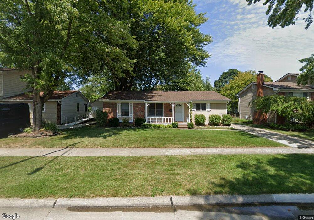
39238 Dillingham St Unit Bldg-Unit Westland, MI 48186
Estimated Value: $224,000 - $253,000
--
Bed
1
Bath
1,134
Sq Ft
$213/Sq Ft
Est. Value
About This Home
This home is located at 39238 Dillingham St Unit Bldg-Unit, Westland, MI 48186 and is currently estimated at $241,023, approximately $212 per square foot. 39238 Dillingham St Unit Bldg-Unit is a home located in Wayne County with nearby schools including P.D. Graham Elementary School, Marshall Upper Elementary School, and Adlai Stevenson Middle School.
Ownership History
Date
Name
Owned For
Owner Type
Purchase Details
Closed on
Jun 5, 2018
Sold by
Lobbestael Karen S
Bought by
Suchan Matthew
Current Estimated Value
Purchase Details
Closed on
Sep 17, 2004
Sold by
Lobbestael Henry
Bought by
Lobbestael Karen S
Home Financials for this Owner
Home Financials are based on the most recent Mortgage that was taken out on this home.
Original Mortgage
$102,000
Interest Rate
5.93%
Mortgage Type
Purchase Money Mortgage
Create a Home Valuation Report for This Property
The Home Valuation Report is an in-depth analysis detailing your home's value as well as a comparison with similar homes in the area
Home Values in the Area
Average Home Value in this Area
Purchase History
| Date | Buyer | Sale Price | Title Company |
|---|---|---|---|
| Suchan Matthew | $130,000 | None Available | |
| Lobbestael Karen S | $43,500 | Commonwealth Land Title |
Source: Public Records
Mortgage History
| Date | Status | Borrower | Loan Amount |
|---|---|---|---|
| Previous Owner | Lobbestael Karen S | $102,000 |
Source: Public Records
Tax History Compared to Growth
Tax History
| Year | Tax Paid | Tax Assessment Tax Assessment Total Assessment is a certain percentage of the fair market value that is determined by local assessors to be the total taxable value of land and additions on the property. | Land | Improvement |
|---|---|---|---|---|
| 2025 | $3,267 | $103,300 | $0 | $0 |
| 2024 | $3,267 | $94,700 | $0 | $0 |
| 2023 | $3,120 | $86,200 | $0 | $0 |
| 2022 | $3,650 | $76,100 | $0 | $0 |
| 2021 | $3,562 | $73,200 | $0 | $0 |
| 2020 | $3,520 | $68,500 | $0 | $0 |
| 2019 | $3,396 | $67,400 | $0 | $0 |
| 2018 | $1,572 | $58,300 | $0 | $0 |
| 2017 | $842 | $56,300 | $0 | $0 |
| 2016 | $2,052 | $54,700 | $0 | $0 |
| 2015 | $3,885 | $46,150 | $0 | $0 |
| 2013 | $3,764 | $39,260 | $0 | $0 |
| 2012 | $1,871 | $40,190 | $0 | $0 |
Source: Public Records
Map
Nearby Homes
- 39214 Dillingham St
- 585 S John Hix St
- 39615 Kirkland Dr
- 39250 Northampton St
- 38386 Maes St
- 00000 Avondale St
- 151 Dawson Ct
- 127 S John Hix St
- 39400 Cherry Hill Rd
- 39605 Dorchester Cir
- 157 Carson Dr Unit 175
- 285 Brookfield Dr Unit 25
- 336 Marigold Cir Unit 45
- 632 Georgetown St
- 571 Summerfield Dr Unit 196
- 39194 Brookfield Dr Unit 182
- 1786 Daisy Ln
- 172 N Bryar St
- 673 Ethan Dr
- 714 Autumn Ridge Dr Unit 64
- 39238 Dillingham St
- 39226 Dillingham St
- 39250 Dillingham St
- 39262 Dillingham St
- 39237 Gloucester St
- 39225 Gloucester St
- 39213 Gloucester St
- 39261 Gloucester St
- 39241 Dillingham St
- 39274 Dillingham St
- 39202 Dillingham St
- 39253 Dillingham St
- 39229 Dillingham St
- 39217 Dillingham St
- 39265 Dillingham St
- 39273 Gloucester St
- 39201 Gloucester St
- 39286 Dillingham St
- 39277 Dillingham St
- 39205 Dillingham St