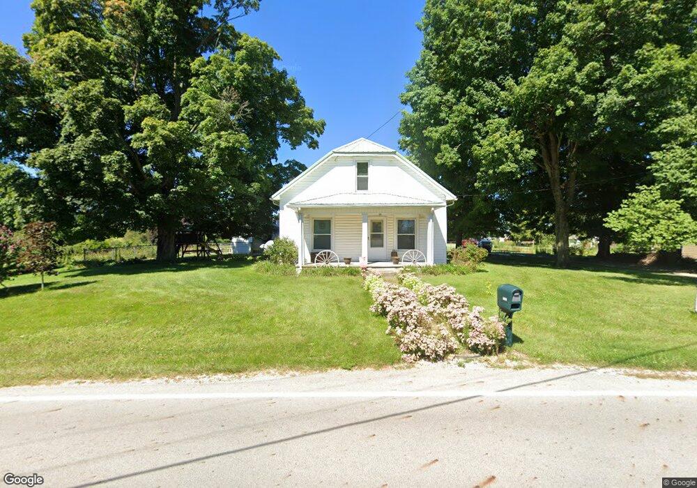
3926 Moorefield Rd Springfield, OH 45502
Estimated Value: $222,903 - $299,000
2
Beds
1
Bath
1,182
Sq Ft
$218/Sq Ft
Est. Value
About This Home
This home is located at 3926 Moorefield Rd, Springfield, OH 45502 and is currently estimated at $257,476, approximately $217 per square foot. 3926 Moorefield Rd is a home located in Clark County with nearby schools including Northeastern Elementary School and Emmanuel Christian Academy.
Ownership History
Date
Name
Owned For
Owner Type
Purchase Details
Closed on
Aug 24, 2022
Sold by
Hayslip Jr Allen E
Bought by
Hayslip Jodi R
Current Estimated Value
Purchase Details
Closed on
Oct 30, 1998
Sold by
Corfman Adaline J
Bought by
Hayslip Allen E and Hayslip Jodi R
Home Financials for this Owner
Home Financials are based on the most recent Mortgage that was taken out on this home.
Original Mortgage
$92,000
Interest Rate
6.78%
Create a Home Valuation Report for This Property
The Home Valuation Report is an in-depth analysis detailing your home's value as well as a comparison with similar homes in the area
Purchase History
| Date | Buyer | Sale Price | Title Company |
|---|---|---|---|
| Hayslip Jodi R | -- | Pavlatos Stacey Robert | |
| Hayslip Jodi R | -- | Pavlatos Stacey Robert | |
| Hayslip Allen E | $115,000 | -- |
Source: Public Records
Mortgage History
| Date | Status | Borrower | Loan Amount |
|---|---|---|---|
| Previous Owner | Hayslip Allen E | $92,000 |
Source: Public Records
Tax History
| Year | Tax Paid | Tax Assessment Tax Assessment Total Assessment is a certain percentage of the fair market value that is determined by local assessors to be the total taxable value of land and additions on the property. | Land | Improvement |
|---|---|---|---|---|
| 2025 | $2,728 | $74,800 | $44,480 | $30,320 |
| 2024 | $2,639 | $61,870 | $36,800 | $25,070 |
| 2023 | $2,639 | $61,870 | $36,800 | $25,070 |
| 2022 | $2,649 | $61,870 | $36,800 | $25,070 |
| 2021 | $2,581 | $51,080 | $30,160 | $20,920 |
| 2020 | $2,583 | $51,080 | $30,160 | $20,920 |
| 2019 | $2,632 | $51,080 | $30,160 | $20,920 |
| 2018 | $2,438 | $45,390 | $27,930 | $17,460 |
| 2017 | $2,093 | $45,388 | $27,930 | $17,458 |
| 2016 | $2,079 | $45,388 | $27,930 | $17,458 |
| 2015 | $1,046 | $43,960 | $27,930 | $16,030 |
| 2014 | $2,091 | $43,960 | $27,930 | $16,030 |
| 2013 | $1,021 | $43,960 | $27,930 | $16,030 |
Source: Public Records
Map
Nearby Homes
- 5060 Morris Rd
- 4607 Plateau Dr S
- 4273 Kay Ave
- 4500 Bosart Rd
- 4890 Brannan Dr W Unit 4890
- 4028 Ryland Dr Unit 4028
- 1977 Willoughby Ave
- 4732 Lehigh Dr
- 4652 Reno Ln Unit 15
- 4954 E County Line Rd
- 4577 Reno Ln Unit 2
- 1921 Elaina Dr
- 5033 Ridgewood Rd E
- 1521 Erika Dr
- 5564 Ridgewood Rd E Unit 7
- 4446 Ridgewood Rd E Unit 3
- 1644 Delmar Dr
- 1470 Oldham Dr Unit 12
- 1495 Victorian Way
- 1398 Elizabeth Ct Unit 66
- 3930 Moorefield Rd
- 3862 Moorefield Rd
- 3988 Moorefield Rd
- 5045 Twitchell Rd
- 1022 Yale St
- 1 Yale St
- 0 Yale St Unit 726795
- 0 Yale St Unit 311190
- 0 Yale St Unit 321466
- 0 Yale St Unit 400941
- 5075 Twitchell Rd
- 5093 Twitchell Rd
- 4936 Old Mechanicsburg Rd
- 5070 Twitchell Rd
- 4936 Mechanicsburg Rd
- 5125 Twitchell Rd
- 5108 Twitchell Rd
- 5090 Twitchell Rd
- 5151 Twitchell Rd
- 4924 Mechanicsburg Rd
Your Personal Tour Guide
Ask me questions while you tour the home.