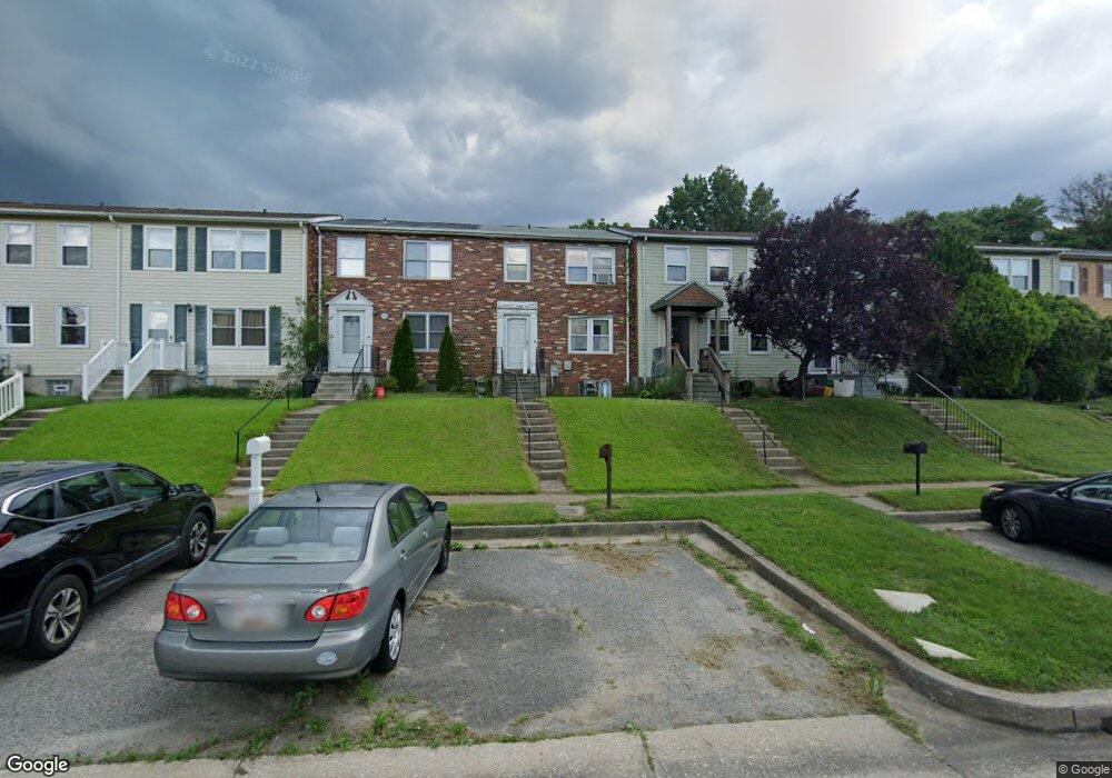
3928 Link Ave Nottingham, MD 21236
Estimated Value: $255,344 - $308,000
Studio
3
Baths
1,220
Sq Ft
$227/Sq Ft
Est. Value
About This Home
This home is located at 3928 Link Ave, Nottingham, MD 21236 and is currently estimated at $276,836, approximately $226 per square foot. 3928 Link Ave is a home located in Baltimore County with nearby schools including Perry Hall Elementary School, Perry Hall Middle School, and Perry Hall High School.
Ownership History
Date
Name
Owned For
Owner Type
Purchase Details
Closed on
Dec 3, 2003
Sold by
Gallon Sean
Bought by
Salazar Carlos
Current Estimated Value
Purchase Details
Closed on
Sep 1, 1999
Sold by
Ocwen Federal Bank Fsb
Bought by
Gallon Sean
Purchase Details
Closed on
Feb 3, 1999
Sold by
Branch April L
Bought by
Ocwen Federal Bank Fsb
Purchase Details
Closed on
Feb 5, 1994
Sold by
Sikorsky Joseph J
Bought by
Branch April L
Home Financials for this Owner
Home Financials are based on the most recent Mortgage that was taken out on this home.
Original Mortgage
$100,550
Interest Rate
7.12%
Create a Home Valuation Report for This Property
The Home Valuation Report is an in-depth analysis detailing your home's value as well as a comparison with similar homes in the area
Home Values in the Area
Average Home Value in this Area
Purchase History
| Date | Buyer | Sale Price | Title Company |
|---|---|---|---|
| Salazar Carlos | $130,500 | -- | |
| Gallon Sean | $84,900 | -- | |
| Ocwen Federal Bank Fsb | $73,363 | -- | |
| Branch April L | $99,900 | -- |
Source: Public Records
Mortgage History
| Date | Status | Borrower | Loan Amount |
|---|---|---|---|
| Previous Owner | Branch April L | $100,550 |
Source: Public Records
Tax History
| Year | Tax Paid | Tax Assessment Tax Assessment Total Assessment is a certain percentage of the fair market value that is determined by local assessors to be the total taxable value of land and additions on the property. | Land | Improvement |
|---|---|---|---|---|
| 2025 | $3,017 | $208,333 | -- | -- |
| 2024 | $3,017 | $199,667 | $0 | $0 |
| 2023 | $1,488 | $191,000 | $64,000 | $127,000 |
| 2022 | $2,937 | $183,133 | $0 | $0 |
| 2021 | $2,473 | $175,267 | $0 | $0 |
| 2020 | $2,473 | $167,400 | $64,000 | $103,400 |
| 2019 | $2,485 | $166,200 | $0 | $0 |
| 2018 | $2,436 | $165,000 | $0 | $0 |
| 2017 | $2,603 | $163,800 | $0 | $0 |
| 2016 | $2,128 | $158,800 | $0 | $0 |
| 2015 | $2,128 | $153,800 | $0 | $0 |
| 2014 | $2,128 | $148,800 | $0 | $0 |
Source: Public Records
Map
Nearby Homes
- 27 Cavan Green
- 13 Leinster Garth
- 4106 Link Ave
- 3754 Foxford Stream Rd
- 3702 E Joppa Rd
- 8876 Paddock Ln
- 19 Derwood Ct
- 8713 Belair Rd
- 4213 Mispillion Rd
- 9036 Simms Ct
- 9046 Naygall Rd
- 4231 Plumer Ave
- 9 Slavin Ct
- 3 Slavin Ct
- 4234 Necker Ave
- 9318 Hines Estates Dr
- 3505 E Joppa Rd
- 25 Arwell Ct
- 24 Lerner Ct
- 4222 Klosterman Ave
- 3930 Link Ave
- 3926 Link Ave
- 3932 Link Ave
- 3924 Link Ave
- 3934 Link Ave
- 3922 Link Ave
- 3936 Link Ave
- 3920 Link Ave
- 3938 Link Ave
- 3918 Link Ave
- 3916 Link Ave
- 3911 Link Ave
- 3940 Link Ave
- 3913 Link Ave
- 3914 Link Ave
- 3907 Link Ave
- 3942 Link Ave
- 3912 Link Ave
- 3919 Link Ave Unit WHITE MARSH BLVD
- 3905 Link Ave
Your Personal Tour Guide
Ask me questions while you tour the home.