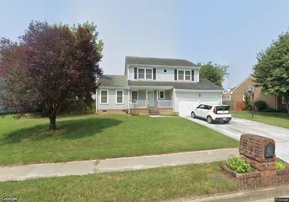
3928 Long Point Blvd Portsmouth, VA 23703
Churchland NeighborhoodEstimated Value: $350,000 - $389,000
3
Beds
3
Baths
1,866
Sq Ft
$199/Sq Ft
Est. Value
About This Home
This home is located at 3928 Long Point Blvd, Portsmouth, VA 23703 and is currently estimated at $371,158, approximately $198 per square foot. 3928 Long Point Blvd is a home located in Portsmouth City with nearby schools including Churchland Primary/Intermediate School, Churchland Middle School, and Churchland High School.
Ownership History
Date
Name
Owned For
Owner Type
Purchase Details
Closed on
Nov 27, 2002
Sold by
Lee Melvin T
Bought by
Abshire Brian K
Current Estimated Value
Home Financials for this Owner
Home Financials are based on the most recent Mortgage that was taken out on this home.
Original Mortgage
$120,000
Outstanding Balance
$50,309
Interest Rate
6.16%
Mortgage Type
New Conventional
Estimated Equity
$320,849
Create a Home Valuation Report for This Property
The Home Valuation Report is an in-depth analysis detailing your home's value as well as a comparison with similar homes in the area
Home Values in the Area
Average Home Value in this Area
Purchase History
| Date | Buyer | Sale Price | Title Company |
|---|---|---|---|
| Abshire Brian K | $150,000 | -- |
Source: Public Records
Mortgage History
| Date | Status | Borrower | Loan Amount |
|---|---|---|---|
| Open | Abshire Brian K | $120,000 |
Source: Public Records
Tax History Compared to Growth
Tax History
| Year | Tax Paid | Tax Assessment Tax Assessment Total Assessment is a certain percentage of the fair market value that is determined by local assessors to be the total taxable value of land and additions on the property. | Land | Improvement |
|---|---|---|---|---|
| 2025 | $3,959 | $326,290 | $86,220 | $240,070 |
| 2024 | $3,959 | $307,960 | $86,220 | $221,740 |
| 2023 | $3,529 | $282,310 | $86,220 | $196,090 |
| 2022 | $3,622 | $278,640 | $86,220 | $192,420 |
| 2021 | $3,078 | $236,780 | $71,850 | $164,930 |
| 2020 | $2,962 | $227,860 | $68,430 | $159,430 |
| 2019 | $2,938 | $226,030 | $68,430 | $157,600 |
| 2018 | $2,938 | $226,030 | $68,430 | $157,600 |
| 2017 | $2,938 | $226,030 | $68,430 | $157,600 |
| 2016 | $2,843 | $218,700 | $68,430 | $150,270 |
| 2015 | $2,843 | $218,700 | $68,430 | $150,270 |
| 2014 | $2,777 | $218,700 | $68,430 | $150,270 |
Source: Public Records
Map
Nearby Homes
- 17 Shoal Ct
- 3866 Augustine Cir
- 3877 Peachtree Ln W
- 3818 Peach Orchard Cir
- 3913 Stateflower Ct
- 3860 Sugar Creek Cir
- 8 Compass Ct
- 4100 Mayfair Way
- 4071 Long Point Blvd
- 3817 Harvest Ct
- 3660B Towne Point Rd Unit A
- 6446 Olde Bullocks Cir
- 5807 Dunkin St
- 3791 Towne Point Rd
- 3433 Willow Breeze Dr
- 6417 Pelican Crescent N
- 3715 Magnolia Dr
- 3705 Bamboo Rd
- 4200 Quince Rd
- 3616 Bowden St
- 3924 Long Point Blvd
- 3932 Long Point Blvd
- 4037 Ketch Dr
- 4035 Ketch Dr
- 4039 Ketch Dr
- 4041 Ketch Dr
- 4033 Ketch Dr
- 4031 Ketch Dr
- 4004 Ebbtide Ln
- 4029 Ketch Dr
- 3920 Long Point Blvd
- 10 Tidal Ct
- 8 Tidal Ct
- 6 Tidal Ct
- 3923 Long Point Blvd
- 4 Tidal Ct
- 3927 Long Point Blvd
- 12 Tidal Ct
- 3931 Long Point Blvd
- 4027 Ketch Dr