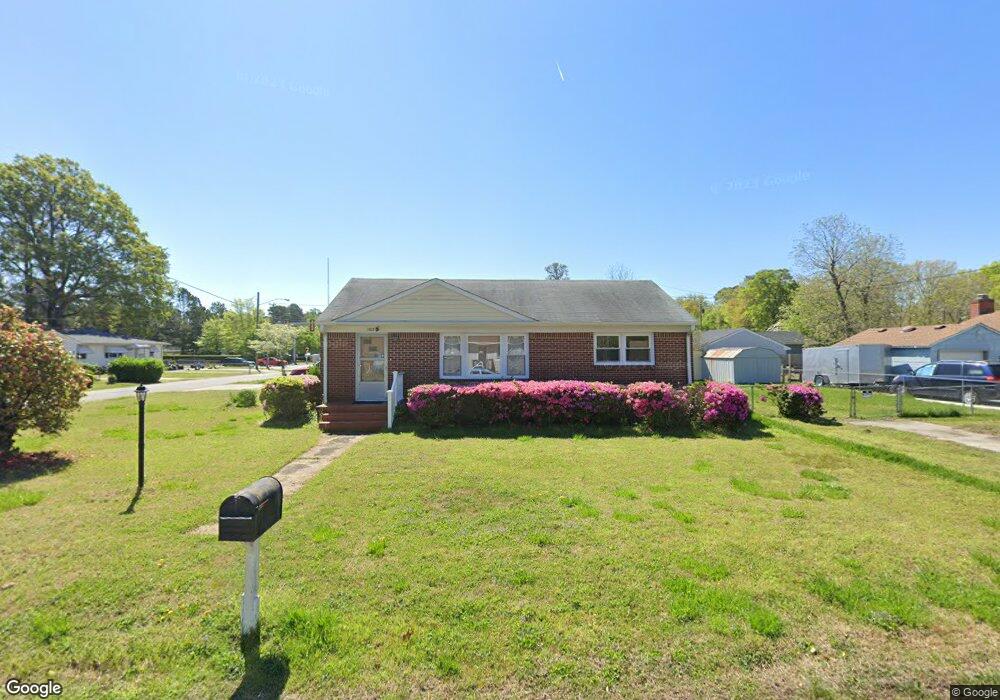
3929 Hubard Dr Chesapeake, VA 23325
Indian River NeighborhoodEstimated Value: $322,283 - $344,000
3
Beds
2
Baths
1,648
Sq Ft
$205/Sq Ft
Est. Value
About This Home
This home is located at 3929 Hubard Dr, Chesapeake, VA 23325 and is currently estimated at $337,571, approximately $204 per square foot. 3929 Hubard Dr is a home located in Chesapeake City with nearby schools including Georgetown Primary School, Sparrow Road Intermediate School, and Indian River Middle.
Ownership History
Date
Name
Owned For
Owner Type
Purchase Details
Closed on
Oct 22, 2021
Sold by
Hill Michael Earl and Hill Jimmie N
Bought by
Muigai Silvester M
Current Estimated Value
Home Financials for this Owner
Home Financials are based on the most recent Mortgage that was taken out on this home.
Original Mortgage
$276,210
Outstanding Balance
$251,878
Interest Rate
2.8%
Mortgage Type
VA
Estimated Equity
$85,693
Create a Home Valuation Report for This Property
The Home Valuation Report is an in-depth analysis detailing your home's value as well as a comparison with similar homes in the area
Home Values in the Area
Average Home Value in this Area
Purchase History
| Date | Buyer | Sale Price | Title Company |
|---|---|---|---|
| Muigai Silvester M | $270,000 | Priority Title & Escrow |
Source: Public Records
Mortgage History
| Date | Status | Borrower | Loan Amount |
|---|---|---|---|
| Open | Muigai Silvester M | $276,210 |
Source: Public Records
Tax History Compared to Growth
Tax History
| Year | Tax Paid | Tax Assessment Tax Assessment Total Assessment is a certain percentage of the fair market value that is determined by local assessors to be the total taxable value of land and additions on the property. | Land | Improvement |
|---|---|---|---|---|
| 2025 | $2,835 | $291,300 | $125,000 | $166,300 |
| 2024 | $2,835 | $280,700 | $115,000 | $165,700 |
| 2023 | $2,451 | $261,300 | $105,000 | $156,300 |
| 2022 | $2,466 | $244,200 | $95,000 | $149,200 |
| 2021 | $2,230 | $212,400 | $80,000 | $132,400 |
| 2020 | $2,178 | $207,400 | $80,000 | $127,400 |
| 2019 | $1,783 | $204,600 | $80,000 | $124,600 |
| 2018 | $1,981 | $215,100 | $80,000 | $135,100 |
| 2017 | $1,981 | $211,200 | $80,000 | $131,200 |
| 2016 | $2,218 | $211,200 | $80,000 | $131,200 |
| 2015 | $1,981 | $211,200 | $80,000 | $131,200 |
| 2014 | $2,218 | $211,200 | $80,000 | $131,200 |
Source: Public Records
Map
Nearby Homes
- 645 Milby Dr
- 705 Milby Dr
- 748 Cardover Ave
- 1615 Oleander Ave
- 837 Providence Rd
- 1524 Linden Ave
- 3303 Rokeby Ave
- 1425 Myrtle Ave
- 1427 Myrtle Ave
- 1941 Miller Ave
- 1504 Chestnut Ave
- 1736 Lockard Ave
- Lot Angora Dr
- 1718 Sparrow Rd
- 1938 Engle Ave
- 1400 Hazel Ave
- 3700 Cornick Ave
- 2006 Sparrow Rd
- 2924 Candlewood Cir
- 2916 Doris Ave
- 3925 Hubard Dr
- 3928 Hubard Dr
- 626 Providence Rd
- 2036 Angora Dr
- 3924 Hubard Dr
- 2040 Angora Dr
- 2028 Angora Dr
- 2028 Angora Dr (18j4)
- 3921 Hubard Dr
- 3920 Hubard Dr
- 620 Providence Rd
- 2025 Angora Dr
- 3917 Hubard Dr
- 2024 Angora Dr
- 3916 Hubard Dr
- 616 Providence Rd
- 632 Providence Rd
- 2021 Angora Dr
- 2012 Emmett Dr
- 2010 Emmett Dr