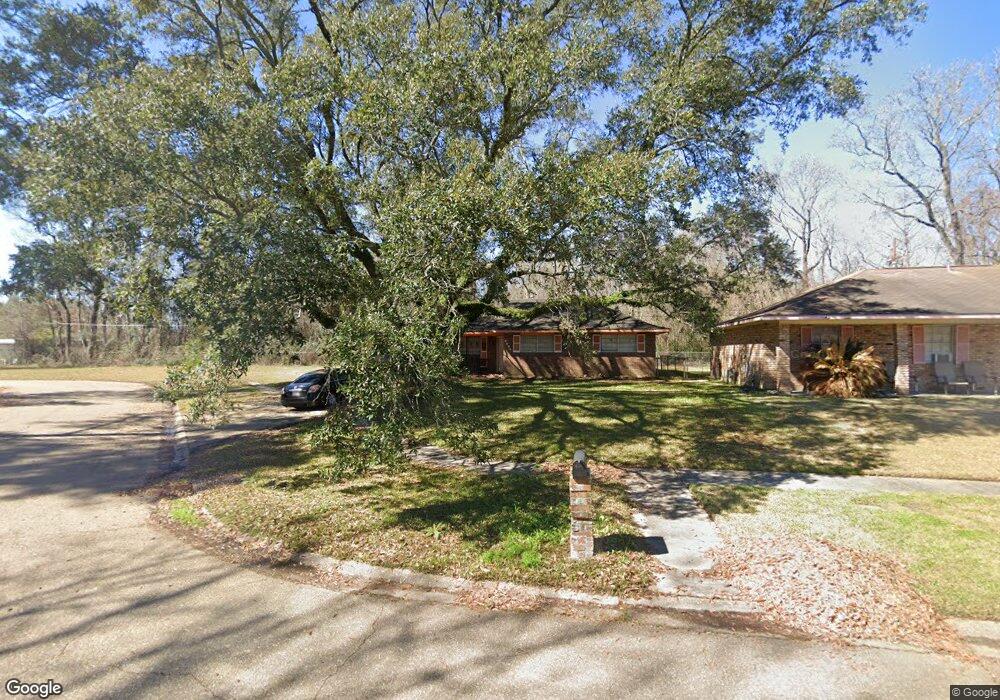
3929 Saint Andrew Ave Baton Rouge, LA 70805
Mid City North NeighborhoodEstimated Value: $85,000 - $150,000
Studio
--
Bath
1,454
Sq Ft
$77/Sq Ft
Est. Value
About This Home
This home is located at 3929 Saint Andrew Ave, Baton Rouge, LA 70805 and is currently estimated at $112,183, approximately $77 per square foot. 3929 Saint Andrew Ave is a home located in East Baton Rouge Parish with nearby schools including Istrouma High School, Capitol Middle School, and Celerity Lanier Charter School.
Ownership History
Date
Name
Owned For
Owner Type
Purchase Details
Closed on
Mar 31, 2008
Sold by
Jackson Ronald G
Bought by
Hicks Monica D
Current Estimated Value
Home Financials for this Owner
Home Financials are based on the most recent Mortgage that was taken out on this home.
Original Mortgage
$103,377
Outstanding Balance
$65,587
Interest Rate
6%
Mortgage Type
FHA
Estimated Equity
$46,596
Create a Home Valuation Report for This Property
The Home Valuation Report is an in-depth analysis detailing your home's value as well as a comparison with similar homes in the area
Home Values in the Area
Average Home Value in this Area
Purchase History
| Date | Buyer | Sale Price | Title Company |
|---|---|---|---|
| Hicks Monica D | $105,000 | -- |
Source: Public Records
Mortgage History
| Date | Status | Borrower | Loan Amount |
|---|---|---|---|
| Open | Hicks Monica D | $103,377 |
Source: Public Records
Tax History
| Year | Tax Paid | Tax Assessment Tax Assessment Total Assessment is a certain percentage of the fair market value that is determined by local assessors to be the total taxable value of land and additions on the property. | Land | Improvement |
|---|---|---|---|---|
| 2024 | $848 | $13,317 | $560 | $12,757 |
| 2023 | $771 | $11,890 | $500 | $11,390 |
| 2022 | $1,420 | $11,890 | $500 | $11,390 |
| 2021 | $1,387 | $11,890 | $500 | $11,390 |
| 2020 | $1,378 | $11,890 | $500 | $11,390 |
| 2019 | $1,308 | $10,800 | $450 | $10,350 |
| 2018 | $1,292 | $10,800 | $450 | $10,350 |
| 2017 | $1,292 | $10,800 | $450 | $10,350 |
| 2016 | $93 | $7,178 | $450 | $6,728 |
| 2015 | $449 | $10,500 | $450 | $10,050 |
| 2014 | $447 | $10,500 | $450 | $10,050 |
| 2013 | -- | $10,500 | $450 | $10,050 |
Source: Public Records
Map
Nearby Homes
- TBD E Brookstown Dr
- 6022 Heidel Ave
- 5921 Linden St
- 6550/6534 Prescott Rd
- 4791 Prescott Rd
- 4561 E Brookstown Dr
- 6745 Ozark St
- TBD Victoria Dr
- 5520 Prescott Rd
- 3575 Victoria Dr
- 4887 Enterprise St
- 4747 Annette St
- 3905 Elm Dr
- 5044 Enterprise St
- 5765 Beech St
- 6872 Clinton Ave
- 2871 Anita Cir
- 4435 Elm Dr
- 5772 Saint Gerard Ave
- 5226 E Brookstown Dr
- 3929 St Andrew Dr
- 3928 Saint Andrew Ave
- 3965 Saint Andrew Ave
- 3983 Saint Andrew Ave
- 000 Saint Andrew Dr
- 4037 Saint Andrew Ave
- 3966 Saint Andrew Ave
- 3908 Saint Andrew Ave
- 3984 Saint Andrew Ave
- 4045 Saint Andrew Ave
- 4036 Saint Andrew Ave
- 4053 St Andrew Dr
- 4044 Saint Andrew Ave
- 4044 Saint Andrew Ave Unit 1
- 4053 Saint Andrew Ave
- 4052 Saint Andrew Ave
- 4052 St Andrew Dr
- 4061 Saint Andrew Ave
- 4004 E Brookstown Dr
- 4060 Saint Andrew Ave
Your Personal Tour Guide
Ask me questions while you tour the home.