Estimated Value: $280,000 - $282,000
3
Beds
2
Baths
1,391
Sq Ft
$202/Sq Ft
Est. Value
About This Home
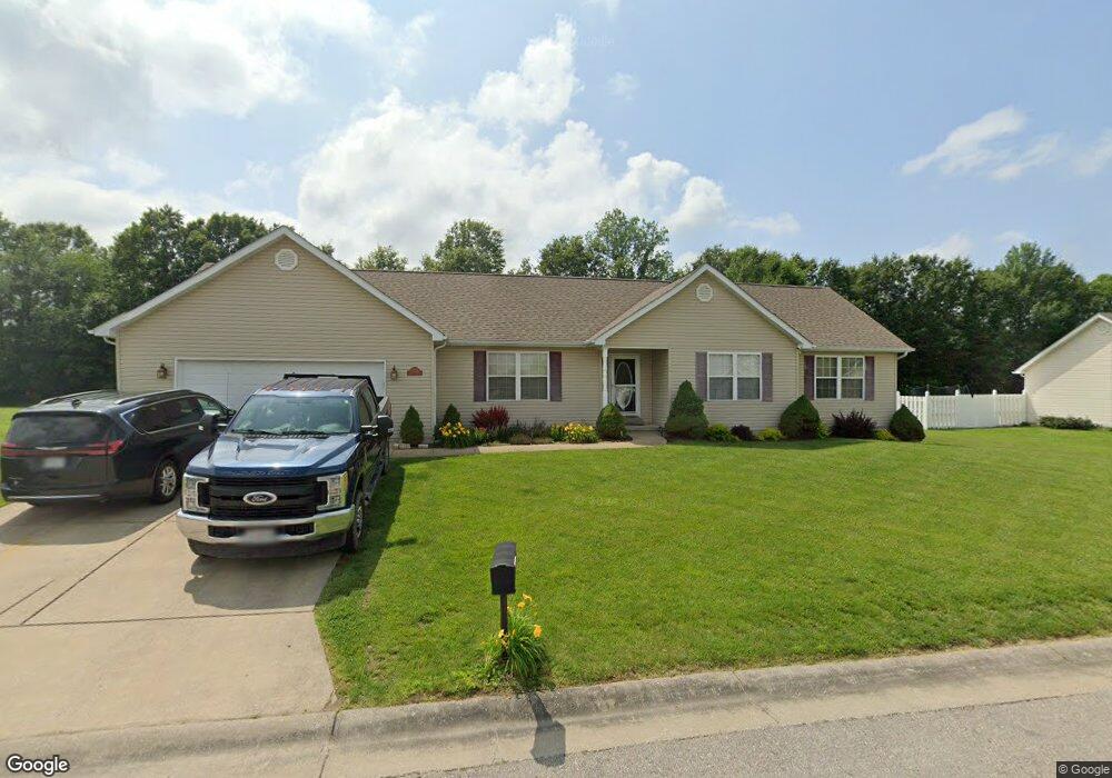
This home is located at 393 Augusta Place, Union, MO 63084 and is currently estimated at $281,302, approximately $202 per square foot. 393 Augusta Place is a home located in Franklin County with nearby schools including Union High School and Immaculate Conception School.
Ownership History
Date
Name
Owned For
Owner Type
Purchase Details
Closed on
Nov 7, 2008
Sold by
Bank Of New York
Bought by
Spencer David J
Current Estimated Value
Home Financials for this Owner
Home Financials are based on the most recent Mortgage that was taken out on this home.
Original Mortgage
$94,900
Outstanding Balance
$61,467
Interest Rate
5.98%
Mortgage Type
New Conventional
Estimated Equity
$219,835
Purchase Details
Closed on
Aug 11, 2008
Sold by
Davis Robert W
Bought by
The Bank Of New York
Create a Home Valuation Report for This Property
The Home Valuation Report is an in-depth analysis detailing your home's value as well as a comparison with similar homes in the area
Home Values in the Area
Average Home Value in this Area
Purchase History
| Date | Buyer | Sale Price | Title Company |
|---|---|---|---|
| Spencer David J | -- | None Available | |
| The Bank Of New York | $138,975 | None Available |
Source: Public Records
Mortgage History
| Date | Status | Borrower | Loan Amount |
|---|---|---|---|
| Open | Spencer David J | $94,900 |
Source: Public Records
Tax History
| Year | Tax Paid | Tax Assessment Tax Assessment Total Assessment is a certain percentage of the fair market value that is determined by local assessors to be the total taxable value of land and additions on the property. | Land | Improvement |
|---|---|---|---|---|
| 2025 | $1,953 | $38,247 | $0 | $0 |
| 2024 | $1,953 | $32,465 | $0 | $0 |
| 2023 | $1,956 | $32,465 | $0 | $0 |
| 2022 | $2,269 | $37,574 | $0 | $0 |
| 2021 | $2,273 | $37,574 | $0 | $0 |
| 2020 | $2,089 | $33,976 | $0 | $0 |
| 2019 | $2,084 | $33,976 | $0 | $0 |
| 2018 | $1,823 | $31,198 | $0 | $0 |
| 2017 | $1,828 | $31,198 | $0 | $0 |
| 2016 | $1,722 | $28,728 | $0 | $0 |
| 2015 | $1,694 | $28,728 | $0 | $0 |
| 2014 | $1,710 | $28,969 | $0 | $0 |
Source: Public Records
Map
Nearby Homes
- 1055 Saint Andrews Dr
- 1076 Vardon Meadows Dr
- 3 Sterling at St Andrews Manors
- 2 Maple at St Andrews Manors
- 2 Summerfield at St Andrews Commons
- 1010 Braid Trail Dr
- 1012 Braid Trail Dr
- 1014 Braid Trail Dr
- 1064 Vardon Meadows Dr
- 2 St James at St Andrews
- 2 Aspen II at St Andrews Mano
- 2 Ashford at St Andrews Manor
- 2 Aspen at St Andrews Manors
- 1005 Braid Trail Dr
- 1056 Vardon Meadows Dr
- 2 Berwick at St Andrews Manor
- 1007 Watson Ridge Dr
- 1041 Vardon Meadows Dr
- 850 Pebble Beach Ct
- 144 Vista Vallarta Dr
- 387 Augusta Place
- 392 Augusta Place
- 398 Augusta Place
- 386 Augusta Place
- 381 Augusta Place
- 0 Bayhill (44) Blvd Unit 80013589
- 0 Bayhill (84) Blvd Unit 80013598
- 0 Bayhill (83) Blvd Unit 80013597
- 0 Bayhill (82) Blvd Unit 80013596
- 0 Bayhill (75) Blvd Unit 80013590
- 0 Bayhill (79) Blvd Unit 80013593
- 0 Bayhill (46) Blvd Unit 80013587
- 0 Bayhill (47) Blvd Unit 80013586
- 0 Bayhill (77) Blvd Unit 80013592
- 0 Bayhill (80) Blvd Unit 80013594
- 0 Bayhill (45) Blvd Unit 80013588
- 0 Bayhill (81) Blvd Unit 80013595
- 0 Bayhill (76) Blvd Unit 80013591
- 0 Bayhill (75) Blvd Unit 10033408
- 0 Bayhill (79) Blvd Unit 10033410
Your Personal Tour Guide
Ask me questions while you tour the home.