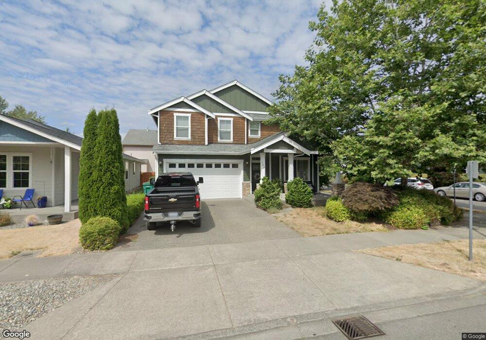
393 Bondgard Ave E Enumclaw, WA 98022
Estimated Value: $671,000 - $725,000
4
Beds
3
Baths
3,046
Sq Ft
$227/Sq Ft
Est. Value
About This Home
This home is located at 393 Bondgard Ave E, Enumclaw, WA 98022 and is currently estimated at $692,637, approximately $227 per square foot. 393 Bondgard Ave E is a home located in King County with nearby schools including Southwood Elementary School, Enumclaw Middle School, and Enumclaw Senior High School.
Ownership History
Date
Name
Owned For
Owner Type
Purchase Details
Closed on
Oct 20, 2008
Sold by
B & R Land Inc
Bought by
Mckeighen Kevin E and Mckeighen Kimberly
Current Estimated Value
Home Financials for this Owner
Home Financials are based on the most recent Mortgage that was taken out on this home.
Original Mortgage
$392,990
Interest Rate
5.9%
Purchase Details
Closed on
Jul 18, 2007
Sold by
Holt Randall and Holt Barbara
Bought by
B & R Land Inc
Create a Home Valuation Report for This Property
The Home Valuation Report is an in-depth analysis detailing your home's value as well as a comparison with similar homes in the area
Home Values in the Area
Average Home Value in this Area
Purchase History
| Date | Buyer | Sale Price | Title Company |
|---|---|---|---|
| Mckeighen Kevin E | $497,990 | Pacific Nw Tit | |
| B & R Land Inc | -- | The Talon Grou | |
| B & R Land Inc | -- | None Available | |
| Holt Randall | -- | None Available |
Source: Public Records
Mortgage History
| Date | Status | Borrower | Loan Amount |
|---|---|---|---|
| Previous Owner | Mckeighen Kevin E | $392,990 |
Source: Public Records
Tax History
| Year | Tax Paid | Tax Assessment Tax Assessment Total Assessment is a certain percentage of the fair market value that is determined by local assessors to be the total taxable value of land and additions on the property. | Land | Improvement |
|---|---|---|---|---|
| 2024 | $6,192 | $645,000 | $202,000 | $443,000 |
| 2023 | $5,739 | $553,000 | $174,000 | $379,000 |
| 2022 | $5,140 | $631,000 | $199,000 | $432,000 |
| 2021 | $5,046 | $512,000 | $172,000 | $340,000 |
| 2020 | $4,600 | $458,000 | $129,000 | $329,000 |
| 2018 | $4,867 | $421,000 | $118,000 | $303,000 |
| 2017 | $4,491 | $397,000 | $108,000 | $289,000 |
| 2016 | $4,416 | $378,000 | $100,000 | $278,000 |
| 2015 | $4,814 | $366,000 | $95,000 | $271,000 |
| 2014 | -- | $382,000 | $107,000 | $275,000 |
| 2013 | -- | $294,000 | $86,000 | $208,000 |
Source: Public Records
Map
Nearby Homes
- 413 Becky Ave E
- 385 Bruhn Ln N
- 629 Barquist Ln N
- 643 Barquist Ln N
- 657 Barquist Ln N
- 685 Barquist Ln N
- 783 Weaver Dr E
- 176 Love Dr
- 721 Weaver Dr E
- 755 Weaver Dr E
- 769 Weaver Dr E
- 746 Weaver Dr E
- 760 Weaver Dr E
- 797 Weaver Dr E
- 811 Weaver Dr E
- 228 Holdener Ln N
- 227 Jasmine Ln N
- 505 Thompson (Lot 1) Dr
- 549 Thompson (Lot 3) Dr
- 431 Rainier Ave
- 512 Cooper Ln N
- 339 Bondgard Ave E
- 513 Cooper Ln N
- 555 Cooper Ln N
- 417 Bondgard Ave E
- 317 Bondgard Ave E
- 394 Bondgard Ave E
- 362 Bondgard Ave E
- 362 Bondgard Ave E
- 340 Bondgard Ave E
- 402 Bondgard Ave E
- 429 Bondgard Ave E
- 295 Bondgard Ave E
- 318 Bondgard Ave E
- 410 Bondgard Ave E
- 556 Deusen Ln N
- 514 Deusen Ln N
- 283 Bondgard Ave E
- 428 Bondgard Ave E
Your Personal Tour Guide
Ask me questions while you tour the home.