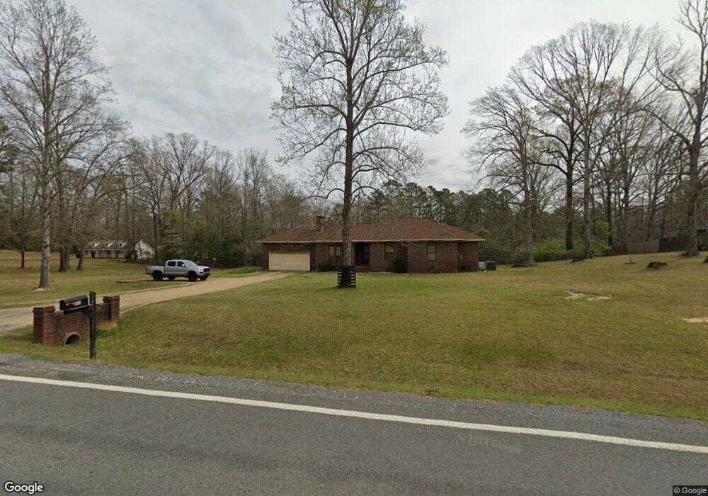
393 Highway 376 N Camden, AR 71701
Estimated Value: $125,000 - $173,776
--
Bed
2
Baths
1,859
Sq Ft
$78/Sq Ft
Est. Value
About This Home
This home is located at 393 Highway 376 N, Camden, AR 71701 and is currently estimated at $145,444, approximately $78 per square foot. 393 Highway 376 N is a home located in Ouachita County with nearby schools including Fairview Elementary School, Ivory Primary School, and Ivory Intermediate School.
Ownership History
Date
Name
Owned For
Owner Type
Purchase Details
Closed on
Mar 18, 2010
Sold by
Mcmullan Bostic Katy D and Bostic Courtney D
Bought by
Brown Ronnie C and Brown Veronica A
Current Estimated Value
Home Financials for this Owner
Home Financials are based on the most recent Mortgage that was taken out on this home.
Original Mortgage
$146,574
Outstanding Balance
$96,478
Interest Rate
5%
Estimated Equity
$48,966
Purchase Details
Closed on
Apr 1, 2003
Bought by
Mcmullan Katy D
Create a Home Valuation Report for This Property
The Home Valuation Report is an in-depth analysis detailing your home's value as well as a comparison with similar homes in the area
Home Values in the Area
Average Home Value in this Area
Purchase History
| Date | Buyer | Sale Price | Title Company |
|---|---|---|---|
| Brown Ronnie C | -- | -- | |
| Mcmullan Katy D | $100,000 | -- |
Source: Public Records
Mortgage History
| Date | Status | Borrower | Loan Amount |
|---|---|---|---|
| Open | Brown Ronnie C | $146,574 |
Source: Public Records
Tax History Compared to Growth
Tax History
| Year | Tax Paid | Tax Assessment Tax Assessment Total Assessment is a certain percentage of the fair market value that is determined by local assessors to be the total taxable value of land and additions on the property. | Land | Improvement |
|---|---|---|---|---|
| 2025 | $485 | $39,330 | $2,410 | $36,920 |
| 2024 | $533 | $24,360 | $1,210 | $23,150 |
| 2023 | $608 | $24,360 | $1,210 | $23,150 |
| 2022 | $658 | $24,360 | $1,210 | $23,150 |
| 2021 | $658 | $24,360 | $1,210 | $23,150 |
| 2020 | $658 | $24,340 | $910 | $23,430 |
| 2019 | $613 | $24,340 | $910 | $23,430 |
| 2018 | $598 | $24,340 | $910 | $23,430 |
| 2017 | $558 | $24,340 | $910 | $23,430 |
| 2016 | $519 | $24,340 | $910 | $23,430 |
| 2015 | $479 | $24,340 | $910 | $23,430 |
| 2014 | $440 | $18,630 | $530 | $18,100 |
Source: Public Records
Map
Nearby Homes
- 2737 Timberline Dr
- 7.25 acres Bensberg Hwy 278w Rd
- 2931 Arkansas 24
- 194 Cal Ray Dr
- 1656 Nix Ave
- 1460 California Ave SW
- 3177 Highway 24
- 1400 California Ave SW
- 2200 Maul Rd
- 1338 Ronald Dr
- 123 Berg Ave
- 0 U S 79
- 230 Berg Ave
- 541 Palisade Dr
- 128 Elaine Ave
- 540 Brookridge Dr
- 308 Elaine Ave
- 507 Lakeside Ave
- 324 Elaine Ave
- 1899 Maul Rd
- 387 Highway 376 N
- 392 Highway 376 N
- 392 Highway 376 N
- 403 Highway 376 N
- 398 Highway 376 N
- 375 Highway 376 N
- 2817 U S 278
- 374 Highway 376 N
- 369 Highway 376 N
- 350 Highway 376 N
- 2687 Highway 278 W
- 340 Highway 376 N
- 2763 Highway 278 W
- 2795 Highway 278 W
- 279 Highway 376 N
- 2817 Highway 278 W
- 2829 Highway 278 W
- 238 Highway 376 N
- 241 Highway 376 N
- 208 Highway 376 N