Estimated Value: $244,000 - $286,000
3
Beds
2
Baths
1,272
Sq Ft
$205/Sq Ft
Est. Value
About This Home
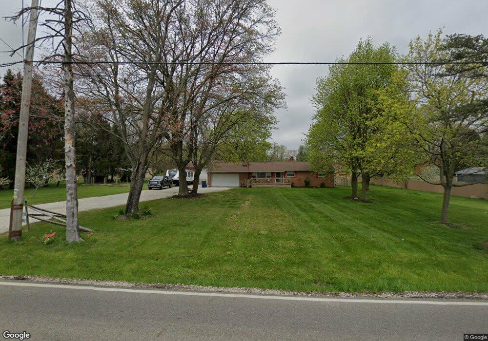
This home is located at 393 Howe Rd, Kent, OH 44240 and is currently estimated at $261,364, approximately $205 per square foot. 393 Howe Rd is a home located in Portage County with nearby schools including Brimfield Elementary School, Field Middle School, and Field High School.
Ownership History
Date
Name
Owned For
Owner Type
Purchase Details
Closed on
Dec 14, 2011
Sold by
Fronek Thomas E and Fronek Karen D
Bought by
Brooks Jason W
Current Estimated Value
Home Financials for this Owner
Home Financials are based on the most recent Mortgage that was taken out on this home.
Original Mortgage
$112,084
Outstanding Balance
$76,599
Interest Rate
3.99%
Mortgage Type
FHA
Estimated Equity
$184,765
Purchase Details
Closed on
Apr 11, 1996
Sold by
Begue Gary L
Bought by
Cain Roger A and Cain Gloria J
Home Financials for this Owner
Home Financials are based on the most recent Mortgage that was taken out on this home.
Original Mortgage
$87,000
Interest Rate
7.46%
Mortgage Type
New Conventional
Create a Home Valuation Report for This Property
The Home Valuation Report is an in-depth analysis detailing your home's value as well as a comparison with similar homes in the area
Home Values in the Area
Average Home Value in this Area
Purchase History
| Date | Buyer | Sale Price | Title Company |
|---|---|---|---|
| Brooks Jason W | $115,000 | Revere Title | |
| Cain Roger A | $125,000 | -- |
Source: Public Records
Mortgage History
| Date | Status | Borrower | Loan Amount |
|---|---|---|---|
| Open | Brooks Jason W | $112,084 | |
| Previous Owner | Cain Roger A | $87,000 |
Source: Public Records
Tax History
| Year | Tax Paid | Tax Assessment Tax Assessment Total Assessment is a certain percentage of the fair market value that is determined by local assessors to be the total taxable value of land and additions on the property. | Land | Improvement |
|---|---|---|---|---|
| 2024 | $3,077 | $64,160 | $14,070 | $50,090 |
| 2023 | $2,768 | $46,350 | $12,850 | $33,500 |
| 2022 | $2,776 | $46,350 | $12,850 | $33,500 |
| 2021 | $2,701 | $46,350 | $12,850 | $33,500 |
| 2020 | $2,733 | $42,500 | $12,850 | $29,650 |
| 2019 | $2,699 | $42,500 | $12,850 | $29,650 |
| 2018 | $2,290 | $42,780 | $17,470 | $25,310 |
| 2017 | $2,290 | $42,780 | $17,470 | $25,310 |
| 2016 | $0 | $0 | $0 | $0 |
Source: Public Records
Map
Nearby Homes
- 0 Progress Blvd Unit LotWP001
- 4595 Creekside Dr
- 788 Cambridge Ct
- 32 Picadilly Ct
- 146 Reserve Dr
- 1079 Carol Ln
- 124 Tallmadge Rd
- 112 Tallmadge Rd
- 0 Middlebury Rd
- 294 Milton Dr
- 726 Hughey Dr
- 850 Marilyn Dr
- 4545 State Route 43
- 1233 Cedar Ridge Rd
- 5096 Spruce Knoll Run
- 3929 Lor Ron St
- 410 Beryl Dr
- 0 Northeast Ave Unit 5114314
- 895 East Ave
- 5088 Spruce Knoll Run
- 373 Howe Rd
- 382 Clearfield Dr
- 363 Howe Rd
- 372 Clearfield Dr
- 4717 Mogadore Rd
- 1100 Huckleberry Ln
- 4737 Mogadore Rd
- 353 Howe Rd
- 4745 Mogadore Rd
- 362 Clearfield Dr
- 352 Clearfield Dr
- 381 Clearfield Dr
- 343 Howe Rd
- 362 Howe Rd
- 361 Clearfield Dr
- 371 Clearfield Dr
- 4751 Mogadore Rd
- 333 Howe Rd
- 4744 Loraine Dr
- 351 Clearfield Dr
Your Personal Tour Guide
Ask me questions while you tour the home.