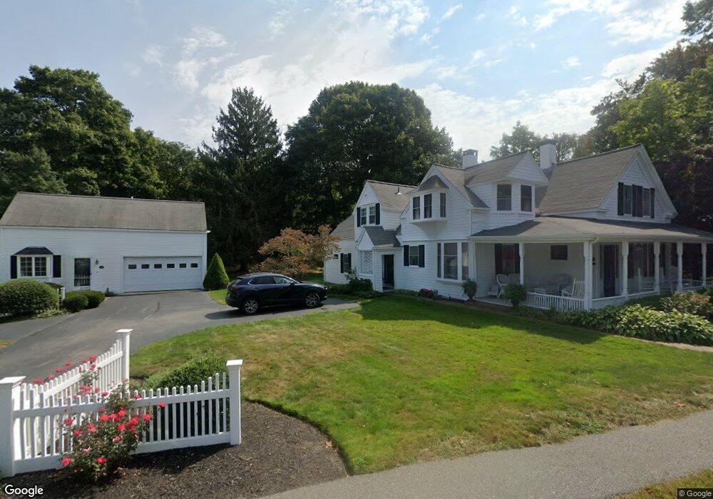
393 Main St Centerville, MA 02632
Centerville NeighborhoodEstimated Value: $957,000 - $1,228,000
--
Bed
2
Baths
--
Sq Ft
0.58
Acres
About This Home
This home is located at 393 Main St, Centerville, MA 02632 and is currently estimated at $1,092,713. 393 Main St is a home located in Barnstable County with nearby schools including Centerville Elementary School, Barnstable United Elementary School, and Barnstable Intermediate School.
Ownership History
Date
Name
Owned For
Owner Type
Purchase Details
Closed on
May 1, 2023
Sold by
Ellis John R
Bought by
Ellis Ft and Ellis Savage
Current Estimated Value
Purchase Details
Closed on
Apr 27, 2023
Sold by
Ellis Susan W
Bought by
Ellis John R
Create a Home Valuation Report for This Property
The Home Valuation Report is an in-depth analysis detailing your home's value as well as a comparison with similar homes in the area
Home Values in the Area
Average Home Value in this Area
Purchase History
Date | Buyer | Sale Price | Title Company |
---|---|---|---|
Ellis Ft | -- | None Available | |
Ellis John R | -- | None Available |
Source: Public Records
Mortgage History
Date | Status | Borrower | Loan Amount |
---|---|---|---|
Previous Owner | Ellis Susan W | $150,000 | |
Previous Owner | Ellis Susan W | $193,000 | |
Previous Owner | Ellis John R | $198,000 | |
Previous Owner | Ellis Susan W | $200,000 | |
Previous Owner | Ellis John R | $65,200 | |
Previous Owner | Ellis John R | $78,800 | |
Previous Owner | Ellis John R | $68,000 |
Source: Public Records
Tax History Compared to Growth
Tax History
Year | Tax Paid | Tax Assessment Tax Assessment Total Assessment is a certain percentage of the fair market value that is determined by local assessors to be the total taxable value of land and additions on the property. | Land | Improvement |
---|---|---|---|---|
2025 | $9,071 | $1,121,200 | $360,100 | $761,100 |
2024 | $8,391 | $1,074,400 | $360,100 | $714,300 |
2023 | $7,925 | $950,200 | $334,800 | $615,400 |
2022 | $7,233 | $750,300 | $231,500 | $518,800 |
2021 | $7,238 | $690,000 | $253,600 | $436,400 |
2020 | $7,252 | $661,700 | $253,600 | $408,100 |
2019 | $7,129 | $632,000 | $264,600 | $367,400 |
2018 | $6,362 | $567,000 | $266,900 | $300,100 |
2017 | $6,051 | $562,400 | $266,900 | $295,500 |
2016 | $6,079 | $557,700 | $263,300 | $294,400 |
2015 | $7,041 | $648,900 | $264,400 | $384,500 |
Source: Public Records
Map
Nearby Homes
- 9 Pine Tree Dr
- 344 Main St Unit 6
- 52 Meadow Farm Rd
- 53 Meadow Farm Rd
- 156 S Main St
- 117 Pheasant Way
- 130 Fuller Rd
- 17 Cedar Point Cir
- 1118 Bumps River Rd
- 48 Valley Brook Rd
- 290 Riverview Ln
- 278 Riverview Ln
- 394 Old Stage Rd
- 155 Great Marsh Rd
- 17 Coddington Rd
- 64 Harrison Rd
- 114 Stoney Cliff Rd
- 14 Lumbert Mill Rd
- 105 Annable Point Rd