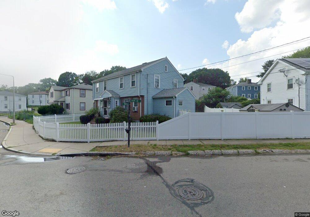
393 River St Unit 2 Mattapan, MA 02126
Southern Mattapan NeighborhoodEstimated Value: $607,000 - $763,000
2
Beds
1
Bath
936
Sq Ft
$743/Sq Ft
Est. Value
About This Home
This home is located at 393 River St Unit 2, Mattapan, MA 02126 and is currently estimated at $695,074, approximately $742 per square foot. 393 River St Unit 2 is a home located in Suffolk County with nearby schools including KIPP Academy Boston Charter School, Berea Seventh-day Adventist Academy, and St. Mary of the Hills School.
Ownership History
Date
Name
Owned For
Owner Type
Purchase Details
Closed on
Aug 27, 2018
Sold by
Green Ebony
Bought by
Tejeda Jeffrey
Current Estimated Value
Home Financials for this Owner
Home Financials are based on the most recent Mortgage that was taken out on this home.
Original Mortgage
$488,476
Outstanding Balance
$422,771
Interest Rate
4.25%
Mortgage Type
FHA
Estimated Equity
$272,303
Create a Home Valuation Report for This Property
The Home Valuation Report is an in-depth analysis detailing your home's value as well as a comparison with similar homes in the area
Home Values in the Area
Average Home Value in this Area
Purchase History
| Date | Buyer | Sale Price | Title Company |
|---|---|---|---|
| Tejeda Jeffrey | $500,000 | -- |
Source: Public Records
Mortgage History
| Date | Status | Borrower | Loan Amount |
|---|---|---|---|
| Open | Tejeda Jeffrey | $488,476 |
Source: Public Records
Tax History Compared to Growth
Tax History
| Year | Tax Paid | Tax Assessment Tax Assessment Total Assessment is a certain percentage of the fair market value that is determined by local assessors to be the total taxable value of land and additions on the property. | Land | Improvement |
|---|---|---|---|---|
| 2025 | $7,284 | $629,000 | $214,900 | $414,100 |
| 2024 | $6,734 | $617,800 | $214,300 | $403,500 |
| 2023 | $6,142 | $571,900 | $198,400 | $373,500 |
| 2022 | $6,222 | $571,900 | $198,400 | $373,500 |
| 2021 | $5,758 | $539,600 | $187,200 | $352,400 |
| 2020 | $4,945 | $468,300 | $185,300 | $283,000 |
| 2019 | $4,406 | $418,000 | $140,200 | $277,800 |
| 2018 | $4,132 | $394,300 | $140,200 | $254,100 |
| 2017 | $4,015 | $379,100 | $140,200 | $238,900 |
| 2016 | $3,897 | $354,300 | $140,200 | $214,100 |
| 2015 | $3,577 | $295,400 | $122,600 | $172,800 |
| 2014 | $3,319 | $263,800 | $122,600 | $141,200 |
Source: Public Records
Map
Nearby Homes
- 24 Constitution Rd
- 10 Briarcliff Terrace
- 4 Crossman St Unit 4
- 32 Violet St
- 11 French St
- 1465 Blue Hill Ave
- 333 Eliot St
- 95 Woodhaven St
- 157 Delhi St
- 27 Hawthorn Rd
- 32 Columbine Rd
- 84 Blue Hills Pkwy
- 48-50 Rockdale St
- 12 Hiawatha Rd
- 15 Fairfax Rd
- 16 Blue Hill Ave
- 15 Cantwell Rd
- 10 Brockton St
- 567B Norfolk St
- 770 Cummins Hwy Unit 1
- 393 River St
- 397 River St
- 23 Mamelon Cir
- 3 Mamelon Cir
- 3 Mamelon Cir Unit 1
- 3 Mamelon Cir Unit 2
- 383 River St
- 19 Mamelon Cir
- 19 Mamelon Cir Unit 2
- 7 Mamelon Cir
- 4 Mamelon Cir Unit B
- 4 Mamelon Cir Unit A
- 00000 Linvale Terrace
- 401 River St
- 401 River St Unit 1
- 401 River St
- 401 River St Unit 401 River st 2 Bos
- 401 River St Unit 2
- 379 River St
- 11 Mamelon Cir