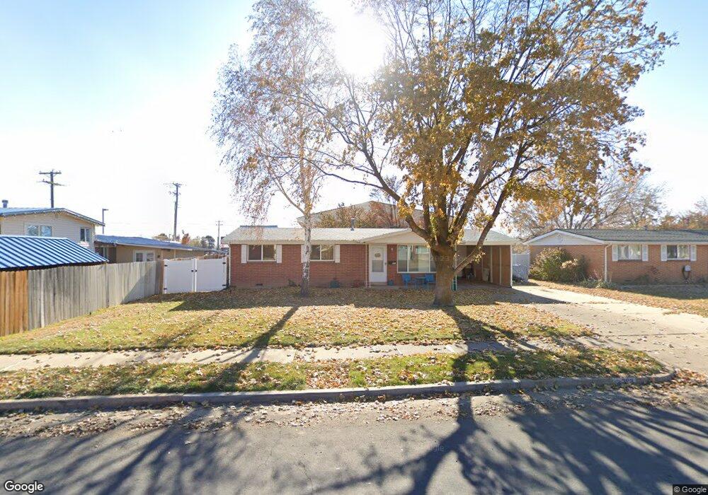
393 W Forbes St Layton, UT 84041
Estimated Value: $341,000 - $381,000
3
Beds
1
Bath
1,000
Sq Ft
$357/Sq Ft
Est. Value
About This Home
This home is located at 393 W Forbes St, Layton, UT 84041 and is currently estimated at $357,161, approximately $357 per square foot. 393 W Forbes St is a home located in Davis County with nearby schools including Lincoln Elementary School, North Layton Junior High School, and Northridge High School.
Ownership History
Date
Name
Owned For
Owner Type
Purchase Details
Closed on
May 12, 2003
Sold by
Granado Vincent D
Bought by
Granado Vincent D and Granado Sheila
Current Estimated Value
Purchase Details
Closed on
Nov 7, 1997
Sold by
Orchard Fsb
Bought by
Granado Vincent D
Purchase Details
Closed on
Sep 6, 1995
Sold by
West One Bank
Bought by
Granado Vincent D
Purchase Details
Closed on
Jul 16, 1985
Sold by
Jones Clifford E and Jones Pamela R
Bought by
Granado Vincent D
Purchase Details
Closed on
Dec 22, 1982
Sold by
Goodell Blaine M and Goodell Terri Lynne
Bought by
Jones Clifford E and Jones Pamela R
Create a Home Valuation Report for This Property
The Home Valuation Report is an in-depth analysis detailing your home's value as well as a comparison with similar homes in the area
Home Values in the Area
Average Home Value in this Area
Purchase History
| Date | Buyer | Sale Price | Title Company |
|---|---|---|---|
| Granado Vincent D | -- | Bonneville Title Company Inc | |
| Granado Vincent D | -- | Associated Title Company | |
| Granado Vincent D | -- | Associated Title Company | |
| Granado Vincent D | -- | Associated Title Company | |
| Jones Clifford E | -- | Associated Title Company |
Source: Public Records
Tax History Compared to Growth
Tax History
| Year | Tax Paid | Tax Assessment Tax Assessment Total Assessment is a certain percentage of the fair market value that is determined by local assessors to be the total taxable value of land and additions on the property. | Land | Improvement |
|---|---|---|---|---|
| 2025 | $179 | $159,500 | $101,220 | $58,280 |
| 2024 | $35 | $157,850 | $117,989 | $39,861 |
| 2023 | $1,620 | $302,000 | $140,713 | $161,287 |
| 2022 | $1,614 | $163,350 | $74,266 | $89,084 |
| 2021 | $301 | $230,000 | $103,826 | $126,174 |
| 2020 | $1,374 | $199,000 | $87,509 | $111,491 |
| 2019 | $1,304 | $185,000 | $83,247 | $101,753 |
| 2018 | $1,145 | $163,000 | $83,247 | $79,753 |
| 2016 | $937 | $68,860 | $26,501 | $42,359 |
| 2015 | $883 | $61,545 | $26,501 | $35,044 |
| 2014 | $772 | $55,055 | $26,501 | $28,554 |
| 2013 | -- | $67,922 | $24,816 | $43,106 |
Source: Public Records
Map
Nearby Homes
- 398 Paul Ave
- 1837 N 440 W
- 1490 N 175 W
- 1583 N 25 E
- 1908 N 200 W
- 103 W 1275 N
- 1096 N 300 W
- 2053 Evans Cove Loop Unit 39
- 2044 Evans Cove Loop
- 2048 Evans Cove Loop
- 1500 N Angel St Unit 12
- 506 W 2200 N
- 2211 N 525 W
- 1553 N 250 E
- 2248 N 500 W
- 1180 N 100 E
- 1366 N Main St Unit 5
- 1094 N Angel St W
- 1036 N Angel St W
- 9 W 2150 N
- 393 Forbes St
- 411 Forbes St
- 411 W Forbes St
- 1635 N Hill Field Rd
- 423 Forbes St
- 423 W Forbes St
- 410 Forbes St
- 388 Forbes St
- 410 W Forbes St
- 435 Forbes St
- 435 W Forbes St
- 1670 Alder St
- 435 Forbes Ave W
- 1675 N Hill Field Rd
- 438 Forbes St
- 438 W Forbes St
- 449 Forbes St
- 1684 Alder St
- 449 Forbes Ave W
- 1684 N Alder St