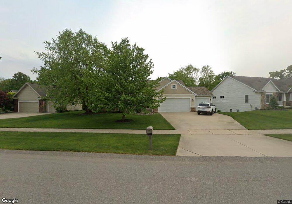
3932 Acadia Dr Hudsonville, MI 49426
Estimated Value: $430,000 - $502,000
4
Beds
4
Baths
2,254
Sq Ft
$210/Sq Ft
Est. Value
About This Home
This home is located at 3932 Acadia Dr, Hudsonville, MI 49426 and is currently estimated at $472,857, approximately $209 per square foot. 3932 Acadia Dr is a home located in Ottawa County with nearby schools including Baldwin Street Middle School, Hudsonville Freshman Campus, and Hudsonville High School.
Ownership History
Date
Name
Owned For
Owner Type
Purchase Details
Closed on
May 31, 2017
Sold by
Baragar Scott L and Baragar Amy Joy
Bought by
Baragar Scott L and Baragar Amy J
Current Estimated Value
Purchase Details
Closed on
Mar 6, 2006
Sold by
Mt Johnson Construction Llc
Bought by
Baragar Scott L and Baragar Amy Joy
Home Financials for this Owner
Home Financials are based on the most recent Mortgage that was taken out on this home.
Original Mortgage
$200,000
Outstanding Balance
$114,429
Interest Rate
6.38%
Mortgage Type
Fannie Mae Freddie Mac
Estimated Equity
$358,428
Create a Home Valuation Report for This Property
The Home Valuation Report is an in-depth analysis detailing your home's value as well as a comparison with similar homes in the area
Home Values in the Area
Average Home Value in this Area
Purchase History
| Date | Buyer | Sale Price | Title Company |
|---|---|---|---|
| Baragar Scott L | -- | Attorney | |
| Baragar Scott L | $240,000 | None Available |
Source: Public Records
Mortgage History
| Date | Status | Borrower | Loan Amount |
|---|---|---|---|
| Open | Baragar Scott L | $200,000 |
Source: Public Records
Tax History Compared to Growth
Tax History
| Year | Tax Paid | Tax Assessment Tax Assessment Total Assessment is a certain percentage of the fair market value that is determined by local assessors to be the total taxable value of land and additions on the property. | Land | Improvement |
|---|---|---|---|---|
| 2025 | $4,164 | $213,700 | $0 | $0 |
| 2024 | $3,603 | $221,800 | $0 | $0 |
| 2023 | $3,237 | $190,100 | $0 | $0 |
| 2022 | $3,717 | $172,500 | $0 | $0 |
| 2021 | $3,620 | $161,300 | $0 | $0 |
| 2020 | $3,589 | $157,000 | $0 | $0 |
| 2019 | $3,598 | $144,600 | $0 | $0 |
| 2018 | $3,193 | $144,500 | $0 | $0 |
| 2017 | $3,135 | $144,800 | $0 | $0 |
| 2016 | $3,117 | $137,300 | $0 | $0 |
| 2015 | $2,975 | $128,500 | $0 | $0 |
| 2014 | $2,975 | $111,700 | $0 | $0 |
Source: Public Records
Map
Nearby Homes
- 6950 Meadowcreek Dr
- 4101 Blair St
- 4106 Blair St
- 6701 Arlene Dr
- 3617 Teton Dr
- 3528 Tearose Dr
- 3544 Nobb Hill Dr
- 6863 Bridgeport Dr
- 6821 Bridgeport Dr
- 0 Baldwin St
- 7318 Alycia Dr
- 4087 Baldwin St
- 3808 Port Sheldon St
- V/L Port Sheldon St
- 7313 Valhalla Dr
- 3204 Port Sheldon St
- 7918 Westside Dr
- 3546 Eagles Roost Trail Unit 3
- 2969 Osprey Dr Unit 27
- 7381 Rolling Hills Dr