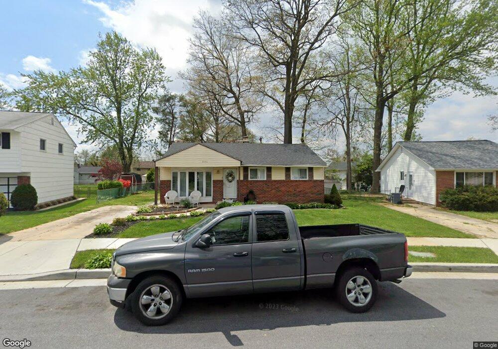
3932 Sadie Rd Randallstown, MD 21133
Estimated Value: $296,000 - $410,000
Studio
1
Bath
1,044
Sq Ft
$322/Sq Ft
Est. Value
About This Home
This home is located at 3932 Sadie Rd, Randallstown, MD 21133 and is currently estimated at $336,684, approximately $322 per square foot. 3932 Sadie Rd is a home located in Baltimore County with nearby schools including Church Lane Elementary Technology School, Northwest Academy of Health Sciences, and Randallstown High School.
Ownership History
Date
Name
Owned For
Owner Type
Purchase Details
Closed on
Jul 22, 2014
Sold by
Xyz Certificates Inc
Bought by
Stollof Sheryl and Stollof Marcie
Current Estimated Value
Purchase Details
Closed on
Oct 2, 2001
Sold by
Love Reginald A
Bought by
Boyd Larita F
Purchase Details
Closed on
Jul 28, 1998
Sold by
Love Reginald A
Bought by
Love Reginald A and Love Lori A
Purchase Details
Closed on
Jun 28, 1995
Sold by
Kubatko Roch E
Bought by
Love Reginald A
Home Financials for this Owner
Home Financials are based on the most recent Mortgage that was taken out on this home.
Original Mortgage
$106,860
Interest Rate
7.8%
Create a Home Valuation Report for This Property
The Home Valuation Report is an in-depth analysis detailing your home's value as well as a comparison with similar homes in the area
Home Values in the Area
Average Home Value in this Area
Purchase History
| Date | Buyer | Sale Price | Title Company |
|---|---|---|---|
| Stollof Sheryl | -- | None Available | |
| Boyd Larita F | $124,500 | -- | |
| Love Reginald A | -- | -- | |
| Love Reginald A | $104,000 | -- |
Source: Public Records
Mortgage History
| Date | Status | Borrower | Loan Amount |
|---|---|---|---|
| Previous Owner | Love Reginald A | $106,860 |
Source: Public Records
Tax History
| Year | Tax Paid | Tax Assessment Tax Assessment Total Assessment is a certain percentage of the fair market value that is determined by local assessors to be the total taxable value of land and additions on the property. | Land | Improvement |
|---|---|---|---|---|
| 2025 | $3,661 | $248,067 | -- | -- |
| 2024 | $3,661 | $230,800 | $74,200 | $156,600 |
| 2023 | $1,518 | $213,900 | $0 | $0 |
| 2022 | $3,081 | $197,000 | $0 | $0 |
| 2021 | $3,484 | $180,100 | $56,200 | $123,900 |
| 2020 | $3,484 | $172,767 | $0 | $0 |
| 2019 | $3,207 | $165,433 | $0 | $0 |
| 2018 | $3,032 | $158,100 | $56,200 | $101,900 |
| 2017 | $2,698 | $150,200 | $0 | $0 |
| 2016 | $2,560 | $142,300 | $0 | $0 |
| 2015 | $2,560 | $134,400 | $0 | $0 |
| 2014 | $2,560 | $134,400 | $0 | $0 |
Source: Public Records
Map
Nearby Homes
- 8829 Sigrid Rd
- 4048 Carthage Rd
- 9063 Meadow Heights Rd
- 8541 Lucerne Rd
- 8604 Woodbrook Ct
- 4226 Huntshire Rd
- 1205/99 Winands Rd
- 3723 Eastman Rd
- 9202 Samoset Rd
- 3506 Bayer Ave
- 8513 Charlton Rd
- 4228 Brookside Oaks
- 4816 Valley Forge Rd
- 4818 Oakland Park Rd
- 8809 Stone Ridge Cir Unit 204
- 8807 Stone Ridge Cir Unit 101
- 8811 Stoneridge Cir Unit 103
- 8905 Stone Creek Place Unit 201
- 8407 Billson Rd
- 9208A Liberty Rd
- 3930 Sadie Rd
- 3934 Sadie Rd
- 3905 Nemo Rd
- 3928 Sadie Rd
- 3903 Nemo Rd
- 8830 Meadow Heights Rd
- 3907 Nemo Rd
- 3936 Sadie Rd
- 8828 Meadow Heights Rd
- 3935 Sadie Rd
- 8841 Sigrid Rd
- 3926 Sadie Rd
- 8826 Meadow Heights Rd
- 3909 Nemo Rd
- 8832 Meadow Heights Rd
- 3933 Sadie Rd
- 8839 Sigrid Rd
- 8824 Meadow Heights Rd
- 3931 Sadie Rd
- 3924 Sadie Rd
Your Personal Tour Guide
Ask me questions while you tour the home.