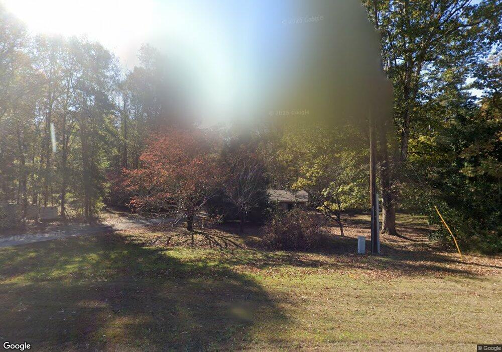
3933 Roanoke Rd Lagrange, GA 30240
Estimated Value: $95,283 - $169,000
2
Beds
1
Bath
896
Sq Ft
$159/Sq Ft
Est. Value
About This Home
This home is located at 3933 Roanoke Rd, Lagrange, GA 30240 and is currently estimated at $142,821, approximately $159 per square foot. 3933 Roanoke Rd is a home located in Troup County with nearby schools including Berta Weathersbee Elementary School, Whitesville Road Elementary School, and Long Cane Elementary School.
Ownership History
Date
Name
Owned For
Owner Type
Purchase Details
Closed on
Jul 23, 2024
Sold by
Knight Helen H
Bought by
Bishop Helen Hodnette and Knight Sharon K
Current Estimated Value
Purchase Details
Closed on
Aug 19, 1998
Sold by
Kathleen Hodnette
Bought by
Knight Helen H
Purchase Details
Closed on
Oct 30, 1979
Sold by
Kathleen C Hodnette Etal
Bought by
Kathleen Hodnette
Purchase Details
Closed on
Jan 1, 1958
Sold by
Guy R Hodnette
Bought by
Kathleen C Hodnette Etal
Create a Home Valuation Report for This Property
The Home Valuation Report is an in-depth analysis detailing your home's value as well as a comparison with similar homes in the area
Purchase History
| Date | Buyer | Sale Price | Title Company |
|---|---|---|---|
| Bishop Helen Hodnette | -- | -- | |
| Knight Helen H | -- | -- | |
| Kathleen Hodnette | -- | -- | |
| Kathleen C Hodnette Etal | -- | -- |
Source: Public Records
Tax History
| Year | Tax Paid | Tax Assessment Tax Assessment Total Assessment is a certain percentage of the fair market value that is determined by local assessors to be the total taxable value of land and additions on the property. | Land | Improvement |
|---|---|---|---|---|
| 2025 | $575 | $21,080 | $4,800 | $16,280 |
| 2024 | $491 | $18,000 | $4,800 | $13,200 |
| 2023 | $500 | $18,320 | $4,800 | $13,520 |
| 2022 | $491 | $17,600 | $4,800 | $12,800 |
| 2021 | $290 | $9,600 | $3,440 | $6,160 |
| 2020 | $290 | $9,600 | $3,440 | $6,160 |
| 2019 | $284 | $9,400 | $3,440 | $5,960 |
| 2018 | $267 | $8,840 | $3,440 | $5,400 |
| 2017 | $267 | $8,840 | $3,440 | $5,400 |
| 2016 | $281 | $9,314 | $3,440 | $5,874 |
| 2015 | $201 | $6,652 | $3,440 | $3,212 |
| 2014 | $201 | $6,652 | $3,440 | $3,212 |
| 2013 | -- | $6,652 | $3,440 | $3,212 |
Source: Public Records
Map
Nearby Homes
- 213 Linda Ln
- 709 Vernon Ferry Rd
- 129 Angela East Dr
- 4.5 ACRES Whatley Rd N
- 0 Deming St Unit 10550189
- 0 Salem Rd Tract 2 Unit 10675187
- 104 Dogwood Point
- 110 Thomas Dr
- 4004 White Oak Ln
- 98 Hearn Rd
- 40 River Point Dr
- 16 River Point Dr
- 474 Newton Rd
- 112 Foxdale Dr
- 113 Colonial Ct
- 101 Ivy Springs Dr
- 311 Cumberland Dr
- 104 Independence Ct
- 245 Teaver Rd
- 203 Shawnee Dr
- 0 Old Pyne Rd Unit 8407025
- 3965 Roanoke Rd
- 100 Linda Ln
- 259 Old Pyne Rd
- 3924 Roanoke Rd
- 3910 Roanoke Rd
- 102 Linda Ln
- 101 Linda Ln
- 3985 Roanoke Rd
- 237 Old Pyne Rd
- 936 Vernon Ferry Rd
- 103 Linda Ln
- 104 Linda Ln
- 949 Vernon Ferry Rd
- 249 Old Pyne Rd
- 225 Old Pyne Rd
- 105 Linda Ln
- 920 Vernon Ferry Rd
- 106 Linda Ln
- 3864 Roanoke Rd
Your Personal Tour Guide
Ask me questions while you tour the home.