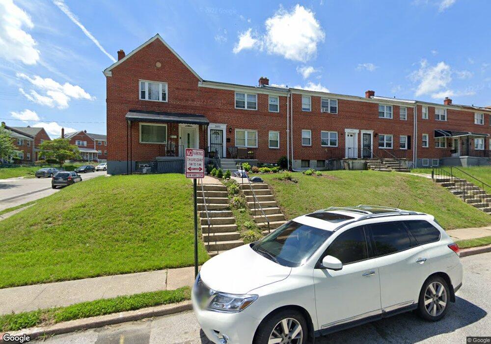
3933 Stokes Dr Baltimore, MD 21229
Edmondson Villiage NeighborhoodEstimated Value: $169,460 - $199,000
--
Bed
2
Baths
1,452
Sq Ft
$127/Sq Ft
Est. Value
About This Home
This home is located at 3933 Stokes Dr, Baltimore, MD 21229 and is currently estimated at $184,230, approximately $126 per square foot. 3933 Stokes Dr is a home located in Baltimore City with nearby schools including Booker T. Washington Middle School, Edmondson Westside High School, and Frederick Douglass High School.
Ownership History
Date
Name
Owned For
Owner Type
Purchase Details
Closed on
Jan 7, 2020
Sold by
Sow Soulemayne
Bought by
Sow Properties Llc
Current Estimated Value
Home Financials for this Owner
Home Financials are based on the most recent Mortgage that was taken out on this home.
Original Mortgage
$101,500
Outstanding Balance
$89,903
Interest Rate
3.73%
Mortgage Type
Commercial
Estimated Equity
$94,327
Purchase Details
Closed on
Feb 15, 2019
Sold by
Deshields-Carey Tracie and Thomas G Deshields Living Trus
Bought by
Sow Souleymane
Purchase Details
Closed on
May 8, 2008
Sold by
Deshields Thomas G
Bought by
Deshields Thomas G
Create a Home Valuation Report for This Property
The Home Valuation Report is an in-depth analysis detailing your home's value as well as a comparison with similar homes in the area
Home Values in the Area
Average Home Value in this Area
Purchase History
| Date | Buyer | Sale Price | Title Company |
|---|---|---|---|
| Sow Properties Llc | -- | None Available | |
| Sow Souleymane | $43,500 | None Available | |
| Deshields Thomas G | -- | -- |
Source: Public Records
Mortgage History
| Date | Status | Borrower | Loan Amount |
|---|---|---|---|
| Open | Sow Properties Llc | $101,500 |
Source: Public Records
Tax History Compared to Growth
Tax History
| Year | Tax Paid | Tax Assessment Tax Assessment Total Assessment is a certain percentage of the fair market value that is determined by local assessors to be the total taxable value of land and additions on the property. | Land | Improvement |
|---|---|---|---|---|
| 2025 | $3,290 | $151,133 | -- | -- |
| 2024 | $3,290 | $140,067 | $0 | $0 |
| 2023 | $3,030 | $129,000 | $25,000 | $104,000 |
| 2022 | $2,659 | $112,667 | $0 | $0 |
| 2021 | $2,273 | $96,333 | $0 | $0 |
| 2020 | $2,672 | $113,200 | $25,000 | $88,200 |
| 2019 | $2,635 | $112,167 | $0 | $0 |
| 2018 | $2,623 | $111,133 | $0 | $0 |
| 2017 | $2,598 | $110,100 | $0 | $0 |
| 2016 | $2,698 | $105,467 | $0 | $0 |
| 2015 | $2,698 | $100,833 | $0 | $0 |
| 2014 | $2,698 | $96,200 | $0 | $0 |
Source: Public Records
Map
Nearby Homes
- 3914 Rokeby Rd
- 4139 Mountwood Rd
- 1226 N Augusta Ave
- 1230 N Augusta Ave
- 1244 N Augusta Ave
- 3806 Rokeby Rd
- 3814 Flowerton Rd
- 1102 Mount Holly St
- 1007 Mount Holly St
- 3904 Woodridge Rd
- 827 N Augusta Ave
- 733 Lyndhurst St
- 802 N Woodington Rd
- 901 Kevin Rd
- 3711 Cranston Ave
- 704 Mount Holly St
- 1017 Wicklow Rd
- 3805 Harlem Ave
- 3657 Gelston Dr
- 3645 Gelston Dr
- 3935 Stokes Dr
- 3935 Stokes Dr Unit 1
- 3931 Stokes Dr
- 3937 Stokes Dr
- 3939 Stokes Dr Unit 2
- 3939 Stokes Dr Unit 1
- 3900 Mountwood Rd
- 3941 Stokes Dr Unit 1 & UNIT 2
- 3941 Stokes Dr
- 3941 Stokes Dr Unit 1
- 3943 Stokes Dr
- 3929 Stokes Dr
- 3902 Mountwood Rd
- 3945 Stokes Dr
- 3927 Stokes Dr
- 3925 Stokes Dr
- 3903 Mountwood Rd
- 3905 Mountwood Rd
- 3901 Mountwood Rd
- 3923 Stokes Dr