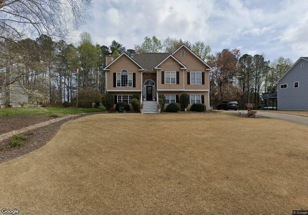
3935 Pheasant Run Trace Cumming, GA 30028
Estimated Value: $390,000 - $413,000
3
Beds
2
Baths
1,645
Sq Ft
$243/Sq Ft
Est. Value
About This Home
This home is located at 3935 Pheasant Run Trace, Cumming, GA 30028 and is currently estimated at $400,024, approximately $243 per square foot. 3935 Pheasant Run Trace is a home located in Forsyth County with nearby schools including Poole's Mill Elementary School, Liberty Middle School, and North Forsyth High School.
Ownership History
Date
Name
Owned For
Owner Type
Purchase Details
Closed on
Jun 21, 2004
Sold by
Kotalik Thomas W and Kotalik Lorrie
Bought by
Ross Kurtis and Ross Valerie
Current Estimated Value
Home Financials for this Owner
Home Financials are based on the most recent Mortgage that was taken out on this home.
Original Mortgage
$140,000
Outstanding Balance
$67,840
Interest Rate
5.87%
Mortgage Type
New Conventional
Estimated Equity
$332,184
Purchase Details
Closed on
Oct 26, 1995
Sold by
Steve Arthur Const Co
Bought by
Kotalik Thomas W Lorrie
Create a Home Valuation Report for This Property
The Home Valuation Report is an in-depth analysis detailing your home's value as well as a comparison with similar homes in the area
Home Values in the Area
Average Home Value in this Area
Purchase History
| Date | Buyer | Sale Price | Title Company |
|---|---|---|---|
| Ross Kurtis | $175,000 | -- | |
| Kotalik Thomas W Lorrie | $122,400 | -- |
Source: Public Records
Mortgage History
| Date | Status | Borrower | Loan Amount |
|---|---|---|---|
| Open | Ross Kurtis | $140,000 | |
| Closed | Kotalik Thomas W Lorrie | $0 |
Source: Public Records
Tax History
| Year | Tax Paid | Tax Assessment Tax Assessment Total Assessment is a certain percentage of the fair market value that is determined by local assessors to be the total taxable value of land and additions on the property. | Land | Improvement |
|---|---|---|---|---|
| 2025 | $3,693 | $161,740 | $48,000 | $113,740 |
| 2024 | $3,693 | $150,616 | $46,000 | $104,616 |
| 2023 | $3,355 | $136,288 | $38,000 | $98,288 |
Source: Public Records
Map
Nearby Homes
- 4035 Haven Way
- 4055 Haven Way
- 3975 Silverthorn Trace
- 4085 Haven Way
- 4040 Haven Way
- 4050 Haven Way
- 4115 Haven Way
- 4060 Haven Way
- 4070 Haven Way
- 4090 Haven Way
- 4225 Penion Point
- 4145 Haven Way
- 4080 Deer Run Dr
- 3980 Starr Creek Rd
- 4245 Standing Rock Way
- 3970 Hurt Bridge Rd
- 4275 Hunters Walk Way
- 4315 Jeston Ct
- 3945 Pheasant Run Trace
- 3925 Pheasant Run Trace
- 3955 Pheasant Run Trace Unit 58
- 3955 Pheasant Run Trace
- 3915 Pheasant Run Trace
- 3940 Pheasant Run Trace
- 3910 Pheasant Run Trace
- 3950 Pheasant Run Trace Unit 12
- 3950 Pheasant Run Trace
- 3950 Pheasant Run
- 3845 Pheasant Run Trace
- 3965 Pheasant Run Trace
- 3960 Pheasant Run Trace
- 3725 Hurt Bridge Rd
- 3915 Mallard Way
- 3745 Hurt Bridge Rd
- 3975 Pheasant Run Trace
- 3815 Pheasant Run Trace
- 3735 Hurt Bridge Rd
- 3785 Hurt Bridge Rd
Your Personal Tour Guide
Ask me questions while you tour the home.