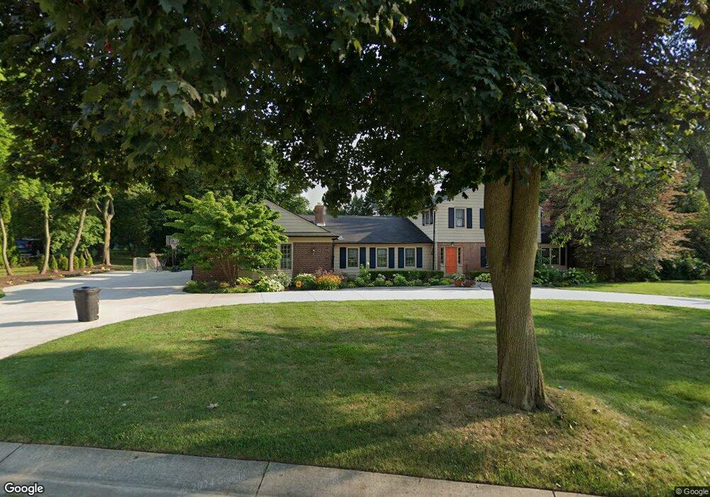
3937 Englewood Ct West Bloomfield, MI 48323
Estimated Value: $767,326 - $1,090,000
5
Beds
4
Baths
4,772
Sq Ft
$184/Sq Ft
Est. Value
About This Home
This home is located at 3937 Englewood Ct, West Bloomfield, MI 48323 and is currently estimated at $877,082, approximately $183 per square foot. 3937 Englewood Ct is a home located in Oakland County with nearby schools including West Hills Middle School, Bloomfield Hills High School, and The Susan And Rabbi Harold Loss Ecc.
Ownership History
Date
Name
Owned For
Owner Type
Purchase Details
Closed on
Nov 13, 2019
Sold by
Zide Elizabeth R and Hosfield Vincent Francis
Bought by
Hosfield Vincent Francis and Zide Elizabeth R
Current Estimated Value
Home Financials for this Owner
Home Financials are based on the most recent Mortgage that was taken out on this home.
Original Mortgage
$552,500
Outstanding Balance
$486,058
Interest Rate
3.6%
Mortgage Type
New Conventional
Estimated Equity
$391,024
Purchase Details
Closed on
Aug 28, 2009
Sold by
Truding Robert M and Truding Dale L
Bought by
Zide Elizabeth R
Create a Home Valuation Report for This Property
The Home Valuation Report is an in-depth analysis detailing your home's value as well as a comparison with similar homes in the area
Home Values in the Area
Average Home Value in this Area
Purchase History
| Date | Buyer | Sale Price | Title Company |
|---|---|---|---|
| Hosfield Vincent Francis | -- | Title First Agency | |
| Zide Elizabeth R | $412,500 | None Available |
Source: Public Records
Mortgage History
| Date | Status | Borrower | Loan Amount |
|---|---|---|---|
| Open | Hosfield Vincent Francis | $552,500 |
Source: Public Records
Tax History Compared to Growth
Tax History
| Year | Tax Paid | Tax Assessment Tax Assessment Total Assessment is a certain percentage of the fair market value that is determined by local assessors to be the total taxable value of land and additions on the property. | Land | Improvement |
|---|---|---|---|---|
| 2024 | $4,249 | $299,080 | $0 | $0 |
| 2022 | $4,112 | $256,540 | $50,090 | $206,450 |
| 2021 | $7,881 | $247,570 | $0 | $0 |
| 2020 | $3,761 | $262,400 | $50,090 | $212,310 |
| 2018 | $7,136 | $249,690 | $34,290 | $215,400 |
| 2015 | -- | $209,560 | $0 | $0 |
| 2014 | -- | $210,560 | $0 | $0 |
| 2011 | -- | $178,930 | $0 | $0 |
Source: Public Records
Map
Nearby Homes
- 2943 Moon Lake Dr Unit 52
- 4170 Prescott Park Cir
- 4174 Prescott Park Cir
- 0 Wendell Rd Unit 20250033815
- 4182 Prescott Park Cir
- 0000 Middlebelt Rd
- 4274 Wendell Rd
- 3217 Interlaken St
- 2460 Turner St
- 3468 Pine Estates Dr
- 2045 Bordeaux St Unit 5
- 3930 Maple Hill W
- 4033 Fox Lake Dr
- 2276 Shore Hill Dr
- 3440 Lone Pine Rd
- 3367 Lone Pine Rd
- 3668 Bayou Dr
- 3142 Bloomfield Shore Dr
- 3642 Orchard Lake Rd
- 1992 Bent Tree Trail
- 3933 Englewood Ct
- 3945 Winterset Ln
- 2836 Baltane Rd
- 2856 Baltane Rd
- 2818 Baltane Rd
- 3991 Winterset Ln
- 3921 Winterset Ln
- 2800 Baltane Rd
- 4048 W Newland Dr
- 3929 Englewood Ct
- 4066 W Newland Dr
- 4066 Newland Dr W
- 3997 Winterset Ln
- 3924 Winterset Ln
- 3997 Winterset Ln
- 3944 Winterset Ln
- 4030 W Newland Dr
- 4110 W Newland Dr
- 3918 Winterset Ln
- 3950 Winterset Ln