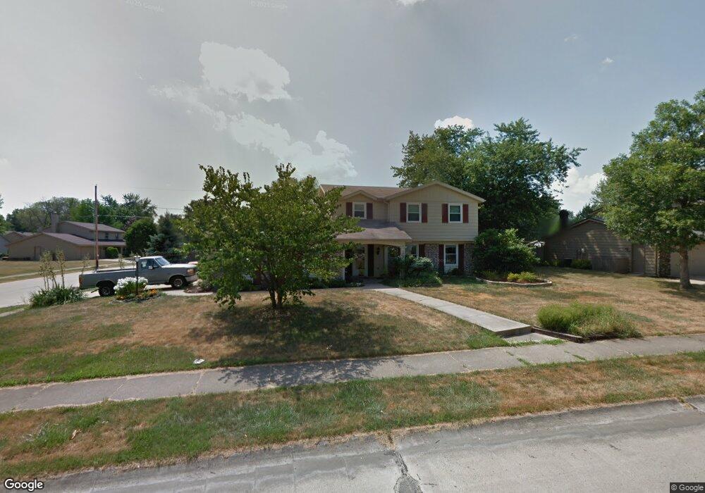
3937 Oakhurst Dr Fort Wayne, IN 46815
Oakhurst NeighborhoodEstimated Value: $253,000 - $260,000
4
Beds
3
Baths
1,948
Sq Ft
$132/Sq Ft
Est. Value
About This Home
This home is located at 3937 Oakhurst Dr, Fort Wayne, IN 46815 and is currently estimated at $256,563, approximately $131 per square foot. 3937 Oakhurst Dr is a home located in Allen County with nearby schools including Glenwood Park Elementary School, Blackhawk Middle School, and R Nelson Snider High School.
Ownership History
Date
Name
Owned For
Owner Type
Purchase Details
Closed on
Dec 26, 2007
Sold by
Cantrell Thomas A and Cantrell Janice L
Bought by
Cantrell Thomas A and Cantrell Janice L
Current Estimated Value
Home Financials for this Owner
Home Financials are based on the most recent Mortgage that was taken out on this home.
Original Mortgage
$117,400
Outstanding Balance
$73,989
Interest Rate
6.13%
Mortgage Type
Purchase Money Mortgage
Estimated Equity
$182,574
Purchase Details
Closed on
Jul 13, 2006
Sold by
Lilly Catherine A
Bought by
Cantrell Thomas A and Hackbush Janice L
Home Financials for this Owner
Home Financials are based on the most recent Mortgage that was taken out on this home.
Original Mortgage
$115,600
Interest Rate
6.73%
Mortgage Type
Purchase Money Mortgage
Create a Home Valuation Report for This Property
The Home Valuation Report is an in-depth analysis detailing your home's value as well as a comparison with similar homes in the area
Home Values in the Area
Average Home Value in this Area
Purchase History
| Date | Buyer | Sale Price | Title Company |
|---|---|---|---|
| Cantrell Thomas A | -- | Trademark Title | |
| Cantrell Thomas A | -- | Metropolitan Title Of In |
Source: Public Records
Mortgage History
| Date | Status | Borrower | Loan Amount |
|---|---|---|---|
| Open | Cantrell Thomas A | $117,400 | |
| Closed | Cantrell Thomas A | $115,600 |
Source: Public Records
Tax History Compared to Growth
Tax History
| Year | Tax Paid | Tax Assessment Tax Assessment Total Assessment is a certain percentage of the fair market value that is determined by local assessors to be the total taxable value of land and additions on the property. | Land | Improvement |
|---|---|---|---|---|
| 2024 | $2,333 | $208,000 | $26,300 | $181,700 |
| 2023 | $2,328 | $207,300 | $26,300 | $181,000 |
| 2022 | $2,276 | $202,900 | $26,300 | $176,600 |
| 2021 | $1,840 | $165,900 | $21,600 | $144,300 |
| 2020 | $1,756 | $161,400 | $21,600 | $139,800 |
| 2019 | $1,626 | $150,500 | $21,600 | $128,900 |
| 2018 | $1,391 | $128,700 | $21,600 | $107,100 |
| 2017 | $1,359 | $125,000 | $21,600 | $103,400 |
| 2016 | $1,202 | $112,400 | $21,600 | $90,800 |
| 2014 | $1,159 | $112,900 | $21,600 | $91,300 |
| 2013 | $1,119 | $109,200 | $21,600 | $87,600 |
Source: Public Records
Map
Nearby Homes
- 4004 Darwood Dr
- 5433 Hewitt Ln
- 4006 Finchley Ct
- 3611 Deer Cove
- 4031 Hedwig Dr
- 4321 Oakhurst Dr
- 6219 Birchdale Dr
- 5107 Louden Dr
- 4111 Sandhurst Dr
- 5317 Stellhorn Rd
- 7342 Starks (Lot 8) Blvd
- 5410 Butterfield Dr
- 4922 Lancelot Ct
- 5109 Woodmark Ct
- 4654 Schmucker Dr
- 5030 Stellhorn Rd
- 2924 Seafarer Cove
- 4209 Reed Rd
- 5526 Tunbridge Crossing
- 4835 Eicher Dr
- 4003 Oakhurst Dr
- 5721 Lionel Dr
- 3923 Oakhurst Dr
- 4011 Oakhurst Dr
- 5720 Lionel Dr
- 3938 Oakhurst Dr
- 5711 Lionel Dr
- 3932 Oakhurst Dr
- 3917 Oakhurst Dr
- 3926 Oakhurst Dr
- 3924 Walden Run
- 4010 Oakhurst Dr
- 4013 Oakhurst Dr
- 5623 Lionel Dr
- 3927 Walden Run
- 3920 Oakhurst Dr
- 3909 Oakhurst Dr
- 3918 Walden Run
- 3939 Darwood Dr
- 4001 Darwood Dr